Cruden Bay (Viaduct & Station Sites)
(Updated September 2014)
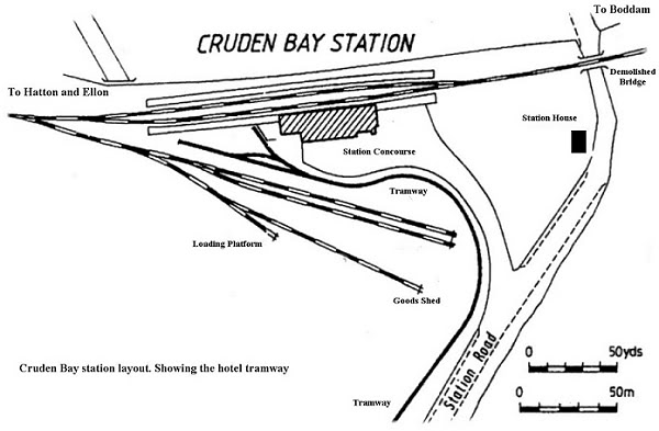
Cruden Bay station was built mainly to serve the GNSR Hotel and Golf Course, hence the electric tramway between the station and hotel. For general use the station was a little far from the center
of the village down a steep road. However, there are a number of small hamlets around that would have benefited from the railway. The tramway was the furthest north electric passenger service in
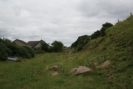
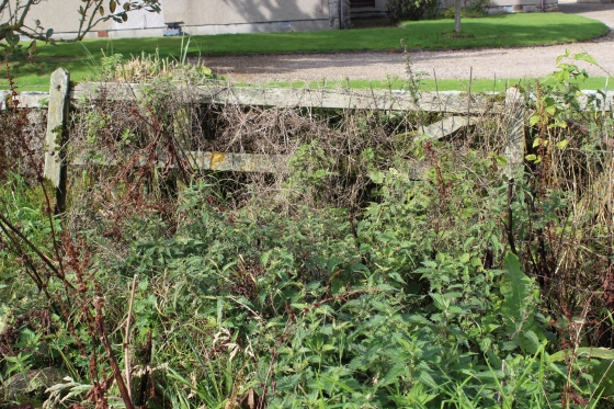
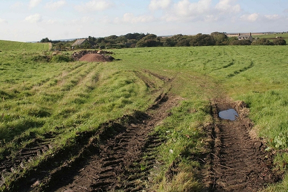
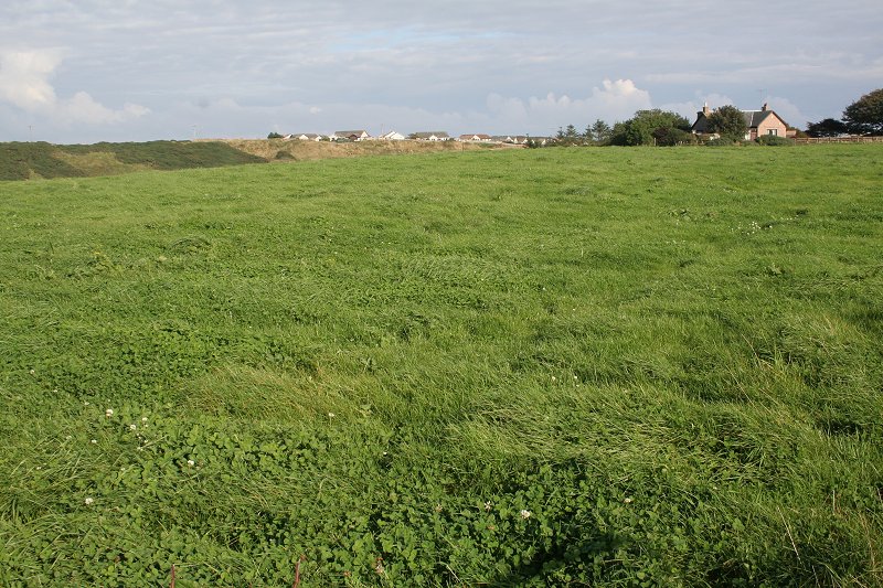
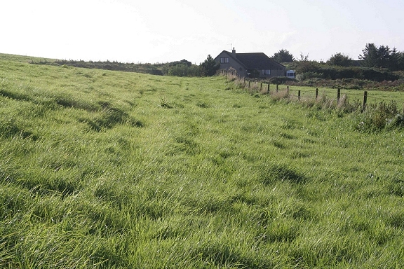
the U.K. The station was situated in a valley and along with the tramway the three-arch viaduct added to the pictorial interest. The station area has been returned to nature with little but the cutting
at the west end, the three arches of the viaduct remains plus the station house to indicate that a railway station and tram terminal ever stood at this spot. Between the cutting and the main road
stood a large brick works that was linked to the railway.
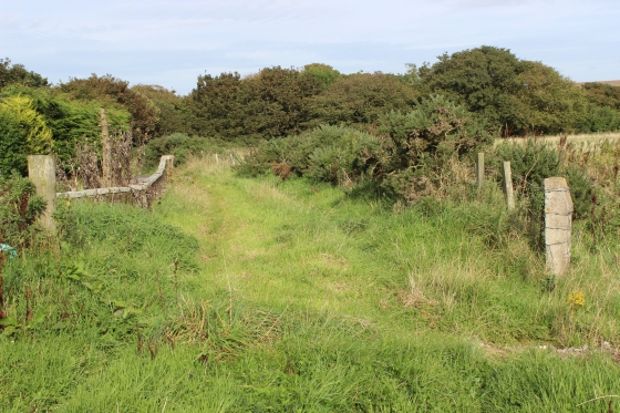
Following in from my walk from Hatton in 2002 and climbing up the embankment from the demolished bridge on the western side of the Nethermill Road, the embankment enters the cutting that
opens up into the station site.
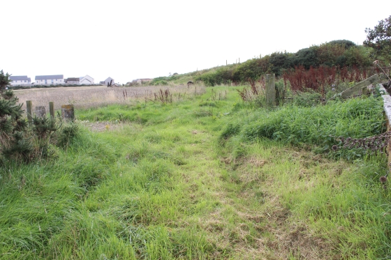
The station site is down station road with the valley on the right leading to the viaduct and the cutting.
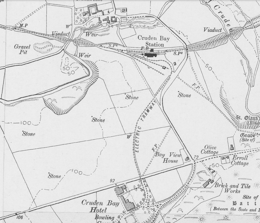
The Brickworks is marked, close to the demolished bridge on the Peterhead/Fraserburgh road. the tramway
from the station to the Hotel is also indicated. The tram ran over mostly fields but today the whole area is
a housing estate as far back as the north end of Station Road. The AD 1004 battle site is where the area
gets it's name from. Cruden is a corruption of the Gaidhlig for " Slaughter of the Danes". King Canute lost
the battle and went home to think again then decided to leave Scotland alone for a bit and attacked
England instead. The proper name of the original village is Port Errol. Cruden Bay was what the GNSR
called their station and the new dwellings built around the railway and Hotel took that name.
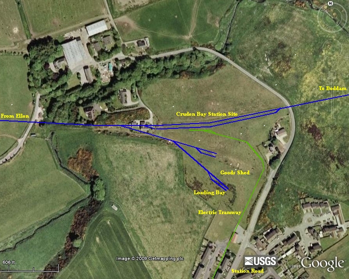
Cruden Bay Station Site from Google Earth V1.
The following photos are reversed from the shooting order to follow through from the Hatton to Cruden Bay pages
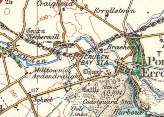
Cruden Station NLS Maps
The following photos are reversed from the shooting order to follow through from the Hatton to Cruden Bay pages

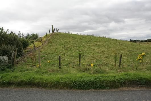
Entering the cutting on the approach to Cruden Bay station. The view is blocked by the garden fence on the left. The chimney and roof of the station house is seen in the background. Railway fencing
remains top right. Right: A little further into the cutting towards the station, looking back towards Hatton and the gap where the railway crossed the road
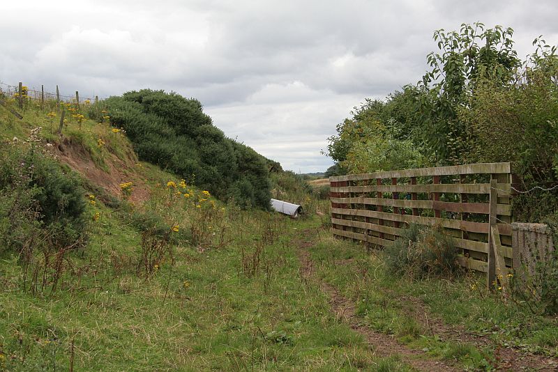
Still looking towards Hatton at the mouth of the station approach. The fence on the right beaks the clear view through the cutting, where the railway crossed another road and onto Hatton.
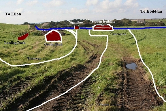
At this point the tracks fanned out behind me into the station and goods yard. Right: Reverse view from the above. Again the fence and dumped equipment spoil the clear view. As described above,
the tracks fanned out from the single line. The station lines to the left while the goods lines curved to the right. Railway fencing can be seen top right. The station house gives layout scale
This must have been the northern entrance to the station, from the Nethermill road. The house that partially blocks the cutting is to the left. Note those iron gates! I would think that they are originals.
The two concrete posts each side of the smaller gate is interesting in that they have been deliberately designed to look ornamental. Right: Standing virtually center of the station platform trackbed.
The Up platform to the left and the Down platform to the right of me, with the two tracks running towards the cutting where the goods lines went off to the left hand side of the field. With so much
demolished it is very difficult to imagine the scene.
From the leading points on coming out of the cutting, two goods lines ran straight ahead, with the shorter track going off to the right up to the short loading platform. The longer line ran straight ahead up
the Goods Shed, which lay close to where the sandy heap is dumped. The single line split into two, one track stopping outside and the other inside the shed. Just ahead of the goods line points another set
of points curved sharp left and then split into the up & down platform tracks, which were out of the picture on the far left. The tramway came in from the far right inside the railway land following Station
Road then just before the station entrance, up by the large trees, turned on a tight curve and eventually stopping at the buffers immediately to the far left.
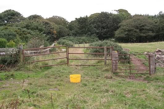
Right: From the far western corner just clear of the cutting. A wideangle view of the goods yard. Another iron gate that suggests that it is an origianal. Possibly the goods yard had been protected by this
gate! However, there had to be a post on the left side of it too, similar to the one on the right, which looks more like a tree runk than a gatepost!.The tramway came down the hill, inside railway poroperty.
The red-roofed building, which is a police station stands on the actual trackbed. The tram line hugged the inside edge of the field all the way to the far left as far as the main gate then on it's long curve
and stopping just behind where I am standing.
23rd Sept 2014 Walk

Original GNSR fencing by the southern entrance.

Left: From the short cutting the station throught opens up where the points to the goods yard turned off to the left.
Right: The southern entrance to the station coming in from Golf Road.

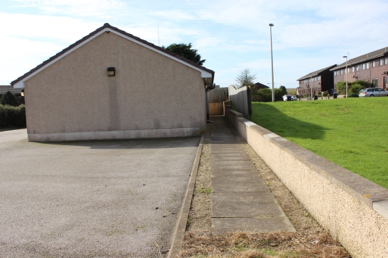
Left: From the south station entrance, looking north over the station site, towards the viaduct. Who could imagine a station ever having stood here.
Right: From the south side of the station entrance, looking southwards over the goods yard toward Golf Road. The track ran left to right atwhat was a local crossing.
===================================================================

Left: Approximately where the Goods platform stood. Looking towards the cutting coming in from Hatton. The goods shed was to my right of the heap of soil with the two goods lines running up to
the mainline points by the cutting. The tram line and terminal ahead a little and to the right and terminating alongside the Up platform, which ran the length of the area.
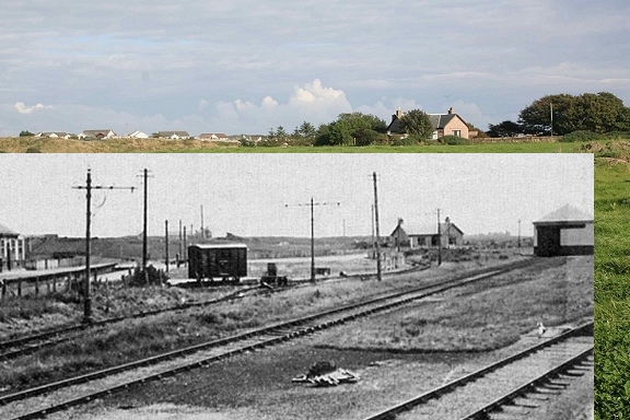
Above right & Below: A "Now & Then" photo. The scene is from the western corner of the station layout by the embankment, looking towards
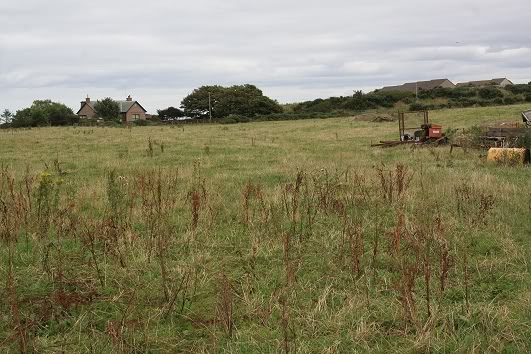
the Station House with the backfilled cutting just beyond the viaduct to the far left. The empty field makes it very difficult to imagine what the
scene was like in the railway days. The montage below is almost impossible to believe and proves just how almost complete the railway
demolition has been. It's almost as if someone was determined that the railway would never return again!
 Img_0182b.jpg

(Nov. 2017). Another interesting find, on the Internet. Here we see the whole of the station, the Goods Shed and the tramway. It's nice to see how
the station and the tramway were laid out and looks very neat. The photos below left and above left, says it all! The Up station buildings were
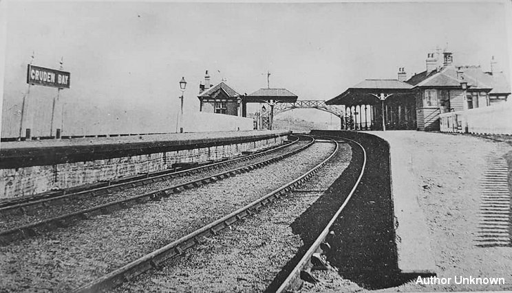
badly damaged in a fire in the 30's and had to be totally demolished. (Author Unknown).
![]()
(October 2024) Cruden Bay Station. The signalman stands outside his signalbox with the Up platform buildings, footbridge between
the two platforms and part of the Down line platform with the Down starting signal towards Boddam. (Grampian Transport Musium).
(June 2019). Another excellent find, this time on Facebook. Cruden Bay station from the Ellon end looking along the platform tracks towards Boddam.
It also includes the station name board on the Down platform. Very neat track work. (Author Unknown).
The closest to the photo above. From around the same spot looking what would have been between the two platforms towards Boddam. This is a much wider angle
view and so taking in more area between the north side of the station (left) site and to the south taking in the station house (right). (17th Sept. 2008).

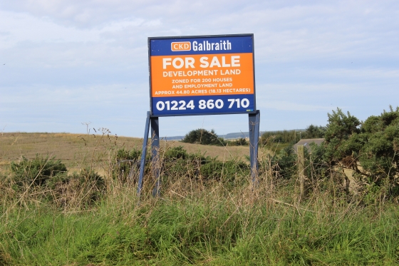
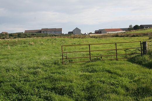
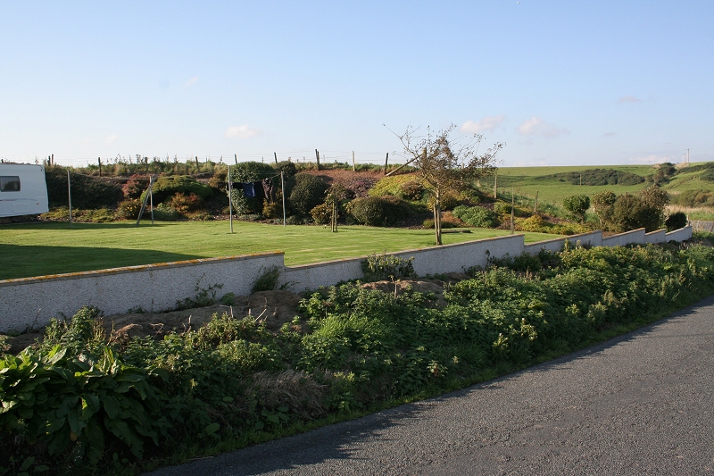
Left: The main station entrance on Golf Road. Right: The station site is up for sale and a housing estate built on it. Surely a mistake should the station ever be considerted for reopening in the future!

Left: The main entrance from within the station site. Right: Looking towards Hatton, along the center of the two platforms.

Left: The western stub of the track bed as it crossed over Golf Road and to the viaduct.
Right: The tracked crossed Golf Road on a bridge and over an embankment to the viaduct to the far right.
The embankment remains where the road bridge stood on Gulf Road.

The north end viaduct as seen from the bottom end of Golf Road, where the road crossed the Cruden River.

=======================================
Another visit to the top side of the viaduct on the 23rd Sept. 2014.


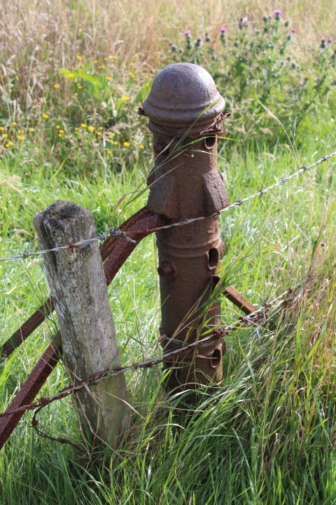
The police Station stands on the tram track bed. A wire tensioning post is the only remains of the line at this spot.


Where the tramway crossed the main road and into the Hotel site.
From 26th Sept 2014
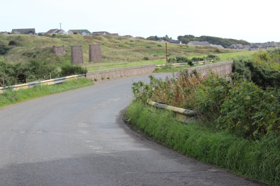
The north end viaduct as seen from the bottom end of Golf Road, where the road crossed the Cruden River.


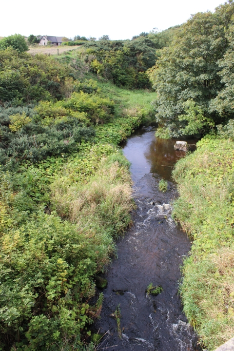
Left: The river Cruden running northwards and curving around to run below the viaduct and into the sea by the beach.
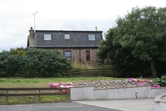
Right: The south side of the river bridge, with the house built out onto the railway cutting at the south end of the station site, top left.

==================================================================================
Another visit to the top side of the viaduct on the 23rd Sept. 2014.
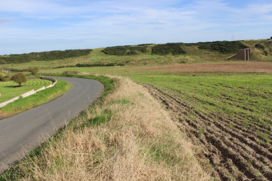
To reach the viaduct there is a foot path, which today starts from the new road that is now part of the new housing estate. (Morrison Place). The path starts from the river bridge and takes you around the higher estate of
Braehead. The path is good until you ahve to get to the top of the viaduct remains, which can be very boggie, with high grass and reeds. You need to take care, both getting there and once on embankment at the top
of the viaduct. There is no fencing at the viaduct edge so care must be taken when at the edge.

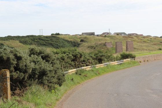
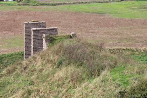
The viaduct remains from the footpath.


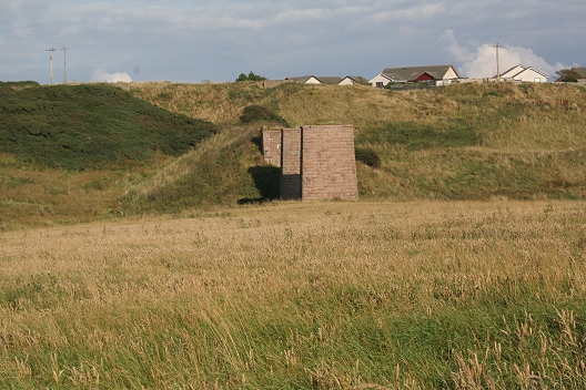
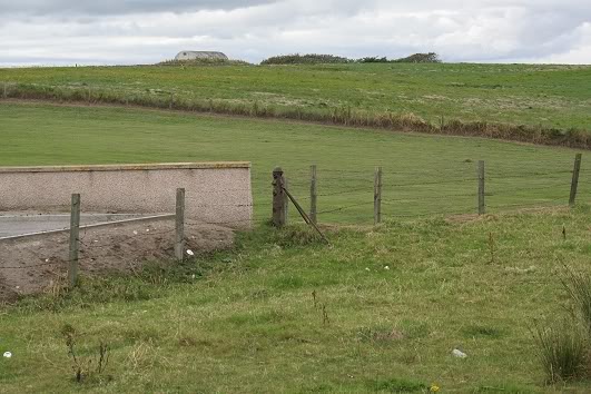
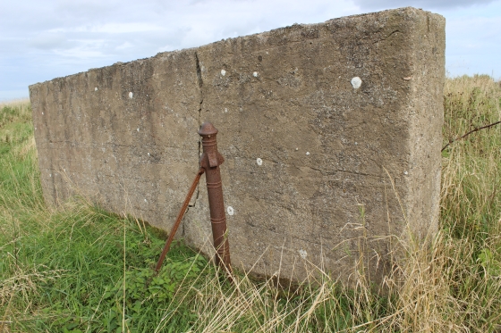
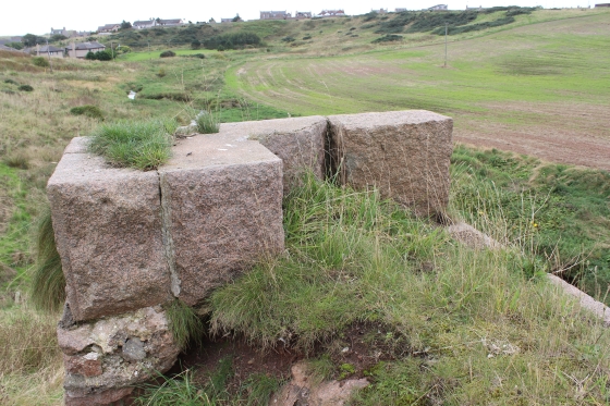
On the track bed on the north side of the viaduct. The cutting has been back-filled. However, you can see the two concrete blocks that mark each side of
the farm access bridge that crossed over the railway. The Down starter signal stood at the opening of the cutting on the left of the track bed. The signal
wire had ran all the way from the signal box at the station.
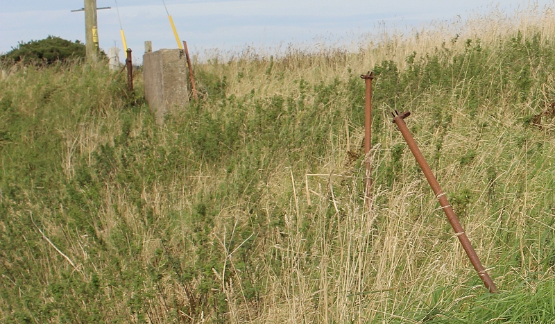
A cropped section from above right. Interesting metal poles, which would appear to be remains of the farm access bridge that crossed the mouth of the cutting.

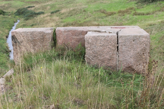
The north side concrete block of the overbridge with a wire tension post still standing.

The viaduct towards the station with the gap of the removed embankment and road bridge
(See below ).
.jpg)
October 2024 Cruden Bay Viaduct overlooking the River Cruden with the embankment from the viaduct to the Gulf Road over bridge then on to the
station site. (Author Unknown).
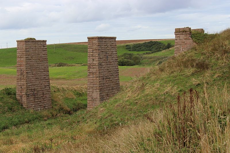
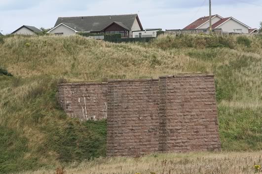
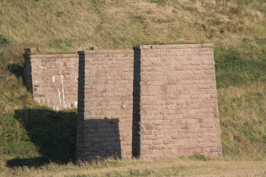
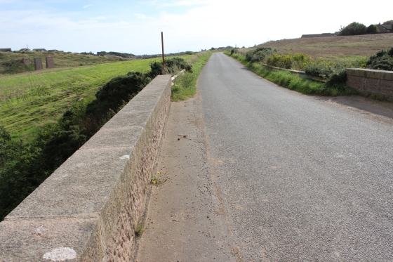
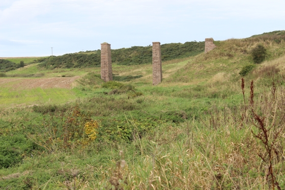
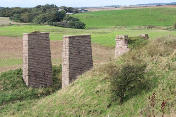
The east and west decorative pink granite edges of th viaduct. Both show considerable corrosion, albeit the stones themselves appear to be quite complete.

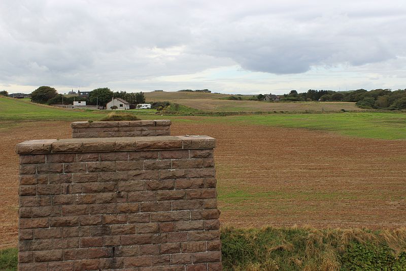
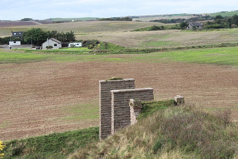
The two granite pillars are still in excellent condition in spite of the years of weathering. Lined up to show the direct line to the embakment on the west side of Guf Road and where the line ranto the station site.
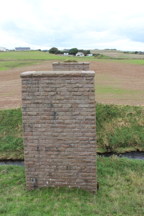
A wideangle, horizontal view of the viaduct peirs.


The granite stone sets of the sides of the viaduct.


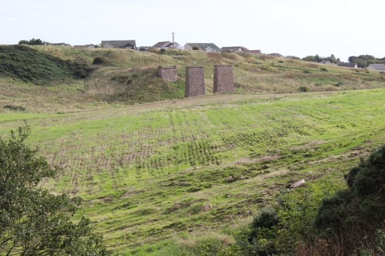
Left: The river Cruden curving off westwards towards Nethermill. Right: The two pillars and north embuttment of the Viaduct.

The viaduct pillars as seen from the main road. The road alongside the new houses at the top of the hill (Braehead) is called 'Station Road' which is completely
misleading if you are looking for the old station site, which is to the far left of the viaduct across the valley. Since taking this photo back in 2002, the view
above can no longer be seen as housing being built here blanks the view. 1999.
=========================================================================================
Cruden Bay Station & Tram pictures
=========================================================================================