Newtyle (Original Station.
HATTON INCLINE TO NEWTYLE OLD STATION
(Original Incline Formation)
(Iincludes screen grabs from Google Earth & Google Street Views)
(Update
April 2013) Hatton Summit to Millhole added)
Update June 2020.
Newtyle (Original Station.
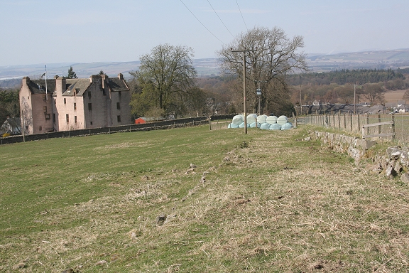
Old & New lines from Millhole to Newtyle
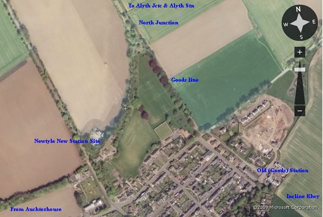
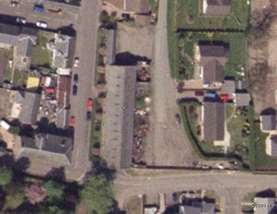
Newtyle railway layout. (Flash Earth)
Below
we start at the remains of the old line where it came down from the new
junction and crossed the road at Bulb Park and look at the remains of
the track bed and
goods yard and where the line continued southwards to the Hatton
incline. After a very enjoyable walk to the area on the 16th April 2010
I have added many new photos,
which have replaced most of the screen grabs from Google Earth and
Street View.

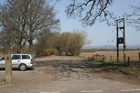
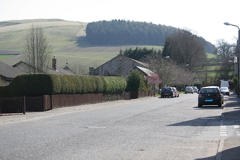
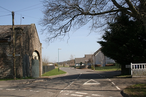
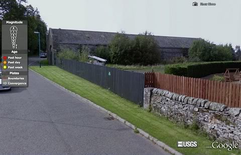
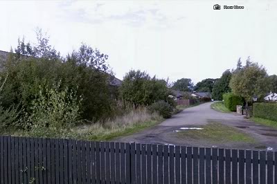
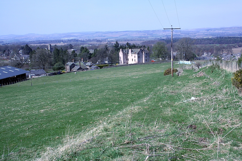
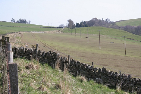
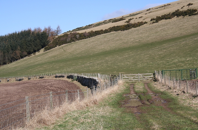
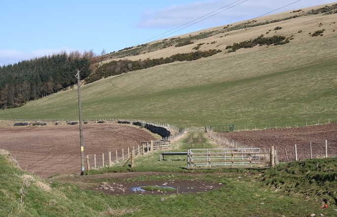
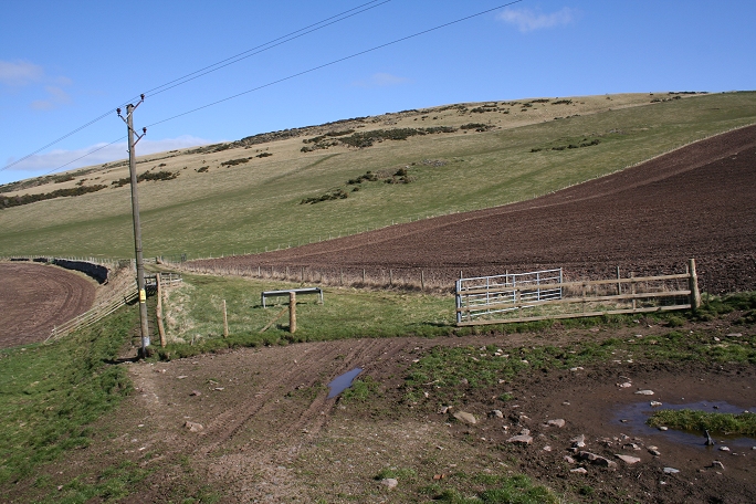
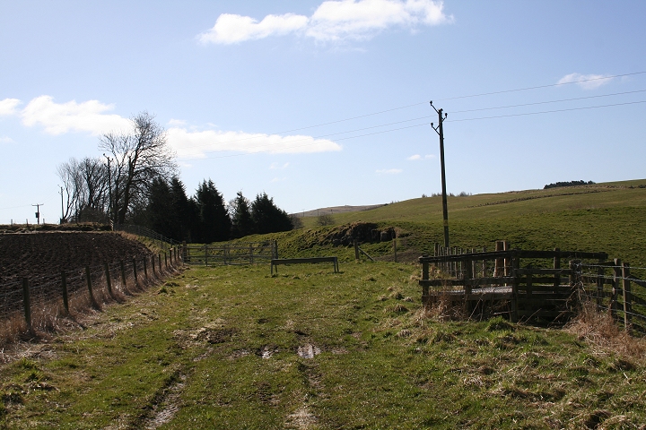
Site of the level Crossing at Bulb Park.
Looking east. The original line came in left, from north
junction to Newtyle old station , to the right.
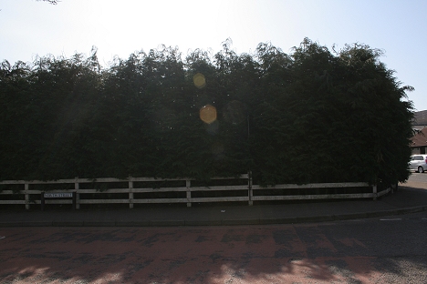
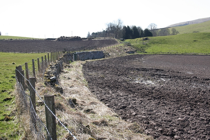
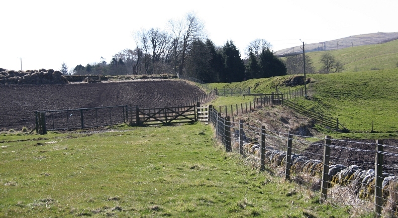
Left: North side of Bulb Park ( road). The old
track bed met the new station line at North Junction. Right: South side.
The track bed is under the houses behind these trees.

Update June 2020:
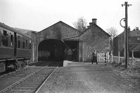
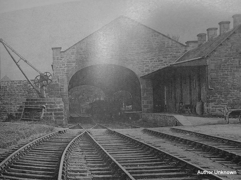
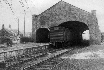
Came across this 1960's photo, taken at the level crossing on Bulb
Road. It shows the crossing gate and the tracks leading up to
the station and Bone Mill. The incline is the line of trees going up
to Hatton Summit behind the station building. This is the same spot
and view as in
the photo above right. Houses now cover the tracks to just before
the single platform that can be see up ahead. Commercial Road is quite
busy.
(Author Unknown).
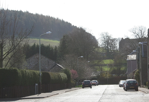
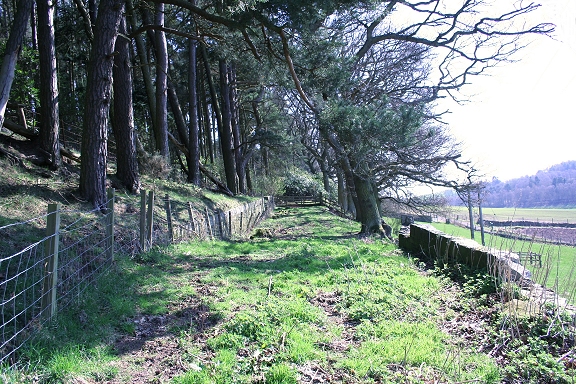
View from Commercial Street. If the trees
weren't there you would have a clear view up the incline,
virtually to the summit. Hatton Castle is up on the right
Left: The old station building is still in
situe, seen here on the left on Commercial Street. The station and
sidings remained in use for goods until total closure in the 60's.
Right: The old station north end seen from the gardens now on the track
bed.
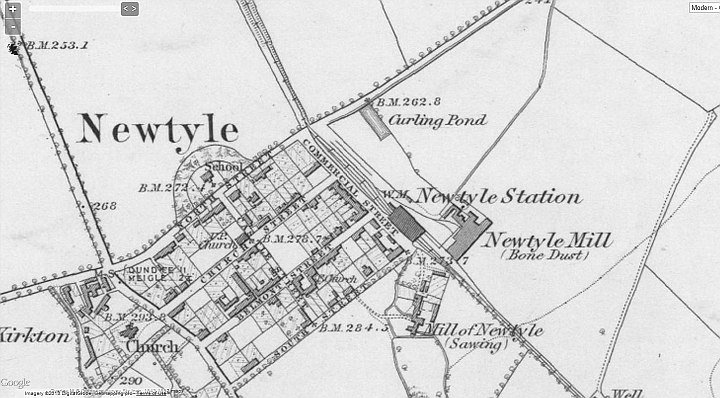
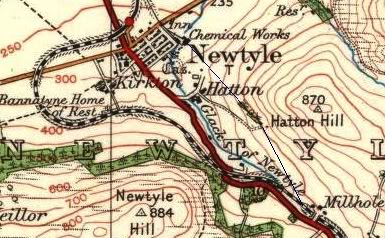
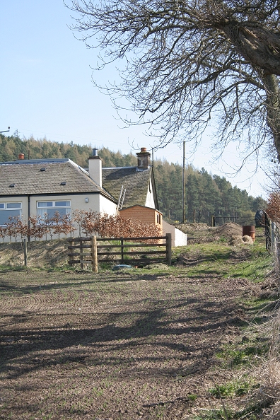
Newtyle (Old)
Station (Map)
Left: North end of Newtyle Old Station in the
60's, with Commercial Street on the
right.
Right: Taken during the period when
the station building was used by a Potatoe merchant in 1974. The old
fertilizer
works is seen far left. It was linked to the railway. The crane spindle
still stands on it's stony perch.
(Photo by Frank Spaven from the David Spaven collection.)
Check link at: http://www.railbrit.co.uk/imageenlarge/imagecomplete2.php?id=29813
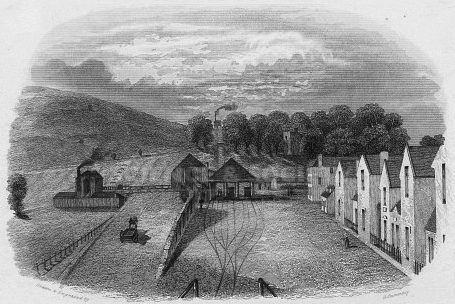
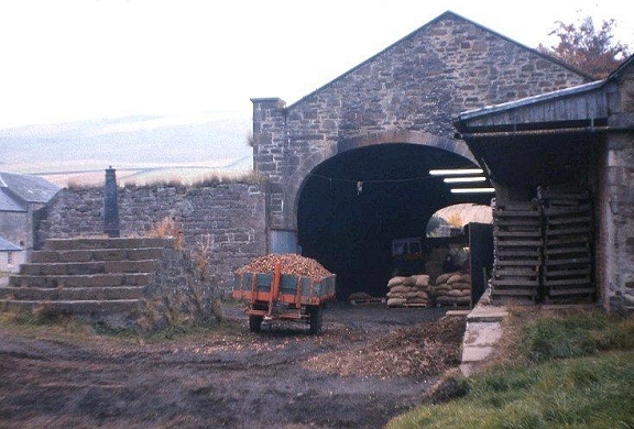
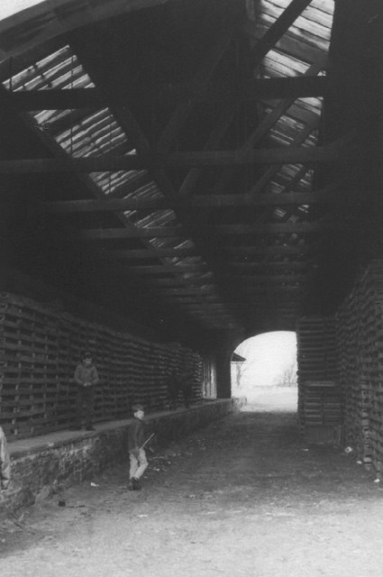
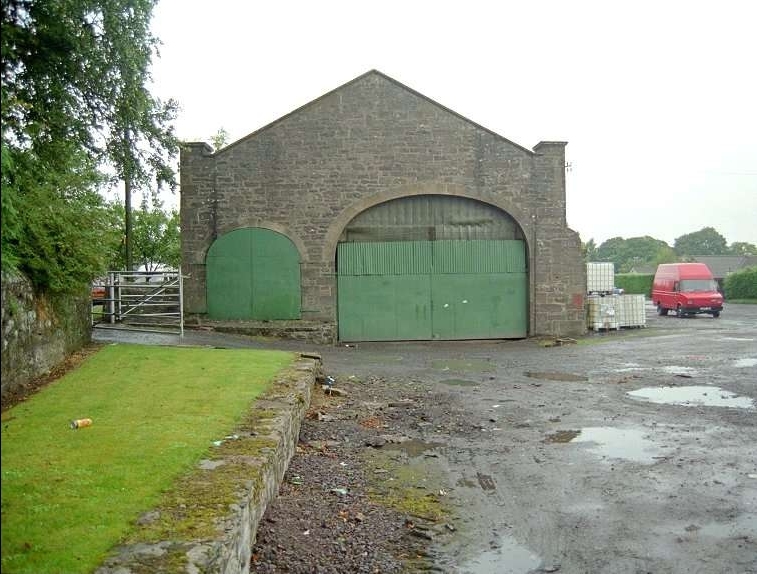
Came
across this photo on Facebook. I have no idea where it's from or
whom the author was. It's an excellent photo of when the goods depot
was still in service.
You can see the track at the north end of the depot and the sudden
steep rise where it continued up the Hatton incline, albeit the
incline had been closed many
years at this time. The central track was used as a head shunt for
the Fertilizer works, which you can just see the top of above the
wall on the far left.
In coming wagons would have been shunted up to the stop block at the
far end and then reversed back through the crossover on the left,
that led to another set
of points in the siding that then went into the works. Outgoing wagons would have done the same in reverse.
Left: North end of the station where the housing cuts off the trak
bed.
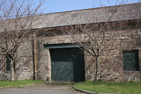
Right: The station entrance.
Left: April 2011 and almost from the same spot
as the photo
above.
Right: North end of
the station showing where the new houses take over the track bed up to
Bulb Park. April 2010.
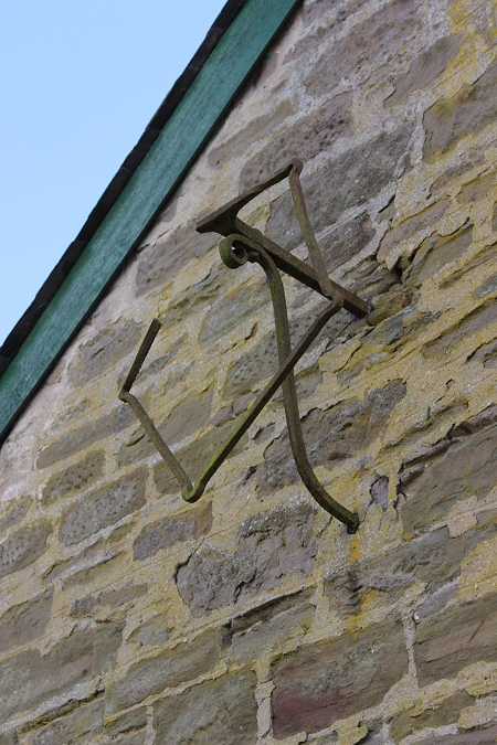
On
the north face of the station building is this metal fixture. Looks as
if it had been some sort
of notice board or perhaps a lamp! (17th April 2014.)

Left: North face of the old
station.
Right: East wall of the old station
Interior of the Goods Depot in 1966 when it was a Potato
store.
Proving that it had been so for at least ten years
(Elliot Simpson)
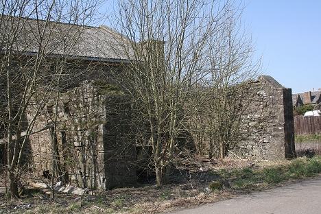
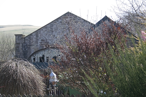
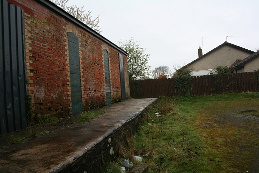
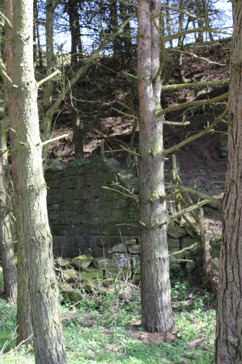
Left: Ruined station building on the east
side.
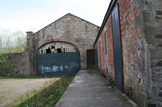
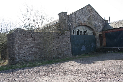
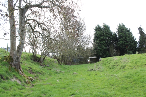
Right: The south facing end of the Old station where it went onto the
Hatton incline
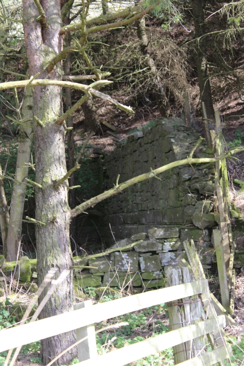
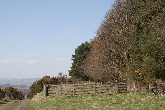
Left: The south end of the station seen from Knox Close.
Looking west. Right: The railway continued across the road and
southwards to the summit of Hatton Incline. Looking east.
This is an interesting Now & Then scenario,
showing the south end with the goods platform extending to outside the
building, where it went on to Hatton Incline.
Knox Close didn't exist at this spot. Left photo by Norrie Forres. Right
photo by Brian Forbes.
A 1998 photo by Ewan Crawford. It shows the platform split between the
gate and the passenger entrance of the shed. The incline to Hatton is
behind the camera. This is the spot where the present Knox Close has
taken over and the road had to be built between then and 2000. It
is
more recent than I realized. It's a shame that the platform had to
be removed as this spot is simply a cul-de-sac today. Interesting that
there
is no fence cutting the siding off and that ground was still open up to
the old fertilzer works which would have been to the right where
Ewan took this photo. This is also the spot where wagons would have been
coupled & uncoupled from the incline rope.
This brings up the question to whether was "Wire
Wheels" at the top and bottom of the D&N inclines as
there was on the High Peak
Railway. I would be interested to know as I have found nothing at
any of the incline sites to suggest there was. And if not, how was the
cable
returned to the engine Houses! Photo from http://www.railbrit.co.uk/index.php

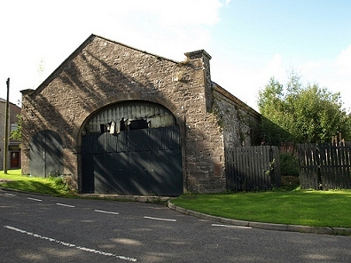
17th April 2014. The building has received
a fresh coat of paint all around.

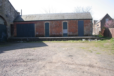
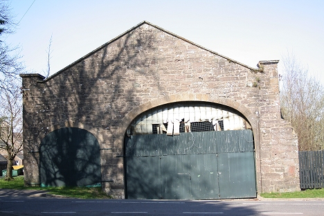
Left: South end of the old station and, Right: West facing
wall with vehicle entrance to the station, which had been well used
during it's time as a goods depot.
(On Commercial Street).
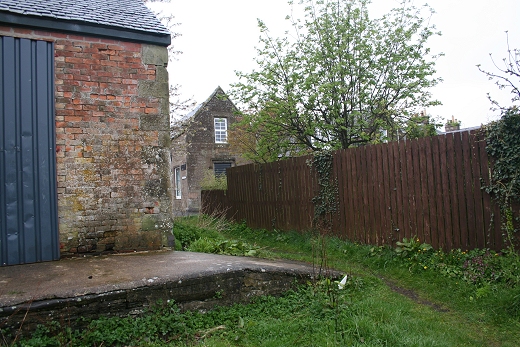
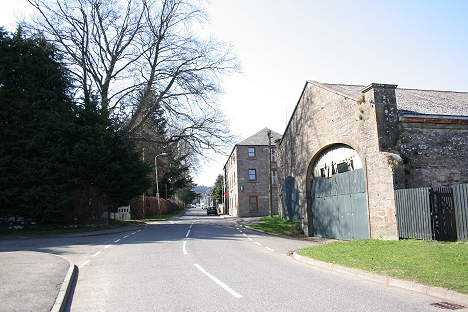
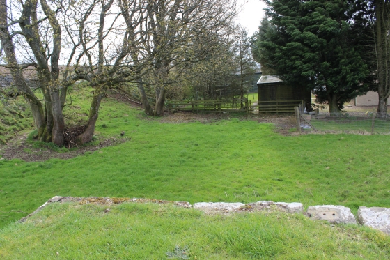
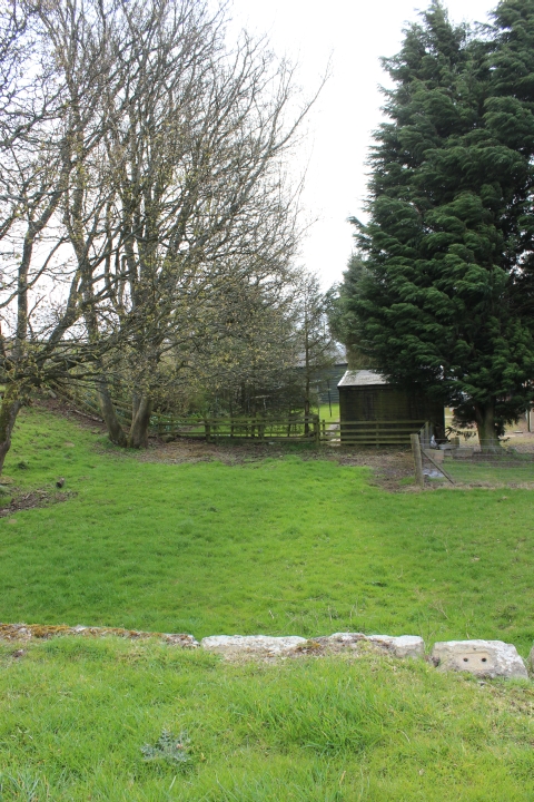
Left: The old station building from Knox Close. Right: The
station approach road and sidings. The Goods Shed stood inside the fence
just to the right.
The wall was 8-10 feet high along the parameter of the goods yard.
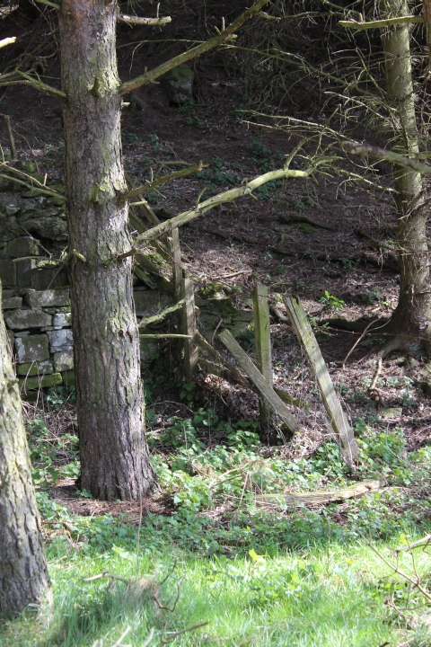
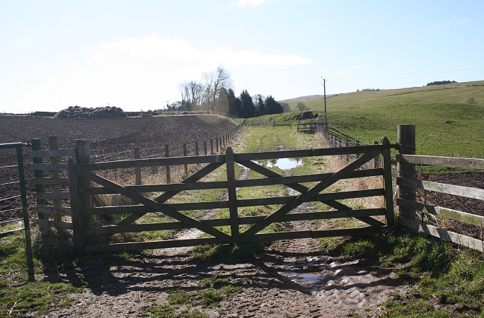
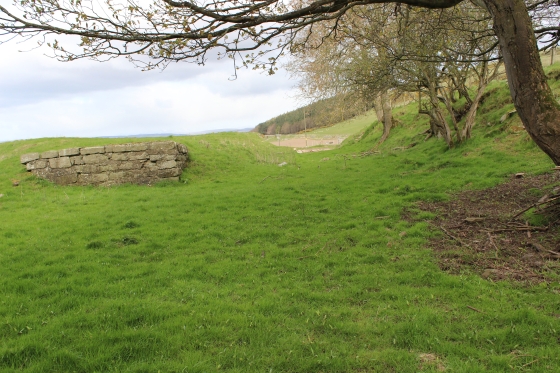
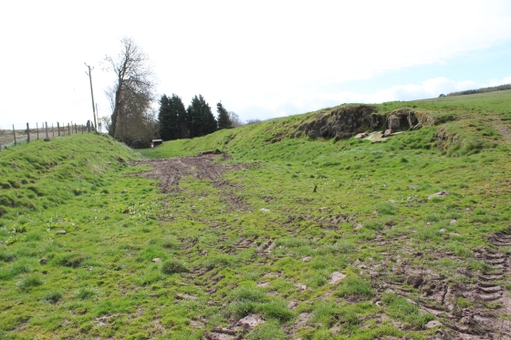
Left: This dead end was once the clear-way up to Hatton
Summit (See B&W photo and comments below). It was also the loco head
shunt until total closure and
was where wagons & coaches were attached and detached from the
incline cables.
Right: The old station site from Flash Earth. Running north to south. The Chemical works stood on the
right where the new houses now stand.
The house is built on the site of the old Fertilizer factory.
This 1966 photo was taken from the
north end of the station (as above right) and looking up the
incline to Hatton summit. and of Hatton station and
engine house. Hatton Castle is seen on the left. They are actually
standing on Knox Close, which didn't exist at this spot at that
time. The white house
is seen in my 2010 photo below right. (Elliot
Simpson).
Left: From the spot explained above. Looking down to
the old Station, hidden by the trees at the bottom. The
Incline as it passed Hatton Castle below
a narrow over bridge. Right: Northwards from the same spot with the
white farmhouse. The large tree is just in the frame on the right.
Left: Site of where the incline dropped below the
bridge at Hatton, by the castle (To the far
left) Right: Northwards the track bed
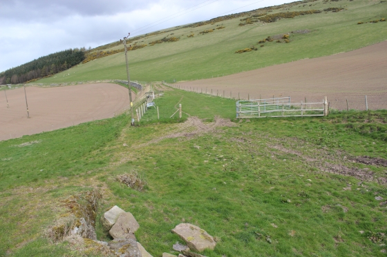
is gated due to cattle grazing. You should ask
permission to walk up and upon the incline. Luckily I met the farmer
when I arrived here.
You can see the natural curve of the trees that helped me pin-point the
B&W photo above.
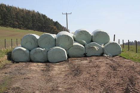
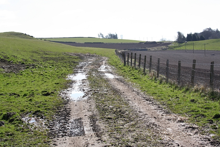
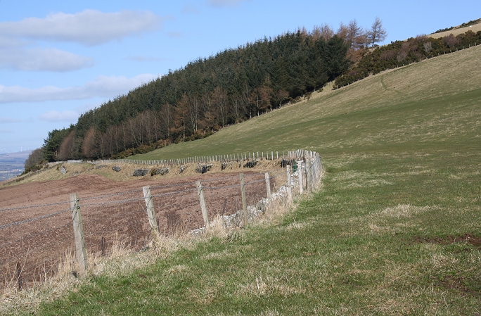
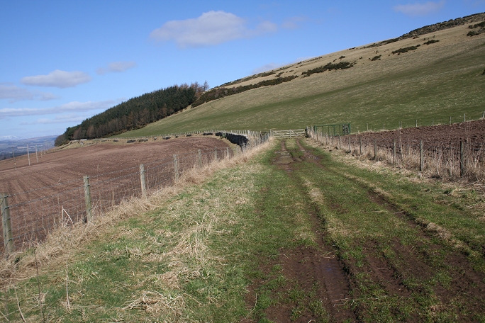
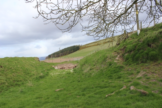
Cattle Feed stacked on the old track bed
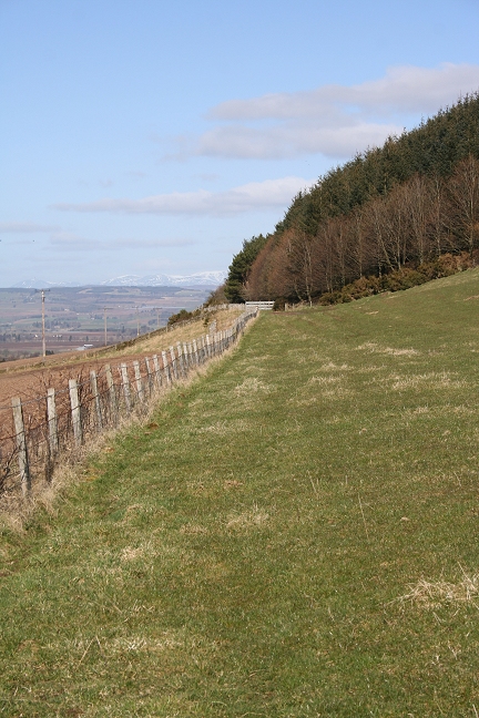
Beyond the bails of Cattle feed you start to see and feel
the steepness of the gradient
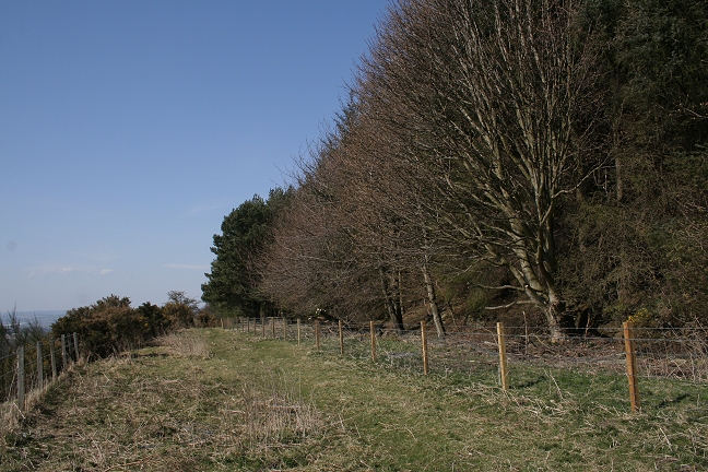
Looking south towards Newtyle Old Station.
Hatton Castle on the left.
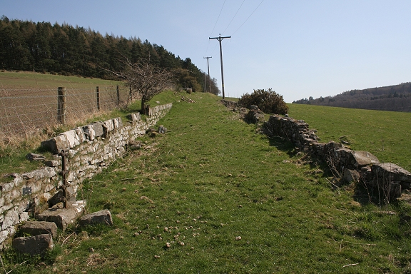
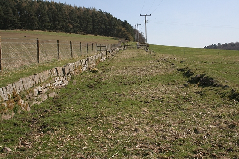
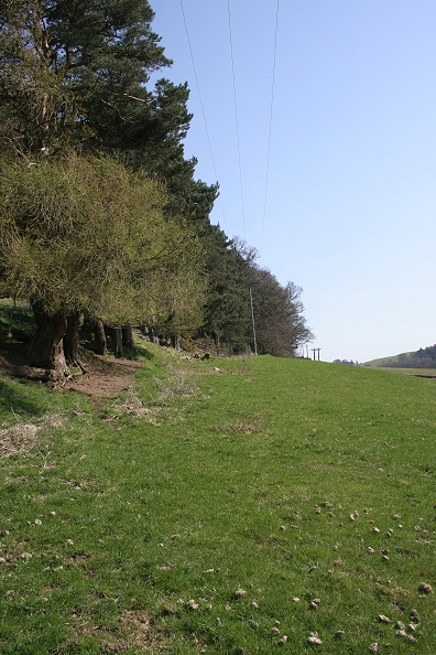
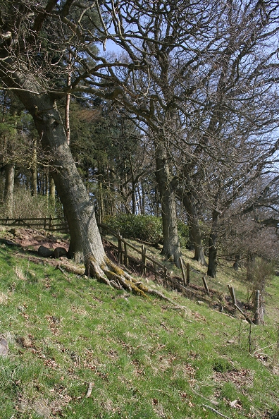
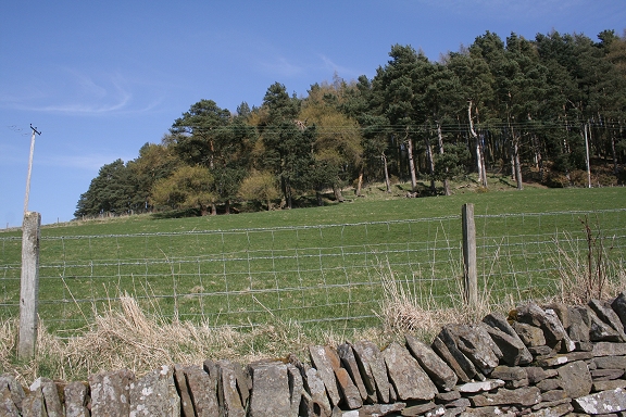
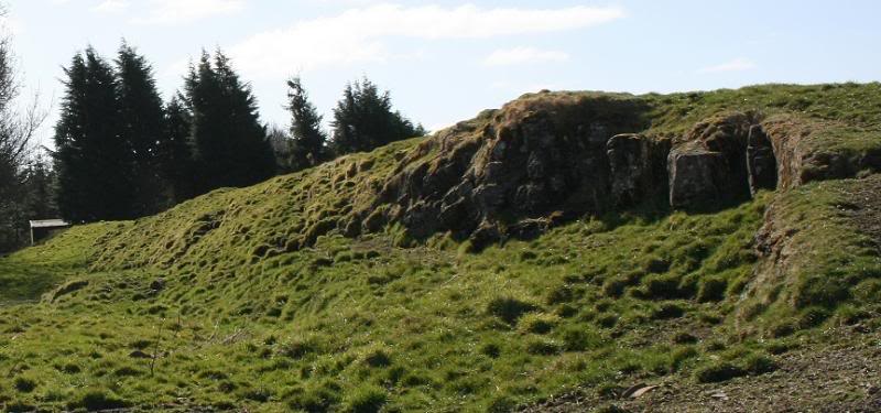
Half way up the north facing incline. Much of
the railway walls are still evident. Note the wire tensioning
post on the left.
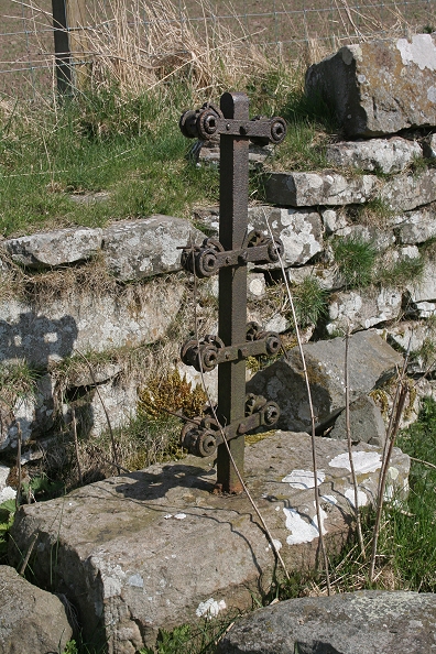

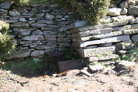
Left: The wire tensioning post is in excellent condition,
albeit the cogs are well seized up.
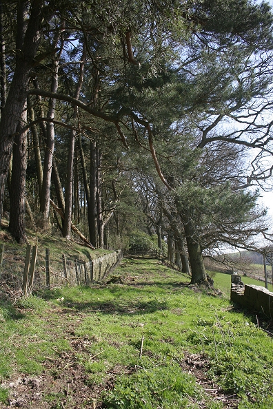
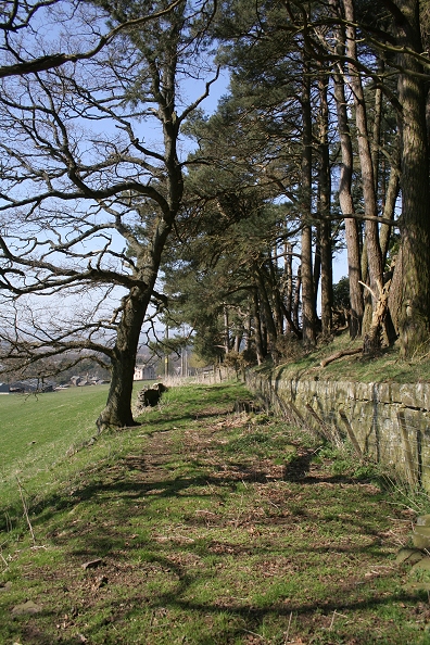
Right: The railway's stone walls are quite extensive towards the summit.
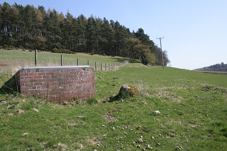

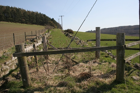
One of the many drains bult in the area after the line
closed that takes water from a reservoir to Dundee that David Martin
explains in the new section following below.
It is always difficult to remember that the inclines all closed back in
the mid 1860's and that many man-made, and natural changes have
taken place since.
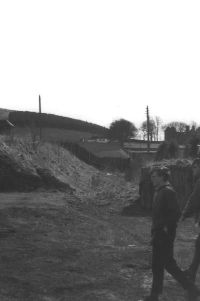
Left: Elliot Simpson's 1960's view. Right: My own 2010 view
close to the same spot half way up the north facing incline. N.B. the
housing on the right
Three parts up the incline. Right: Close to where the
Engine House stood.

Left: Nearing the summit
Right:
This is where you have to get down
the bank on the right and walk around the area to where the Station
House Stood.
Left: Looking southwards to
Newtyle. Close by the Engine House site.
Right: Approaching the summit, where the station house stood.
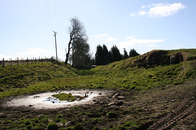
Site of the engine house.
POSSIBLE ENGINE HOUSE REMAINS (17th April 2014)
At
this spot you can see the remains of a stone building. This may be the
remains of the
engine house or simply a heavy retaining wall.. I couldn't get over
the fence to have a
closer look. (17th April 2014).
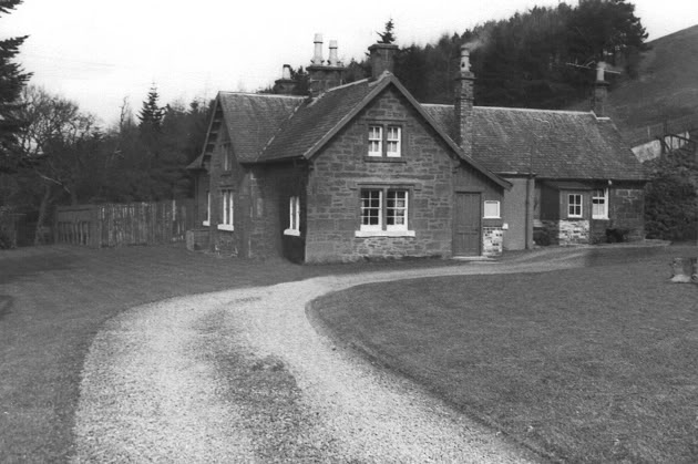
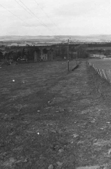
Hatton station house in 1966. (Elliot Simpson).
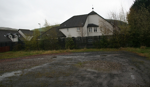
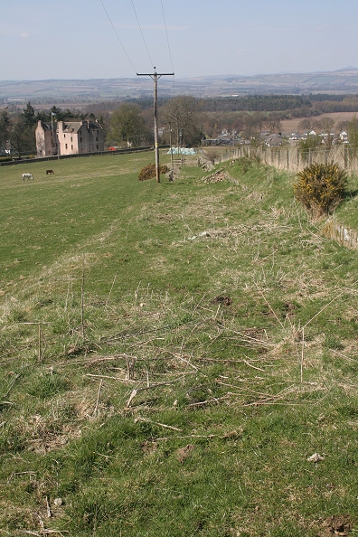
Left: The Station House site in April
2010. A sad sight and such a waste of a very nice
house.
Right: The site of the station house
is now fenced off for grazing. The steep road that the engine house and
station
staff had used comes up from Hatton Farm on the left, with Newtyle way
below.
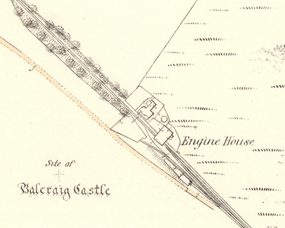
Hatton Station
& Engine House (Map)
At Hatton Summit, where the incline drops down the south
facing incline to Millhole and Auchterhouse. This is as far as I went on
this walk, although I was very tempted to
keep walking towards Millhole. Perhaps another time! The view on the
right is virtually the opposite view to Elliot's B&W photo below..
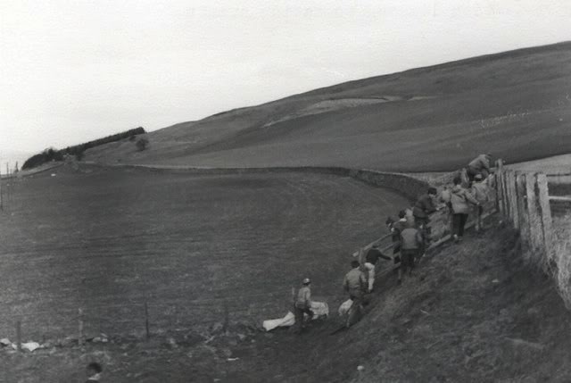

Left: Ramblers getting onto the old incline
track bed in 1966. (Elliot Simpson).
Right.
Almost the same spot. 17th April 2014.
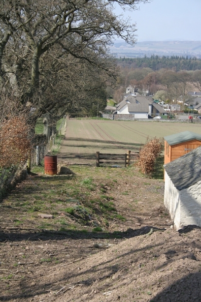
Part
way down the incline, overlooking Newtyle, with the Castle jst ahead
and the church to the left. (16th May 2010).
On the way down via the farm road the 1 in
12/13 incline is quite obvious.
=======================================================
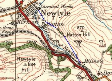
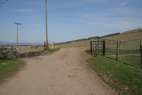
Update April 2013 Hatton Summit to Millhole
On the 19th of April 2013 I managed a walk from Dundee
(Downfield) to Hatton Summit via the new line but taking in the
incline track bed from Millhole to Hatton Summit. From Auchterhouse
I walked the road as far as Millhole farm and attempted to get
permission to go through the farm up to the old track bed. However
there was no one available and I simply walked around the
small house at the farm site and was able to get onto the old track
bed from there by climbing over the gate that blocked the way. I had
considered that it was a simple walk from here to the
summit but what I had not realized that there had been a shallow rock
cutting at this point and quite wide before it leveled out again and
headed for the Summit. The rock cutting was interesting
and I wondered why it had been built so thoroughly. I had read about a
siding on the line called Pitnappie Siding and as Niall Ferguson
mention that Pitnappie siding was close to Hatton summit
I took it that this was the spot. AS it turned out I was wrong and
that the siding was further south by Pitnappie farm and where the
level crossing was on the single-arch bridge at the junction with
the Couston road.
These photos are in reverse to the order taken
as had walked northwards towards the summit but they are placed in
order to run from the summit towards Millhole.
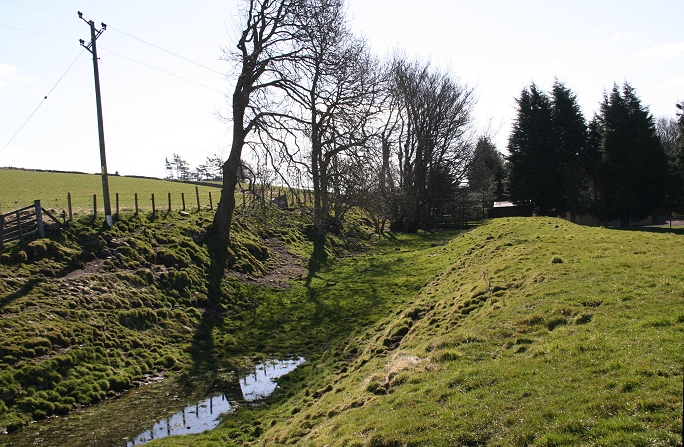
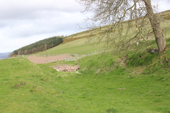
From Hatton Summit towards Millhole. Two days before there was a day of heavy rain and the ground is still very wet and bogy.
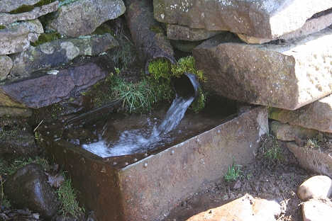
A spring just south of the Hatton
House site towards Auchterhouse. According to David Martin "The red
brick 'water drains' were built in the 1880s and mark the line of
the pipe
which takes water to Dundee from the Litrathen Reservoir. It
is dated to at least ten years after the incline ceased operation.
Similar brick structures appear every few
hundred meters along the pipe line".
From the Spring towards Hatton Station
Site at the summit
From this point the off side railway
fencing has been totally removed up to the summit
About halfway between Millhole and Hatton Summit.
Leaving the north end of the cutting the
line curving off towards the summit.
Reverse view to the above. The stone
reinforced wall where Elliot and the rambler's had climbed up onto the
track bed in the 1966
black and white photo above.
Note the embankment of the
newer divergence line to the right.
The embankment
of the newer track bed as seen from the rocky cutting. The track bed
has just left the north side of the
three-arched bridge at Millhole and is curving towards where it
crossed the B954 then taking the long horseshoe curve
into Newtyle for the new station site.
On the left the farmer has built wooden
steps too and grom the field. Elliot and the ramblers wouldn't need to
struggle up
the embankment today.
Reverse view from the
above. Notice the S-bend formation running through the shallow
cutting. It would appear that the local farmer wouldn't sell his
bit of land to allow for a straight run, which looks to have been
reasonably feazable .
Another fence across the track bed and
the first sign that there is a cutting up ahead
It still looks has a very
railway-like appearance. Note the present wooden steps down to the
fields on the right.
The track bed does appear to be much wider
through the cutting but if this has simply been a single line I am
wondering why
the track bed appears to widen for the cutting.
An interesting rock cutting. The bare rock
suggests that perhaps some blasting was used to form the cutting.
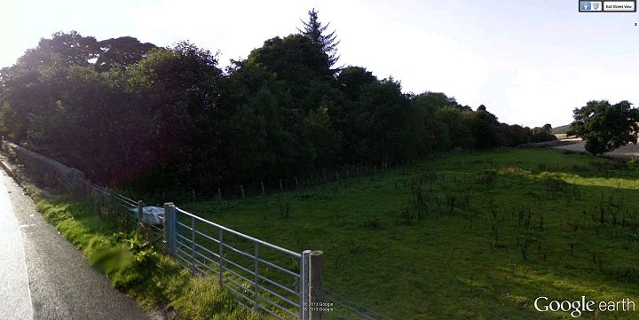
From the rocky
embankment the track bed stops at the private garden parameter. From
here it dropped steadily above what became
Pitnappie Cutting for the new line and up to the level crossing prior
to Pitnappie siding.
A
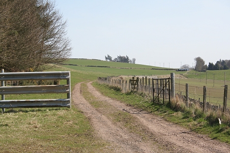
retaining wall by Millhole Farm. 1(16th April 2014).
Left:
End of track bed on the north side of Millhole
Farm.
Right Same spot looking northwards towards Hatoon Summit. (Both 17th
April 2014


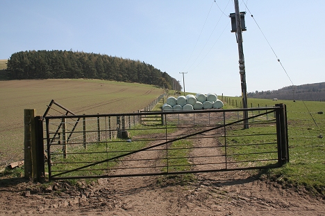
The next port of call south of Hatton (Millhole) is the
remains of Pittnappie Goods Siding, where the loading bay is still
seen. A short quarry track led from Pitnappie Quarry, below the
main road and up to the platform. The tunnel below the main road has
been blocked up. The old incline trackbed was cut off from the
new line just before the points for the loading Bay.

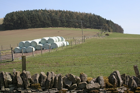
Screen
grab from Google Earth of the Millhole area, showing the old and new
track beds. Included is the Ex level crossing and the site of
Pitnappie
siding where the two lines separated.
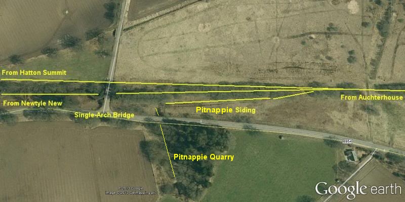
Site of Pitnappie siding. You
can make out the shape of the goods platform. Also the spur too an from
the quarry that went below the B594.

The road entrance was on the corner by the
road junction to Couston.
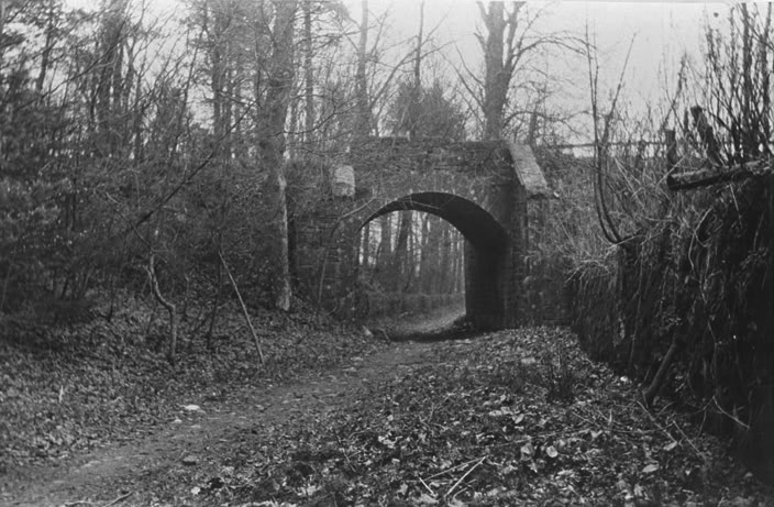
A screen grab of the site
of the level crossing by the single-Arch bridge on the Causton road,
seen on the left with the deep cutting following
the tree line to the right. This is looking towards Millhole.
Pitnappie siding was on the south side of this crossing, which was
deserted when
the single-arch bridge was built for the new line to
Newtye. The sidings is the spot where the old and new
lines separated.
This is as far
as this section goes for the moment but with learning about Pitnappie
siding and that the deep cutting is being being cleared with
new drainage added I shall return to this area again when the
opportunity arrives.
David Martin has an excellent collection of photos of the drainage work through Pitnappie cutting on at his Flicker site:
http://www.flickr.com/photos/davidmam/sets/72157632899189326/
SEE PAGE AUCHTERHOUSE TO NEWTYLE via Dronley (New Route) for continuation from Pitnappie Goods Site.
=================================================================================
This photo is out of context. I am not sure
where it should go but could be the bridge on the divergence between
Rosemill and Dronley.
Above would be the Templeton Road.
The Hatton incline between Millhole and Hatton in the 60's
================================================
To conclude this section here is a phtoto of Hatton Castle
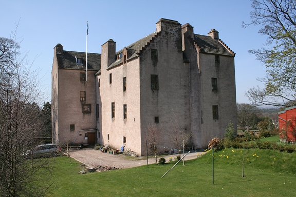
Hatton Castle. Renovated after many years of
disuse
http://www.scotland.com/castles/angus-dundee/hatton/
https://www.youtube.com/watch?v=5_DxCgUWtuk Video incluHatton incline seen from he air.
=================================================
NINEWELLS JUNCTION TO FAIRMUIR JUNCTION (New Route) Back to D&N Index
Links & Reading:
The Dundee & Newtyle Railway by Niall Ferguson. Still available from some books shops and on the Internet.
The Dundee & Newtyle (A history by Elliot Simpson)
http://www.auchterhouse.com/history/railway.htm (Includes and excellent map of the railway)
http://www.geograph.org.uk/search.php?i=7762615 Excellent 'remains' photos including the Law Tunnel, Balbeuchley Incline and Dronley
http://www.hows.org.uk/personal/rail/incline/dund.htm Explains the inclines but sketches are very poor quality and almost useless.
Video Screen grabs from the The Railways Of Scotland Volume 8 "Dundee". An excellent video available on DVD, from Cinerail at: http://www.cinerail.com/cinerail/railways-of-scotland.html There are many great archive scenes of almost every
Scottish route you can think of. Well worth a look.The Cromford & High Peak Incline railway in Derbyshire has been luckier in having much of it's buildings, including an Engine House preserved. This is what could have happened, indeed, should have happened with at least one of the D&N
inclines. However, the C&H gives an excellent comparison of what the D&N would have looked like.http://www.hows.org.uk/personal/rail/incline/hop.htm
Boddam To Ellon Branch (Walks) By Bill Reid.
Hosted by www.theatreorgans.com
This page brought to you by:
VintageHammond.Com - We Buy-Sell-Trade Vintage Hammond Organs and Roll or Kari Organ/Vending Machine Moving Dollies Order Roll or Kari Dollies Here