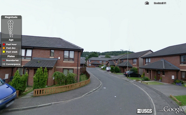
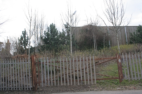
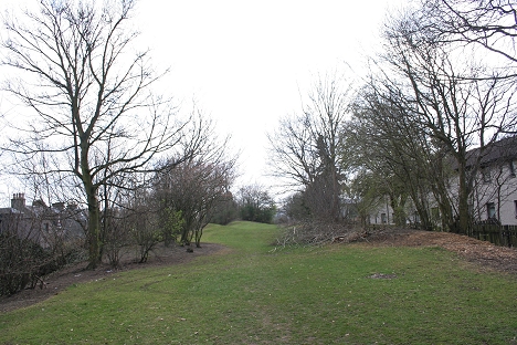
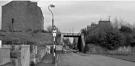
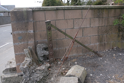
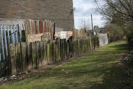
Left: Site of Back Of Law Station just south of Law Tunnel, which contained a Smith's Shop, Wright's Shop and Engine Shop.
Right: Sit of Back Of Law Station and goods sidings (Looking South towards Strathmore Avenue)
LAW TUNNEL TO DOWNFIELD STATION
(Update Aug. 2015)
Left: Site of Back Of Law Station just south of Law Tunnel,
which contained a Smith's Shop, Wright's Shop and Engine Shop.
Right: Sit of Back Of Law Station and goods sidings
(Looking South towards Strathmore Avenue)
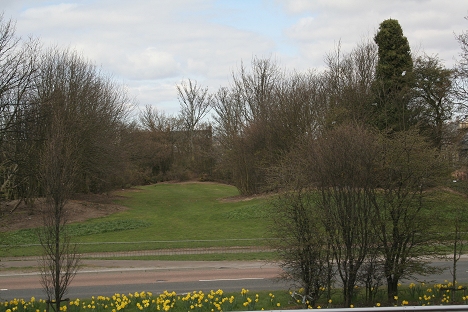
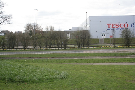
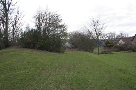
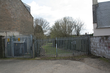
Left: From the Law Tunnel and Back Of Law sidings where it
crossed Strathmore Avenue. Right: North side of Strathmore Avenue where
the track bed ran below the road and to
the west side of Kings Cross Hospital to Crossroads Station at
Clepington Road.
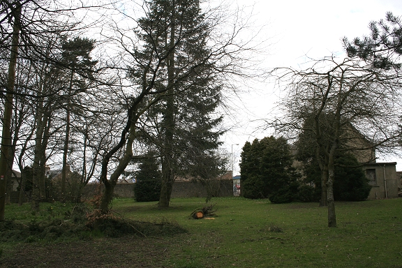
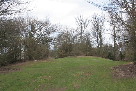
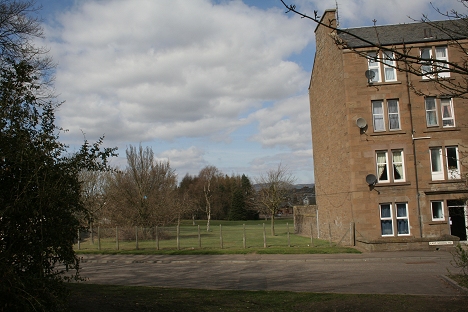
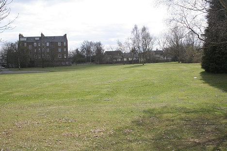
Kings Cross Hospital between Strathmore Avenue and
Clepington Road. The remains of the incline track bed are seen on the
left. This may be the remains of Crossroads station, which stood
here. The station house, which now stands within the
hospital grounds remained as a private home until recent years but is
now abandoned and in a poor state.
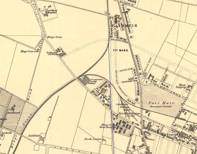
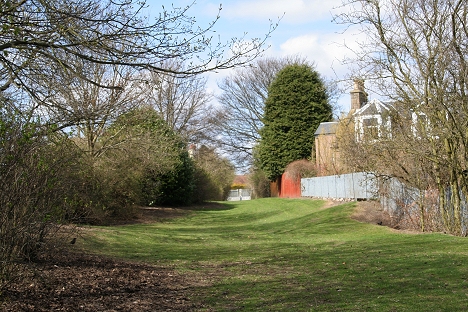
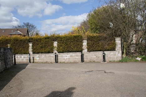
Fairmuir. The blue line shows the run of the old line from
just north of the Law Tunnel and under Clepington Road to
Balgray Road, where the new line from Lochee joined the old track
northwards. Balgray Road became part of the
Kingsway bypass.
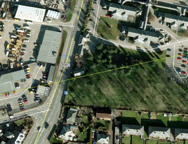
Crossroads Station Site, with the Station House askew to
Clepington Road (B960), dictated by the angle that the railway
came in from off the Law Tunnel. Fairmuir Goods Yard site is on the left
side of the road.
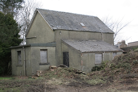
Crossroads station house stands in the hospital grounds.
Sadly it lies empty and boarded up and is looking rather run down. I
suspect the problem is the fact that it is in the
hospital grounds and private tenancy wouldn't be very welcome or
practical. However, due to it's historical past it really should be
preserved.
 CrossroadsUnderBridgeSouthSide.jpg
Left: This was probably the station clock. Right: Site
where the railway ran below Clepington Road and northwards.
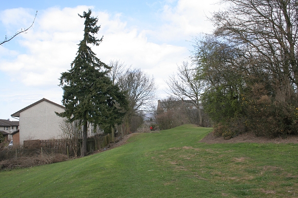
Looking south from the station house, with the line of
sight towards Strathmore Avenue. There would
have been a clear view from here to the Back Of The Law sidings
and the northern tunnel mouth.
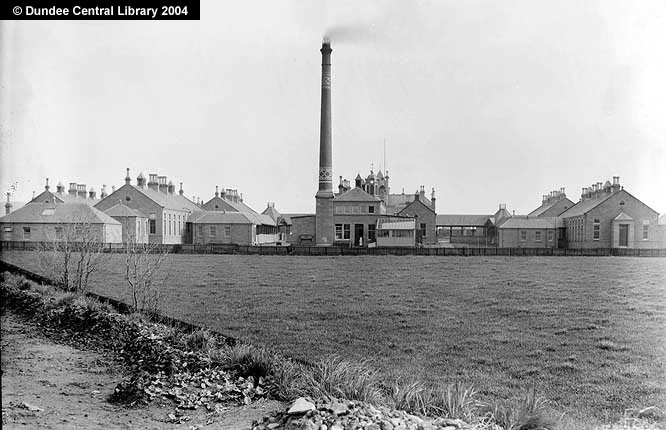
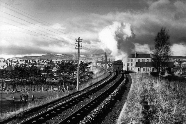
The Dundee Central Library photo above would have been taken from
somewhere between here and
Strathmore Avenue, looking back towards the camera.
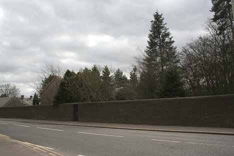
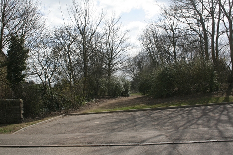
Left: The railway bridge on the south side of Clepington
Road, on the west side of Kings Cross Hospital. Crossroads
station was just behind the bridge and the station house is
partly hidden by the trees on the left. Right: On the North side of
Clepington Road. The industrial estate is on the site of Fairmuir Goods
Yard. The track bed has been
backfilled up to the bridge and Clepington Road level. The track bed ran
towards the over bridge at Balgray Road, which is now the Kingsway
bypass.
l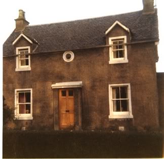
 DNRlwyEntranceToOldInclineTrackbedP.jpg
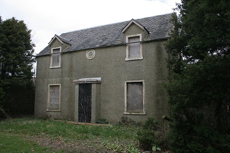
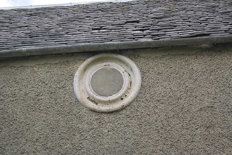
Left: Crossroads Station House in better times. The white
circle above the door may have been the station clock. Right: This
private path in Muirfield
Crescent was a ganger's entrance onto the old track bed, which runs east
to west in front of Tesco in the shopping center.
The old track bed from within the industrial estate. Behind
the fence. Looking northwards.
Left: The track bed is below the trees on the left, which
is now in Lintrathen Gardens. Right: Looking north towards the
Kingsway. The Muirfield & Maryfield branch cut
across this scene, while the old D&N ran directly northwards..
Left: South remains of the Bridge over the Kingsway. To the
east side of Tesco. Right: Northern remains of the Bridge on the
Kingsway by-pass. This photo ties up with the one
below in that it shows the extra width at this point due to the two
lines meeting on the north side of the road.
Left: The Kingsway Bridge During demolition in the 60s'
Right: Remains of the 'new' bridge in the 60's. The incline railway met
the new line at this point and can just be made out to the
right of the newer track bed. The scene northwards looks very much
in open countryside compared to the present day scene. However you can
walk this section as far as East School
Road, where the tall tenement building stands up ahead. (Right:
Elliot Simpson).
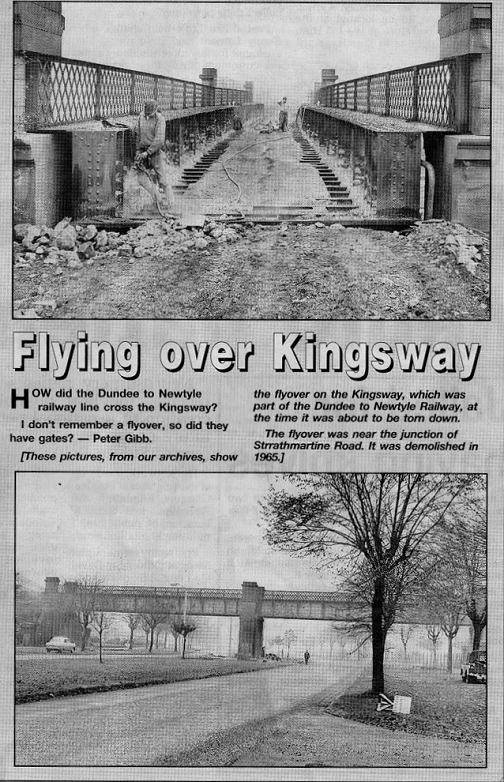
Interesting piece of news print that I
found on the internet. Shows the Kingsway
over bridge at the time of it's demolition in 1965.
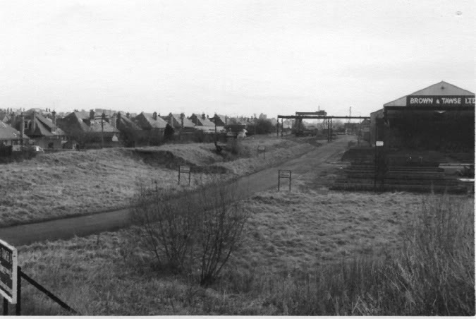
The incline track bed at Fairmuir as it ran south towards
Crossroads Station. It was used as the driveway into Brown & Tawse
Ltd.
The overhead Crane spanned over both old & new track beds. Taken
from the track bed of the new line on the south side of the
Ex Kingsway over bridge. (Elliot Simpson).
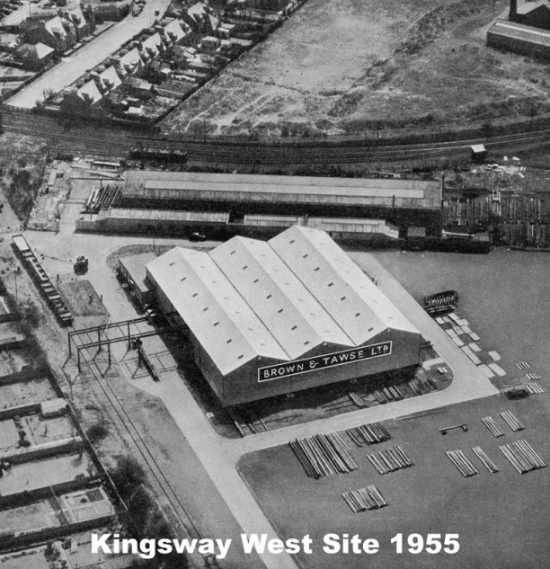
Photos and comment added by ---- -----. (May 2014).
My thanks to Donald
----, of Dundee who sent me these photos of Muyirfiled Junction, which
includes Brown & Tawse' building site. The track seen in the first
photo is that running east from
Muirfield Junction towawards Muirfield and Maryfield goods
yards. You can also msee the spur that ran into the work site. The
road seen going off at top left is ----- ----. The incline
railway coming in from the Back Of The Law, just out of site, far
left.
The 1980 photo above is
of the same spot but also shows the later divergence from Lochee
coming in from the top center. Lintrathan Gardens is
seen to the top far left. The Dundee Ice Rink, now sadly gone, is
seen bottom right. The road running at an angle though the site is on
the
original incline railway track bed. The work
site of Brown & Tawse is still very much in action and there is no
sign of the land clearance and
the new shopping centre that now stands at this spot.
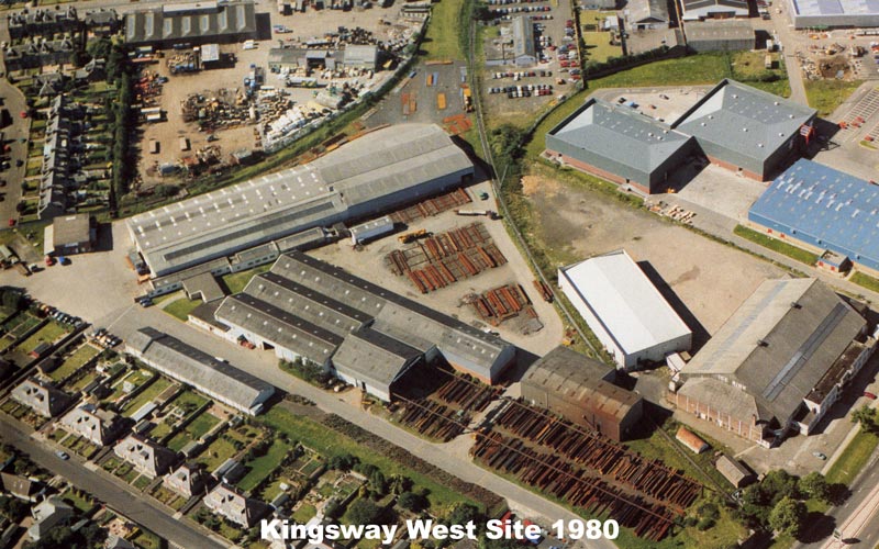
Photos from Brown & Tawse Web Site at: http://www.browntawse.com/
Left: Looking south over the Kingsway to the over bridge
site, where the B&W photo above was taken from. Right: North side of
the Kingsway looking towards Downfield.
You can walk the track bed from the Kingsway to East School Road.
While this photo was simply titled "Near Downfield" my
immediate guess was that this was just north of the Kingsway!
The extra width on the right suggests this is where the old and new
track beds met! Today, behind the trees on the left is
the bottom of Laidon Terrace and the train is about to cross over East
School Road. The four storie tenement is still
there as is the house just in front of it. A neighbour mentioned that
the latter was a house for railway staff .
Approximately at the same spot as above. I have used a
slightly wider angle than the original but not having
the photo with me it was very much a guess. The four storie house on
East School Road is obvious and you
can just make out the house in front of that, through the tress. The end
of which is now Laiden Road. On
the left the remaining fir tree is probably the most easterly one of the
line of trees seen in the B&W photo above.
This is quite a pleasant walk today.
Left: Midway between East School Road looking towards the
Kingsway. Right: Looking towards East School Road.
East School Road. Site of over bridge. Left Towards
Americanmuir Road. Right: Towards the Kingsway bypass. You can't walk
the trackb ed from here to Camperdown Road but
must walk around via Strathmartin Road.
Left: The over bridge on School Road. (Author
Unknown).
Right: View looking south from Camperdown Road towards East School Road.
This section is
part of the School grounds, which is why it is fenced off at both ends.
Left: Site Of Camperdown Road over bridge (South). Right
Looking north towards Americanmuir Road. While you can walk to the
Americanmuir Road end of the track bed you can't
et out and have to turn back and walk around Strathmartin Road.
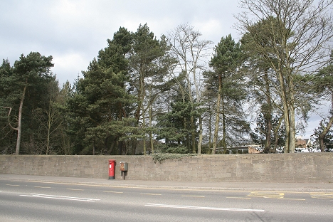
This wire tensioning post is the only original railway
artifact to be seen between the Kingsway
and Downfield. North side of Camperdown Road.
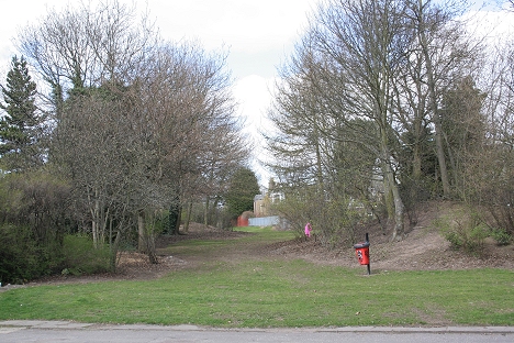
A short way into the track bed towards Americanmuir Road.
Looking north then south respectfully
At the Americanmuir Road end of the track bed, which is
fenced off. Looking north then south respectfully. Not a pretty sight
but the sleepers are a nice touch.
Left: Southern side of the Americanmuir Road over
bridge.
Right: Northern side of the over bridge looking towards Downfield &
Baldovan Station.
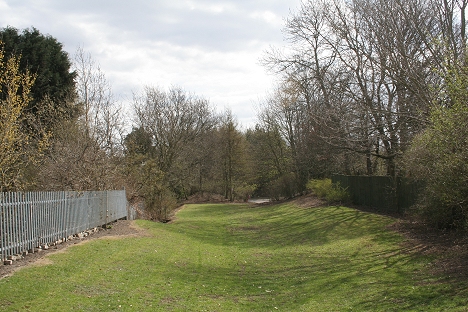
After walking the three sections from the Kingsway I considered it a real shame that you couldn't walk the track bed all the way to Americanmuir Road as it is a lovely green walk,
which makes you feel that you are in the countryside rather in a heavily built-up area. The gate is padlocked and may be open at certain times. An interesting point too is that the
fence is the same make as used by rail Rail track for railway security. They may still be responsible for the upkeep of these sections.
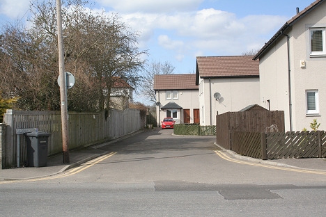
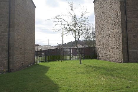
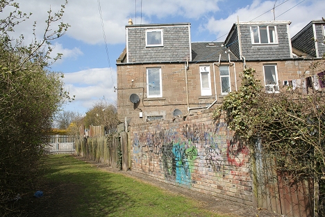
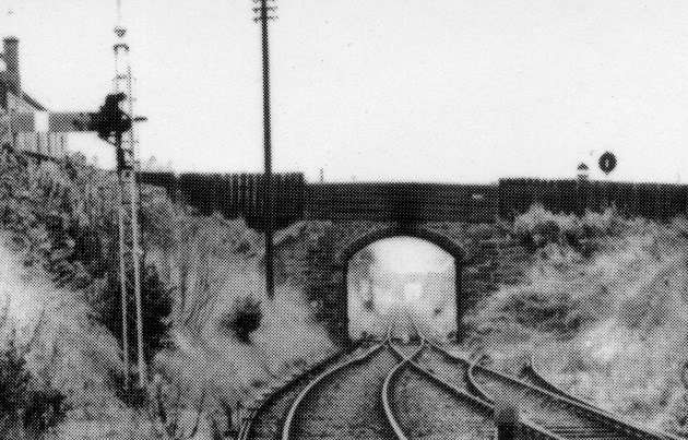
It is difficult to accept that the railway ran along
Caledonian Gardens. Left: Looking north. The fence probably follows
the western side of the track bed, which was all in a cutting.
Downfield station is approx. 200 yards beyond this spot and would
have been visible to the driver as he braked into the station. The
semaphore signal seen below would have
been on the right by the house windows Right: Looking
south. The brick wall is probably the western parameter of the
track bed.
View from Baldovan & Downfield station, with the bridge
at which is now Caledonian Gardens by Clone Street road
crossing (above). The bridge at Americanmuir Road is in the distance.
(D. C. Thomson)
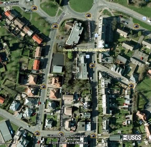
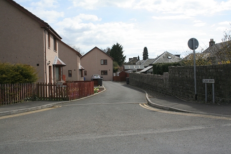
From Caledonian Gardens to Downfield Station, which lay
between Frederick Street and Strathmartin Road
Two new links well worth a visit.
https://www.youtube.com/watch?v=5_DxCgUWtuk
https://www.facebook.com/DundeeLawTunnel
==========================================
DOWNFIELD TO ROSEMILL JUNCTION (Original Route) Back to D&N Index
Links & Reading:
The Dundee & Newtyle Railway by Niall Ferguson. Still available from some books shops and on the Internet.
The Dundee & Newtyle (A history by Elliot Simpson)
http://www.auchterhouse.com/history/railway.htm (Includes and excellent map of the railway)
http://www.geograph.org.uk/search.php?i=7762615 Excellent 'remains' photos including the Law Tunnel, Balbeuchley Incline and Dronley
http://www.hows.org.uk/personal/rail/incline/dund.htm Explains the inclines but sketches are very poor quality and almost useless.
Video Screen grabs from the The Railways Of Scotland Volume 8 "Dundee". An excellent video available on DVD, from Cinerail at: http://www.cinerail.com/cinerail/railways-of-scotland.html There are many great archive scenes of almost every
Scottish route you can think of. Well worth a look.The Cromford & High Peak Incline railway in Derbyshire has been luckier in having much of it's buildings, including an Engine House preserved. This is what could have happened, indeed, should have happened with at least one of the
D&N inclines. However, the C&H gives an excellent comparison of what the D&N would have looked like.http://www.hows.org.uk/personal/rail/incline/hop.htm
Boddam To Ellon Branch (Walks) By Bill Reid.
Hosted by www.theatreorgans.com