THE ABERDEEN TO INVERURIE CANAL (Remains)
As at APRIL 2029 with older photos to add to interest.
Bill Reid
(PAGE FOUR OF EIGHT)
SCATTERBURN TO BUCKSBURN
The next sign of the canal is at Scatterburn, where Maggiemoss Road and South Anderson Drive with Great Northern Road.
The original Maggiemoss Road at this point has been abandoned, which luckily, for the time being has protected the small
area where the canal remains and where a very old house used to stand.
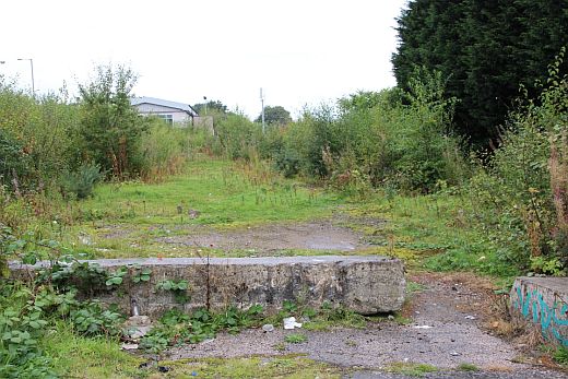

Left: The canal bed looking southwards towards Bucksburn. The building on the left is at the joining of Great Northern and Auchmill Road that was the Council and County
Council border, where Scatterburn tram terminus was. Right: Looking towards the City. The house below stood at this spot by the canal bed.
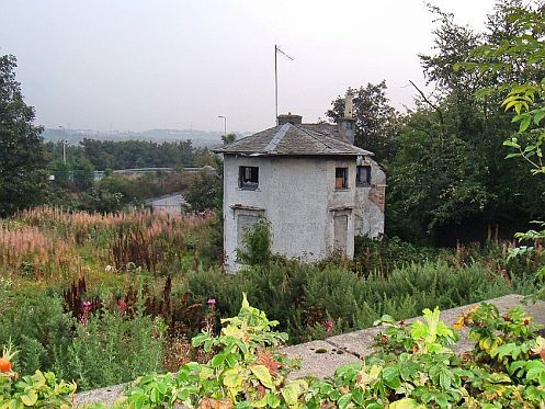
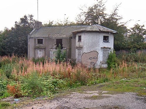
This house stood alongside the canal. The canal ran past between the house and the wall in the foreground. I remember it as a beuitiful building with a nice garden and
recall the owner working on the side of the house on a ladder. It is not certain if this had actually been part of the canal or possibly a Toll House. You can just see the
new section of Maggiemoss Road behind and to the left of the house. As you see in the photo above, right. It no longer exists.
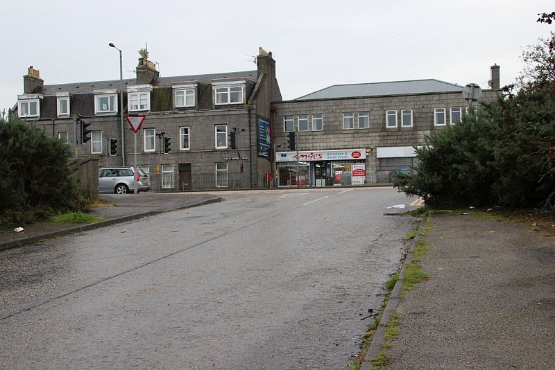
The abandoned Maggiemoss Road junction with Great Northern Road. The canal ran across the road where I am standing.
The housing estate where I was born is up behind the shops. This is where I grew up. I remember the Ex Co-op being built
in 1957. There is a new Maggiemoss road and bridge over the railway and this section of the road has been abandoned.
The old railway bridge where we watched train from still exist but is blocked off. Persely station was on the west side of the
bridge. The Station Garage stands on the site today.
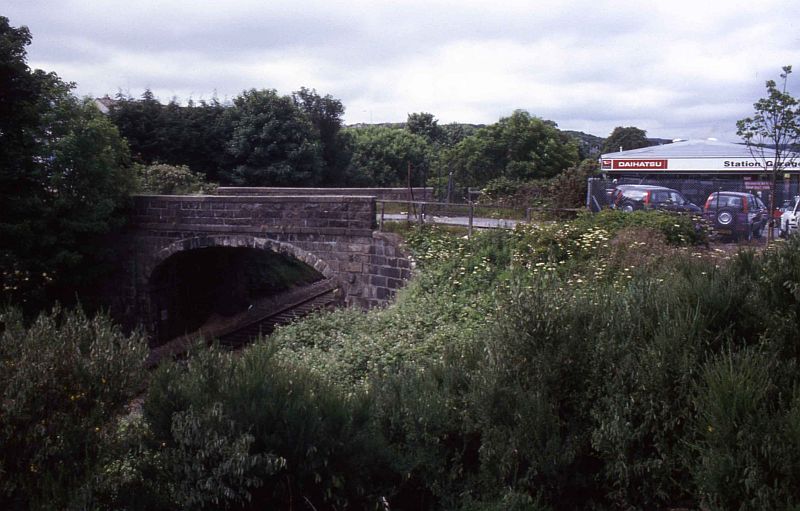
The old Persely Bridge (East side) which is isolated. Station Garage on the old station site. 1990's.
.JPG)
The old bridge today (East Side) with double track on the Up side already laid and awaiting commissioning. (13th April 2019)
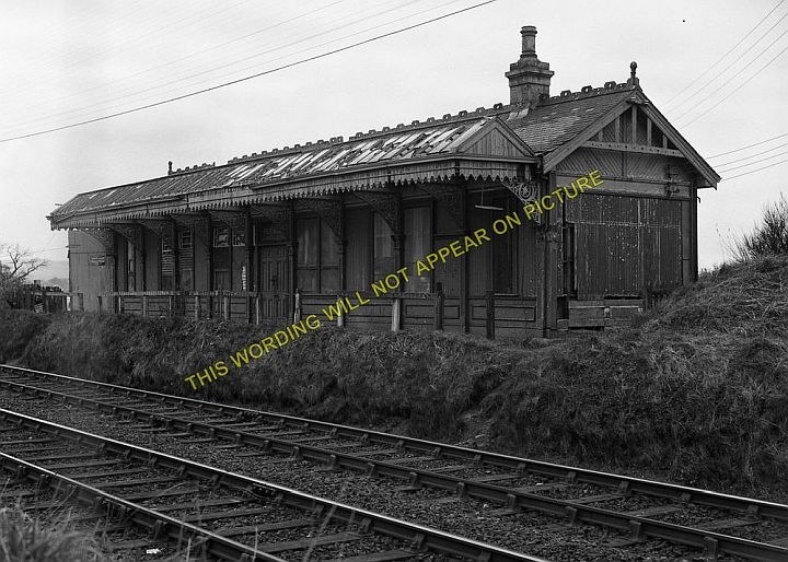
Persley statin building on the Up side of the line. Ths photo can be purchased on the internet without the water mark.
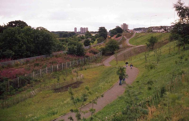
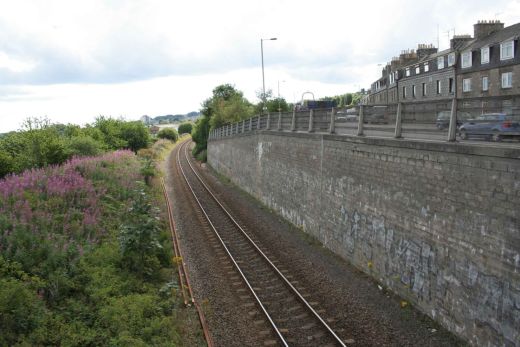
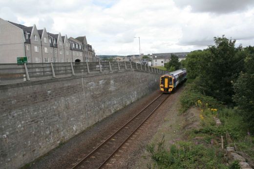
The train in the photo is passing the site of Persely station. The photos above were taken by the over bridge you just see behind
the train. From this you can see that the canal bed has been dug out to quite a low level than when it was there. A small linear
path has been formed for quite a way, following Auchmill Road and railway towards Bucksburn. This is looking towards the City.
Our tram terminus was where the light coloured building on the far right stands.
.jpg)
Scatterburn tram terminus (1950's). Just as I remember it. I lived just a couple of hundred yards up the road
on the right and for safety I stood at the corner by the high wall at the bottom of Manor Avenue watching
trams come and go. I enjoyed lots of chat with the drivers and conductors over the years and got to know a
good number of them. There was only two of these 1940 built experimental Standard streamlined trams
(numbers 140 & 141) and both are caught in this photo. (Author Unknown).
This was the limits of the Aberdeen District Tramways but until 1928 the rails continued to Bankhead Road
in Bucksburn that was the Aberdeen Suburban Tramways. The canal ran on the opposite side of the granite
built wall on the left. These two trams and 30 odd of the SuperStreamliner trams were all taken down to
the private tram track at the beach and burned. Many were were less than ten years old in 1958.
.jpg)
A reverse view to the above photo. The canal ran behind the wall. On the right you can just make out
Maggiemoss Paper Mill in the distance which no longer exists and is now a large modern housing estate.
N.B. Above the front of the tram are three metal fittings on the overhead wire. The center of the three
fittings is the toothed block that caught the pantograph and forced the pantograph to face in the opposite
direction for running back into town. This object was an invention of an Aberdeen Tram employee that
was then used by many other tram systems in the UK. Uually the turn over was acted when the tram
departed townwards. However, here the pantograph is already turned which means that the driver had
made the change-over once passengers had departed then moved further back beyond the block.
(Author Unknown).
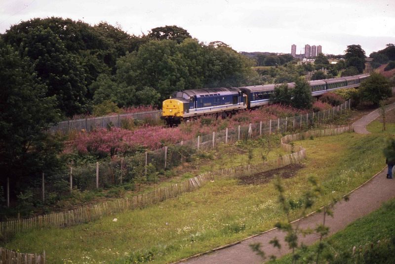
From Auchmill Road. A class 37 hauls a rake of Mk 2 coaches on a Inverness service, in 1994.
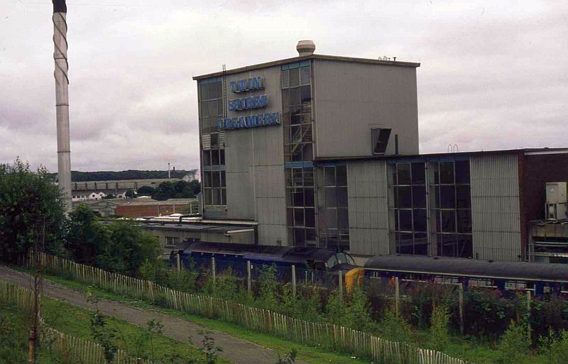
The train passes the Three Spires Creamery that no lobger exists. We had a Saturday night, Sunday turn too and from the Creamery.
Here the railway passes quite close to the canal bed, which of course had been much higher than the present path indicates.
=============================================================================
CANAL REMAINS AT BUCKSBURN
The canal at Bucksburn became the site of both the Goods sidings and the station. Today it is a housing estate but remans of the canal are quite obvious. The station,
which closed in the mid 60's has been mentioned for reopening as part of the Cross City scheme. It desn't look as if there is room for a station and sufficient car
parking unless some, if not all of the houses are demolished. The Station Hotel is at the junction of Station Road and Inverurie Road. It reverted to to it's original
name 'The Staging Post' in the 1970's reflecting its age, going back to when the Canal was built. Stagecoach services kept the canal's finances low. While the
coach was more expensive it was also far quicker.
.JPG)
.JPG)
Left: Station Road where the canal crossed. Right: The section of north sde canal wall still in place.
.JPG)
.JPG)
The canal continued northwards behind the Staging Post Hotel. Again! was there a bridge at this spot?
.JPG)
.JPG)
.JPG)
.JPG)
.JPG)
.JPG)
.JPG)
The retaining wall running at the rear of the shops on Auchmill Road. Could the stone box have been part of the canal workings!
.JPG)
.JPG)
Left: The canal running northwards. Right: Southwards. The ground has been raised to form a path up to Auchmill Road and a bus stop for tenents of the
new housing state.
.JPG)
.JPG)
The Up platform egge is just seen through the railings. Tis is now double-tracked with the new up line jus waiting to be put in service.
.JPG)
.JPG)
Left: Where the railway diverted from the canal. Auchmill Road above on the right. Right: The new buildings has been built across the canal bed (far left) and what was the
Goods yard. I did a number of second man turns on the daily diesel shunting loco, in the 60's. One of my jobs was to nip up to the baker shop for some morning rolls
'Rowies' as Aberdonians call them a bit of bacon which we had for breakfast before starting shunting duties. We returned to Kittybrewster goods yard with whatever
wagons were required 1.30pm for booking off at 2pm and stabling the loco on the depot.

Reverse view from above left: Bucksburn station and goods yard in the 60's. The canal followed the
path of the track running into the goods sidings. (Photo by Ben Brookbank.
.JPG)
.JPG)
.JPG)
.JPG)
.JPG)
.JPG)
The canal wall (on the left) with station Road running down to join Maggiemoss Road by Maggiemoss Paper Mill, sadly now also gone. The canal curved through the houses
on the left and behind the Church and on through Stonywood to Dyce.
.JPG)
The Greenburn runs at a third level below the road and canal before running
below the railway by Bucksburn viaduct and station site.
From the over bridge at the top of Goodhope Road and Auchmill Road. Left: Towards Scatterburn. Right: From Bucksburn station site. Running on the actual canal bed.

From the same spot n September 2005. Left. Towards the station site. Bucksburn Signalbox stood on the right immediately below the bridge. The canal curved
off to the left just beyond the trees while the railway turned to the right. This was also where the points took train into the goods sidings. Right: A telephoto
view showing the remains of the down platform. The two platform edges may now have gone due to the present double tracking work.
REMAINS OF CANAL BEHIND St. Machars Scottish Episcopal Church (Bucksburn)
During a walk through Bucksburn on in April 2022 I was able to get up to the railway fencing at the top of Maggiemoss Road to where the canal
passed behind the (now) St Machars Scottish Episcopal Chrch stands on Old Meldrum Road. There is no sign of the canal as it is taken over
by the railway. This section has recently been re-doubled tracked between Kittybrewster and Dyce.
.JPG)
The perameter of the canal fencing with the railway built upon the site just behind the Church.
.JPG)
.JPG)
Heading Towards Bankhead
.JPG)
From the southern tunnel mouth at the junction of Old Meldrum Road and Bankhead Road. Looking towards Aberdeen. Bucksburn station was just
up ahead.
.JPG)
Towards Aberdeen.
.JPG)
The railway today as it passes behind the church and enters the cut & cover tunnel
over Old Meldrun Road.
========================================================================
CANAL REMAINS AT STONYWOOD
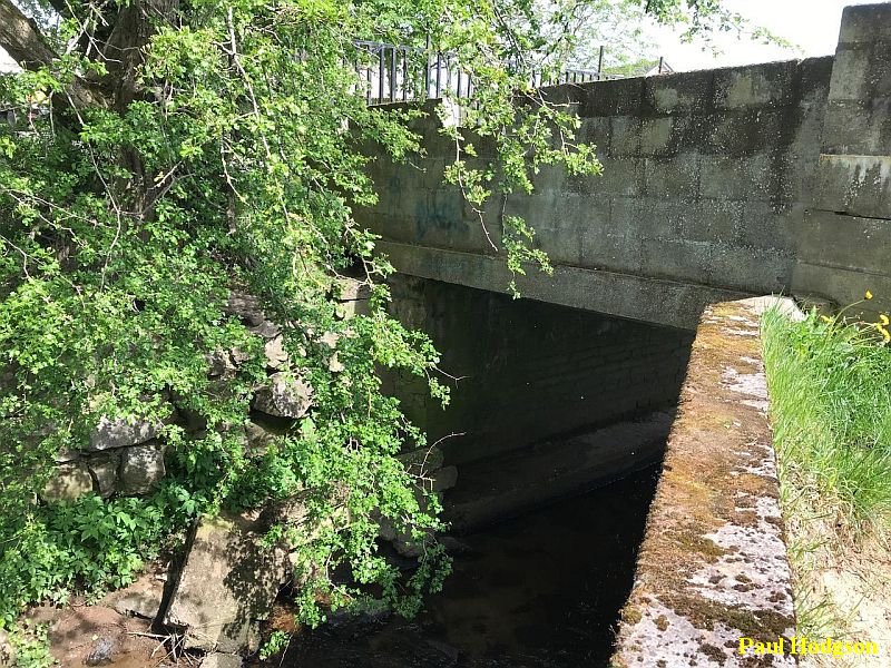
I haven't been able to visit Stoneywood as yet but my thanks to Owen Hodgson for kindly sending these five photos of spots where you can still see canal remains.
My thanks to Paul Hodgson for allowing me to use them here. The canal twisted and turned in some quite lengthy divergence from what you would think it would have done,
especially in regards to saving in totasl length but I expect, like the railways afterwards they were restriced by many of the lanbdowners on the way.
The photos were taken from Ash Parde in Stonywood and are the only remains still seen until you reach the old over bridge on Pitmeddan Road to the north west of Dyce.
.jpg)
The remaining canal wall in Ash Parade, Stoneywood.
.jpg)
.jpg)
.jpg)
=============================================================
(5) CANAL REMAINS AT DYCE (Pitmedden Road).
Back To Index Page
=============================================================
Please respect the copyright of all photographs and videos in these web sites. Thank you.
Contact me at reidcrcwdr@aol.com if you have anything to add to these pages.