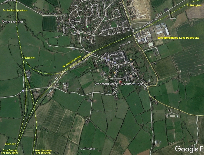
Woodford Halse Station and junctions from Google Earth.
WOODFORD HALSE RAILWAY WALK
(5th September 2018) (April 2019)
52 years to the month since the closure of the Great Central Railway London Extension from Annersley Junction to the north
of Nottingham to London Marylebone station. The line closed on the 3rd Sept. 1966.
Woodford Halse Station and junctions from Google Earth.
Woodford Halse and the old Great Central Railway has always intrigued me. I first got to know about these places when moving down from Scotland
in 1964 under the redundancy rules of the time due to much of the north east of Scotland lines being closed down on what was The Great North Of
Scotland Railway. I moved to Didcot on the Western Region. In 1965 we were given booked duties working coal trains too and from Woodford Halse
via Oxford, Banbury and Culworth Junction It was a steep branch from Banbury to Woodford and it made for hard work but it was also very enjoyable
and has left fond memories of working up to Woodford. It was very sad seeing everything become so run down. Each time we worked there there was
less and less railway artifacts such as signalling, points etc. until near the end there were no signal arms on any but the most important signals that
kept what trains there were going. I remember the train crews at the loco depot sitting around hoping for some work but which became less and less
as traffic was deliberately moved away to the Midland and Western lines. Crews would releive us on shed and do the duties of servicing the loco for
our return working, while we enjoyed a break in the driver's cabin. They were still very keen keen railwmen, to the end.
Then, all to quickly the final closing day arrived and both massive goods yards station and signals were no more.
A few Woodford drivers, guards etc. moved to Banbury and I met an Ex Woodford man on a goods train in London and he had moved down to
Brighton. My favourite story came from a driver who went to Banbury. His father told him of when he was a child his father took him on a bank
above Woodford and watched the railway being built. His father became a driver at Woodford and so did he himself. The sad ending to the story
was that he and his dad stood on the same hill in the 1960's watching the railway being dismantled. The last mainline built in the U.K. lasted just
one lifetime. 1899 - 1966.
Such a fine railway deserved to developed into a present day high speed railway but the route has always been ignored. Indeed, instead of being
much of HS2 it is being sliced up by HS2 using just short sections here and there and so permanantly destroyed as being a complete mainline
railway ever again.
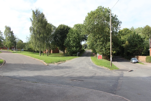
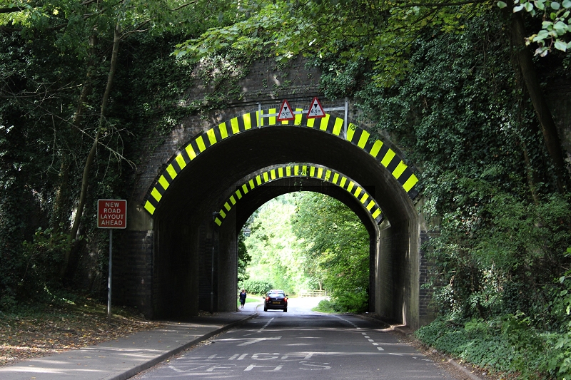
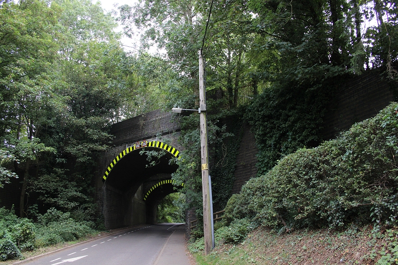
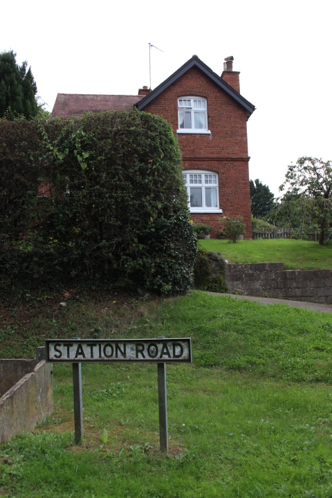
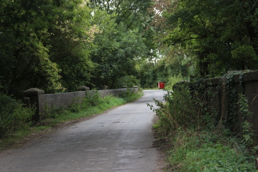
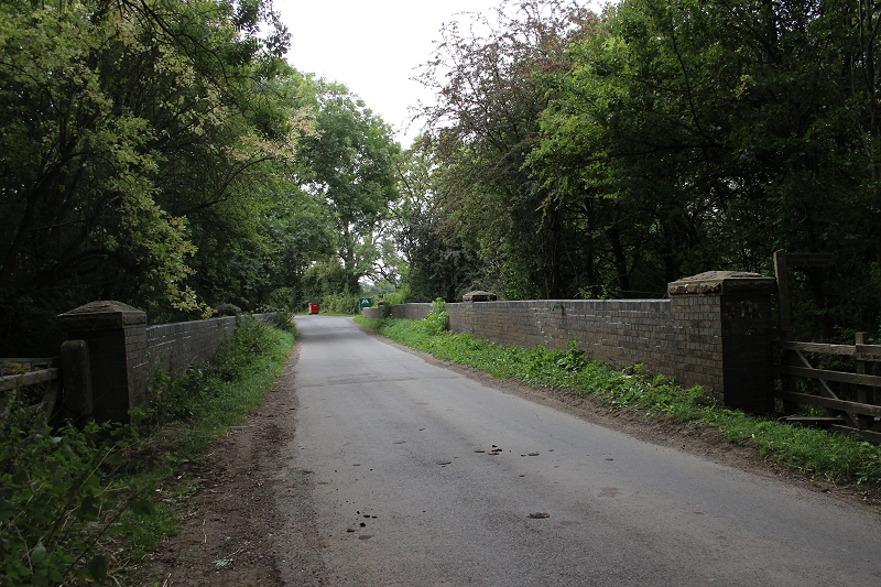
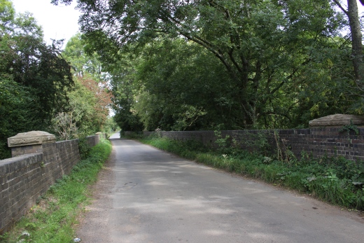
From the bus stop on Station Road. The station entrance is part way down the road, on the left. The two bridges over the north end of the station just
beyond that. Bus service No. 200. Banbury to Davantry. 15 past the hour from Banbury. 35 minutes past the hour to Banbury. Services in both
directions use the same stops in Woodford Halse. Check which direction a bus arriving is going to before getting on.
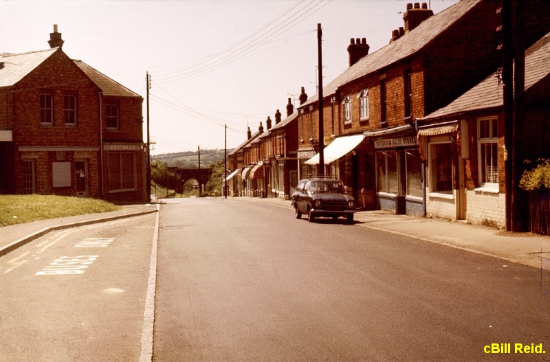
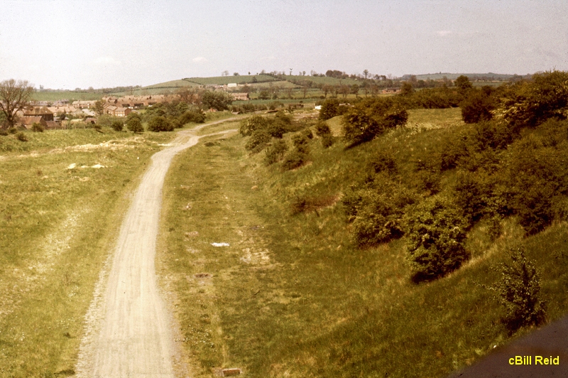
Station Road in 1978. The two bridges and country background are seen more clarly compared to the heavy overgrowth of today. Locals
can no longer see their own countryside environment. The Footwear factory on the left is still in business. However, at this time many
Ex railway staff had left the village and some of the shops stood empty. Notice, one single car parked, in comparison to the preset day
scene below.
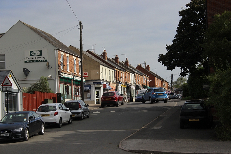
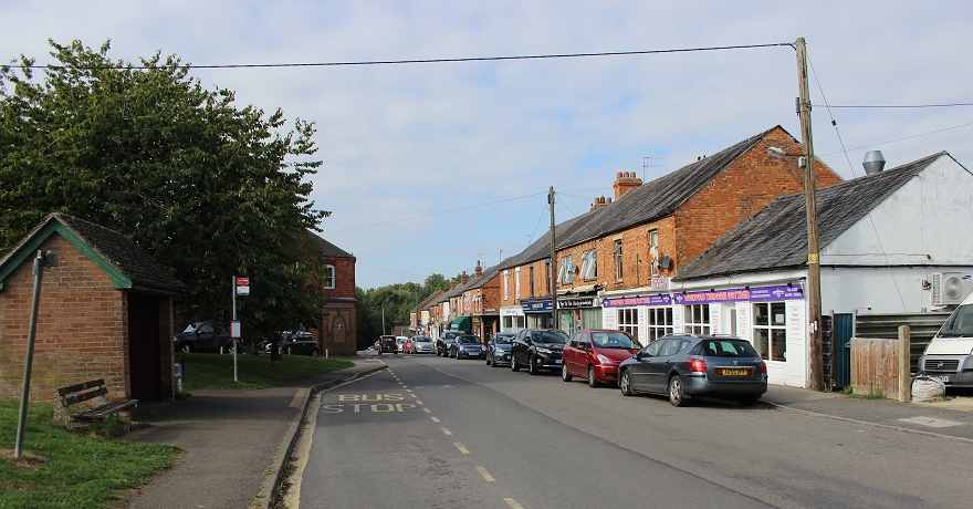
Station Road looking northwards. Virtually all of the shops appear to be in business.
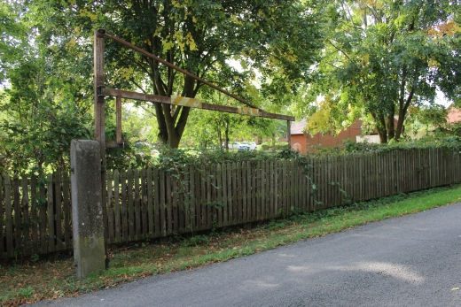
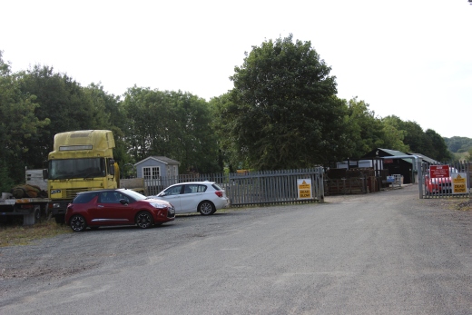
Left: The station entrance off Station Road is used by a local wood dealer, seen here in the center of the image with Station road to the right.
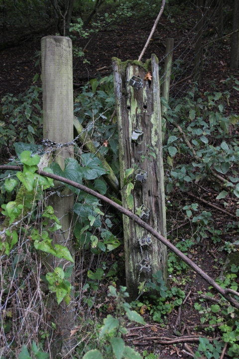
Right: An original gate post and height gauge still stands at the entrance.
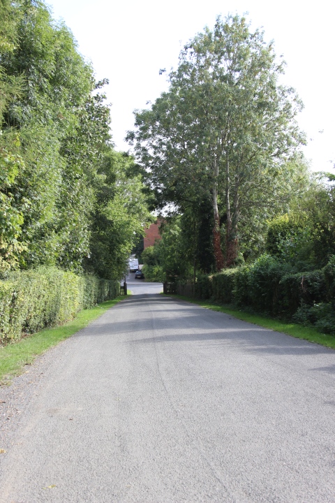
The station entrance road, towards Station Road.
You would have been looking directly at the station platform and buildings that ran at the same
angle behind the fence.
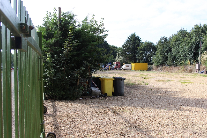
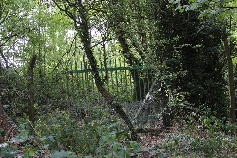
Poking the camera through the fencing you see the station platform area which is used as a Winter store by a travelling Fun Fair (Southwards).
The 'wooden' platform that served the Stratford services ran along the perameter of the treeline to the right. The main island platform ran
down the middle. The wooden platform was rebuilt in concrete but kept the 'wooden' name until closure. The camera would have been
looking right down the 'Up' edge of the platform while I would have been standing, if not on the platform but on the Up main line.
And again, with the fence that blocks off the station road bridges (Northwards). I recall waiting to go to the shed light engine and looking
down the gap between the bridges, with the terraced houses and the church seen to the right.
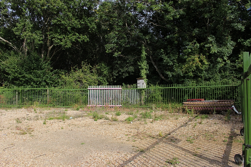
The whole length of the station is fenced off by the Fun Far people. A siding
ran down this length with the western edge of the island platform following
this fence.
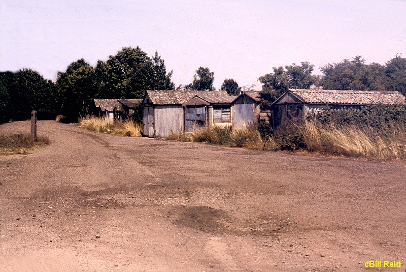
The remains of the various types of sheds that were used by station staff. Two goods sidings ran alongside this part of the road.
Opposite view from above photos. Towards Station Road. See below.
The lock-ups. Taken in 1978. Looking towards station Road. Same spot as above.
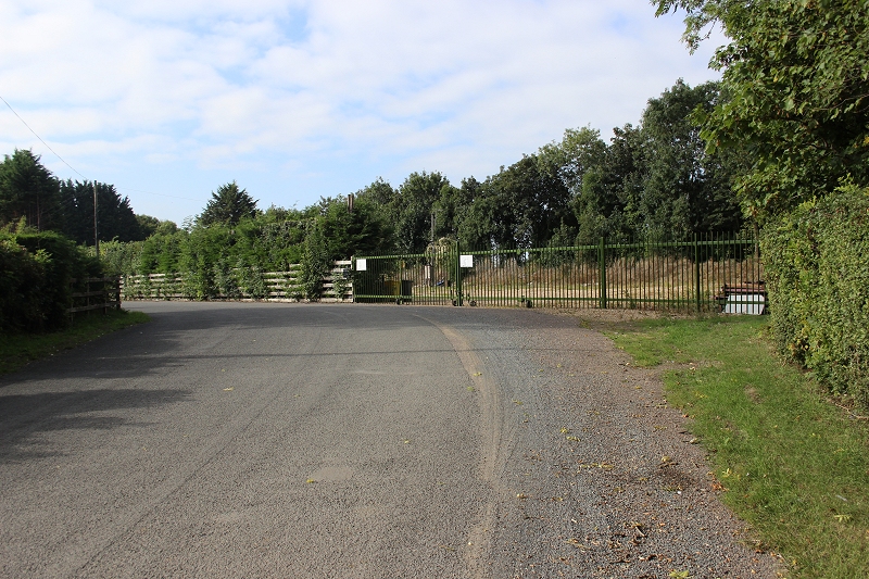
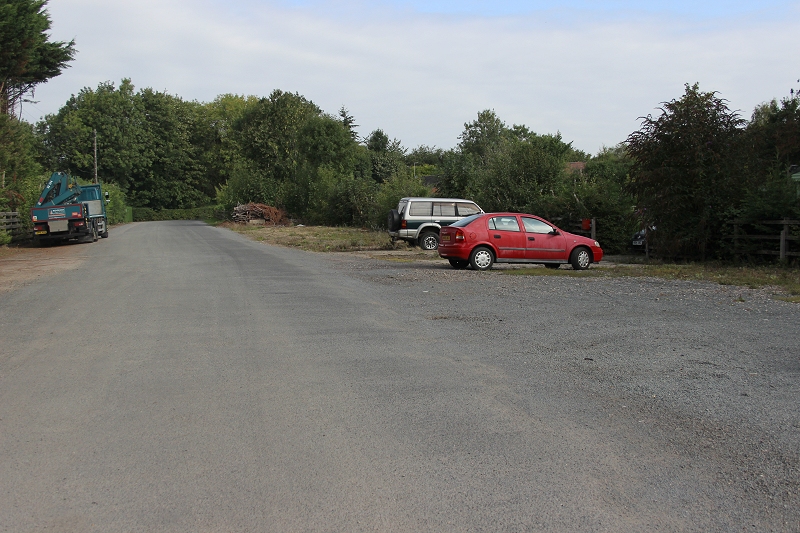
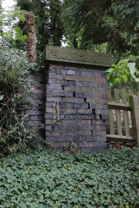
The north end of the Timber site with the Fun Fair site behind where the way is cut off just prior to the start of the two bridges. The office is
to the left where you can request permission to enter the work site. This is in line with the concrete post seen above, left.
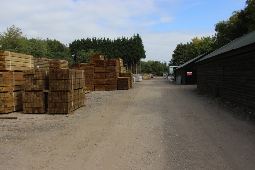
Within the timber company's site. Looking northwards. My thanks to the folk at Mainline Timber Ltd. for their permission to enter the work site. You need to take care as there are
Forklift truck movements at any time and HG vehicles picking up outgoing orders.
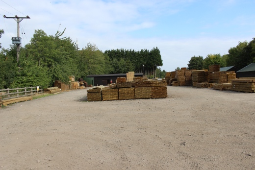
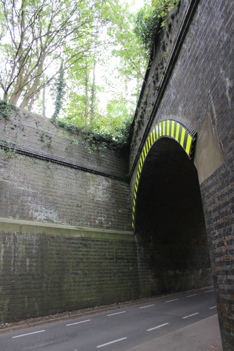
At the southern end of the work site it is once again fenced off by a another commercial work site that goes on right down to Birdcage bridge. It's quite a large business and the
site is full of heavy JCB type of machines. The signal box controlling the junction to Stratford Upon Avon would have been to the right by the trees.
Present day view from the same spot as in the 1978. See photo below.
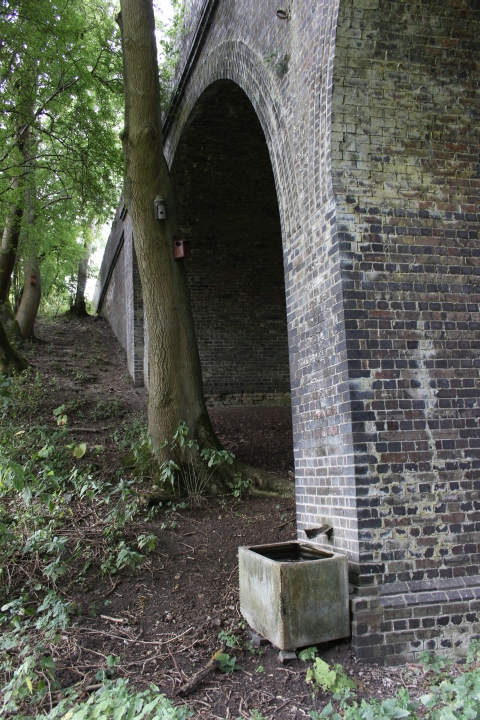
The platform remains in 1978. The 'wooden' platform on the left. The main island platform to the right. The concrete post at the bottom of the
platform ramp is the remains of a Loco watering hose. See below.
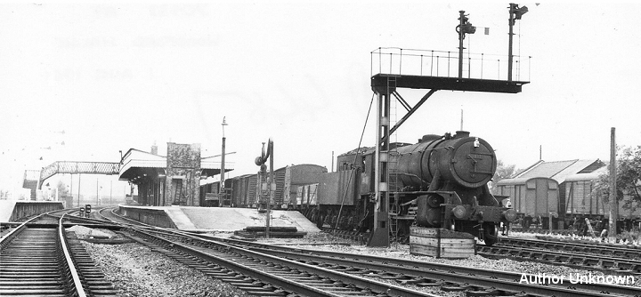
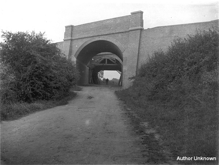
Again, from close to the same spot as above, a freight passes through the station, southwards. You can see the station goods
sidings where the line of sheds stood, to the far right. (Author Unknown).
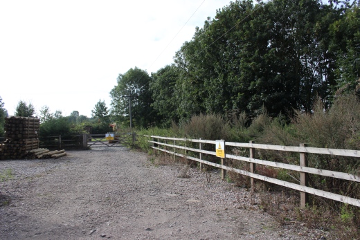
This is as far as you can go within the timber company's compound. Behind the fence is the JBC site, occupying the site down to Birdcage
bridge.
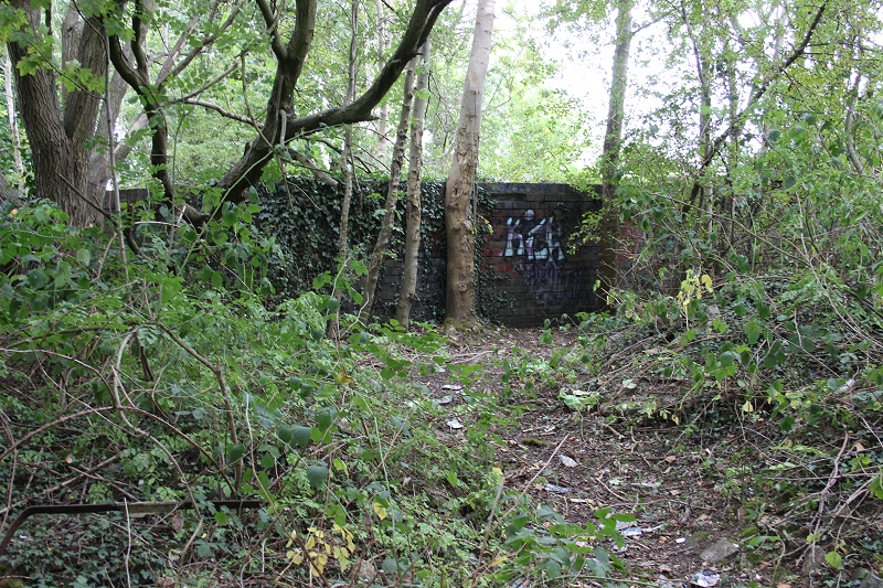
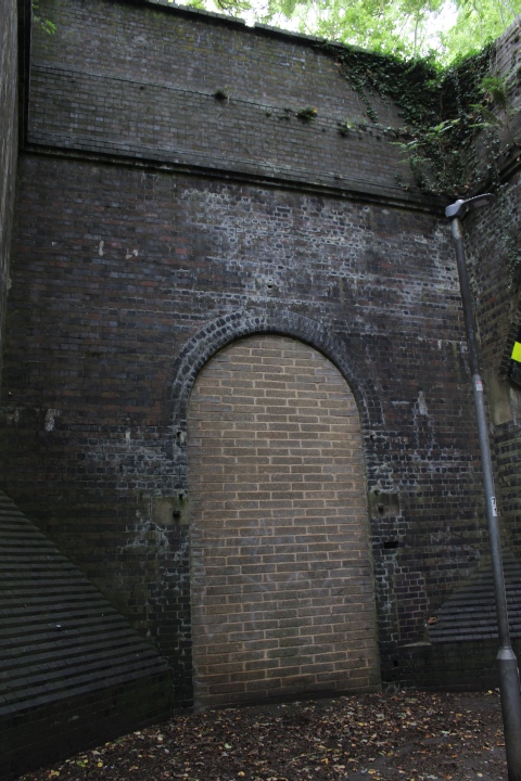
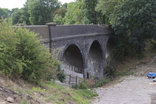
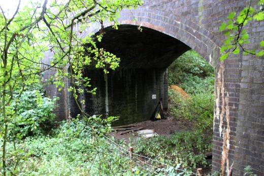
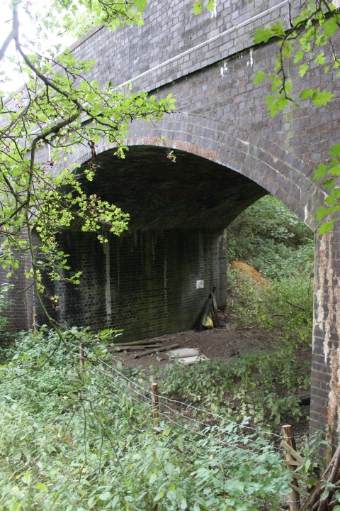
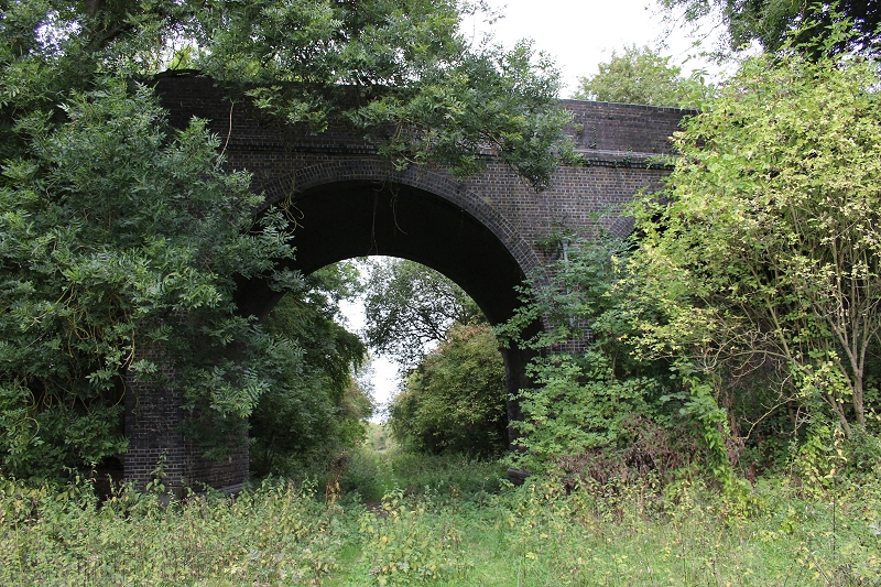
The two bridges over the north end of the station. The station entrance was an arched doorway to the left between the two bridges. The
doorway has been bricked-in. Looking down Station Road towards Hinton.
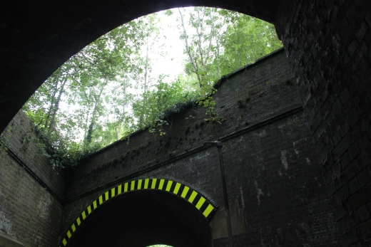
At the north end of the station bridges. There was a small culvert below the railway. Left: The trees stand on the south side of the culvert. Right: Looking north from the opposite side
of the culvert.
.JPG)
From the north end of the bridges the land widens where the run into the down yard began. Left: Towards the station. Right: The goods yard to the left while the mainline ran to
the right (Nothwards).
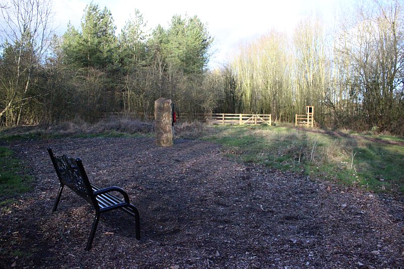
Changes continue to be made. Along with the seats a standing stone has been buit on what were the sidings at the south end of the down
goods yard. (22nd February 2019).
The railings at the north end of the station bridges. The station site where the Fun Fair Winter storage is immediately ahead.
 s-l1000.jpg
This is the scene you would have seen if the view ahead (Photo above) was clear. The signal box at the south end of the station controlled
the S&MJ branch to Stratford Upon Avon. It joined the Western mainline at Fenny Compton. The 'wooden' platform (right) as it was before
being rebuilt in concrete. The platform ramp by the side of the bridge wall on the left is still there but it is within the fenced-off area.
This photo is available for purchase on the internet, without the water mark.
The northern wall of the two bridges. This is fenced off. The photo taken through a fence. I was looking for the north end ramp of the
Down platform, which still remains but couldn't see it. It may show up easier during winter and early spring when the undergrowth is at
it's lowest. It is probably just out of sight (at ground level) behind the two tress to the left.
Even in the Winter moths the undergrowth is still too dense to see the short ramp of the platform edge. (22nd February (2019).
.JPG)
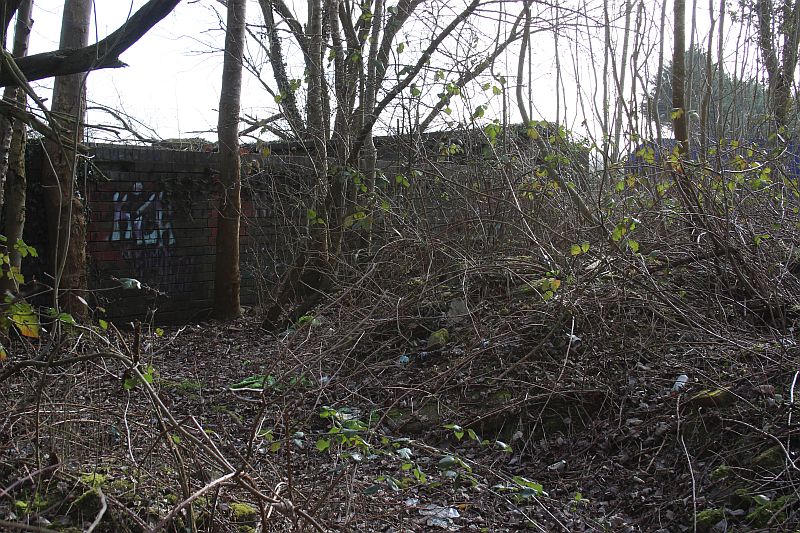
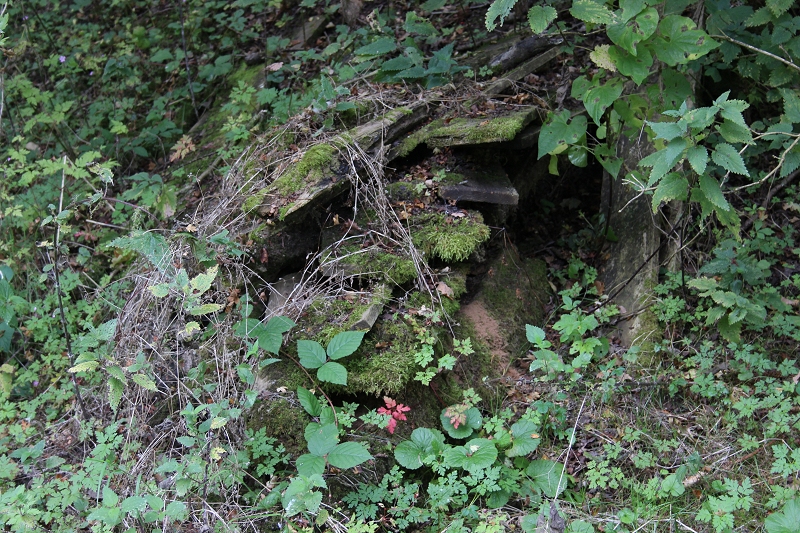
Possible remains of a ganger's hut. Close by where No. 1 signal box stood. Controlling trains into the Down Sidings.
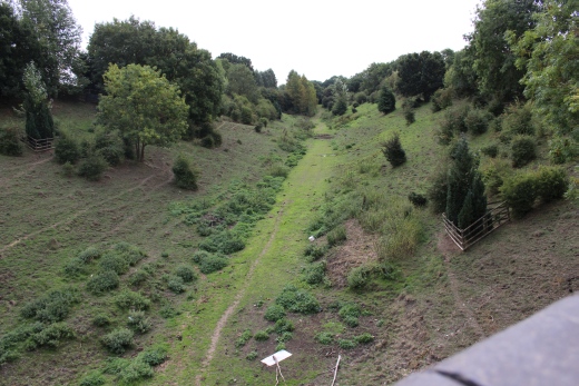
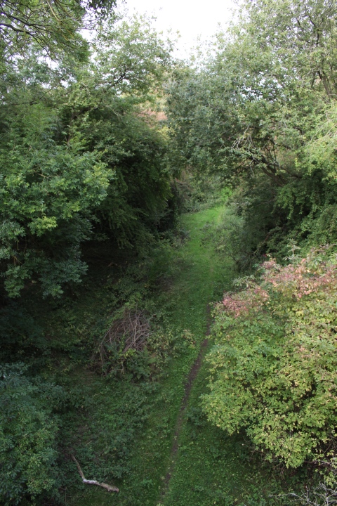
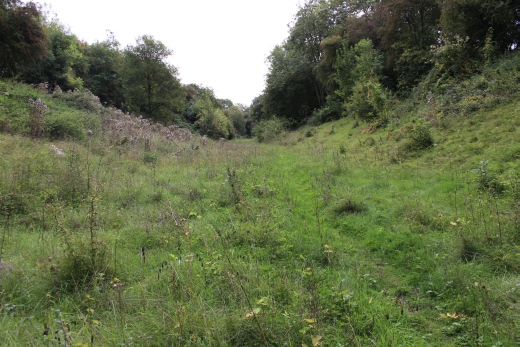
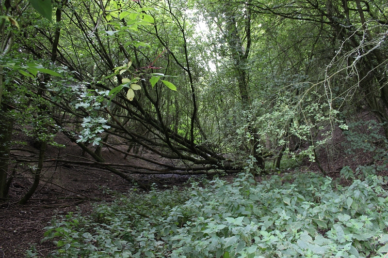
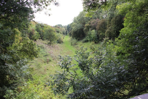
From the culvert gap, northwards through waht was the Down Goods idings and
the main line towards the depot and onto Charwelton. This is now the Great
Central Woodlands, where you can walk up to the loco depot site on Byfield Road.
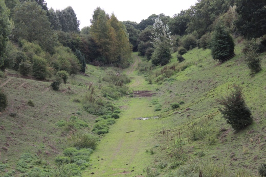
Once a massive clearway with the full width and length of the Up & Down
Goods sidings in fron of you.
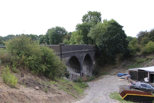
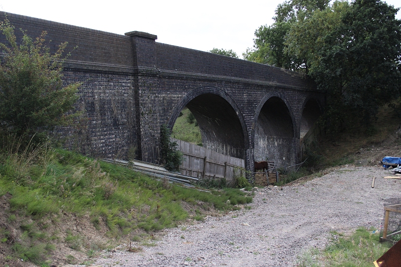
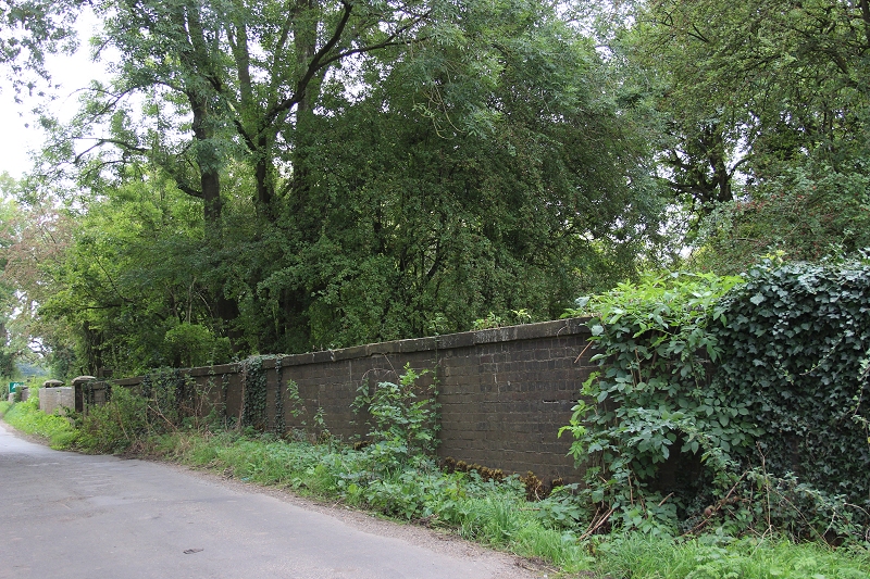
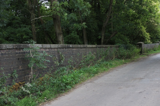
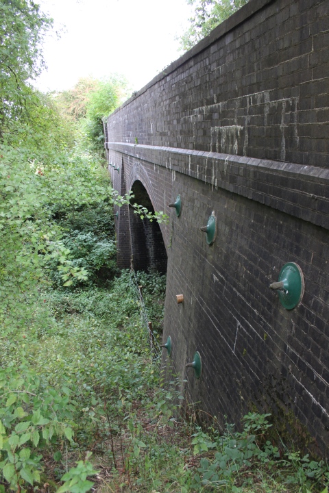
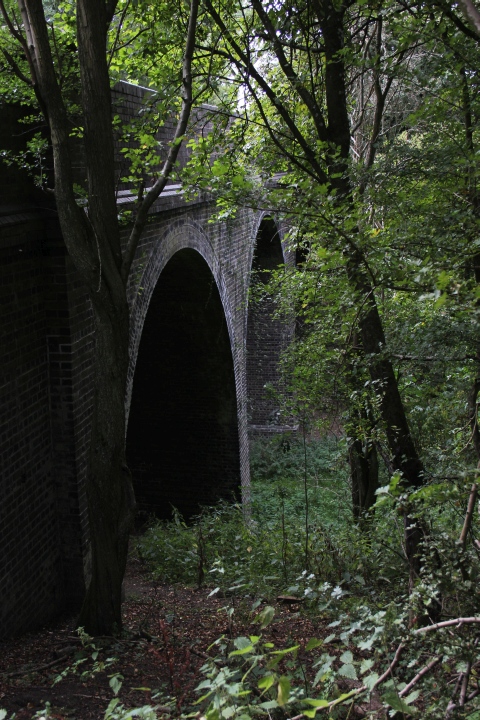
The two bridges over Station Road are still well preserved. The Ex station entrance is bricked up.
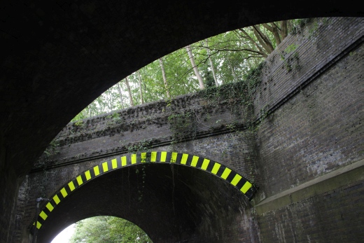
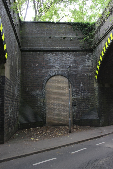
The bricked-up station entrance. The only time I used it was in the early 70's when going up to Woodford to see the MOD attempt to blow the roof off the locomotive
shed. The attempt was a failure as the blast merely lifted the roof, which promptly settled back down again. It took three efforts, I believe to demolish the building. It was
also that day that I motorbiked up the track be to Charwelton and also through Catesby tunnel. The rails were lifted and the ballast fairly level and I was able to get through
without any difficulty, if a bit slow. The tunnel was very dark and wet and the years of soot swallowed up the light from my headlamp but enough on the ground to watch
out for any rough spots. It was interesting going over the two viaducts with pleasant views all around. I remember the site where Staverton signal Box and loop had
been, although the signal box had gone. I was able to get to the site of Braunston & Willoughby station where I got back onto the road and headed back homewards. It
was April and the skies quite bleak with some sleety rain at times.
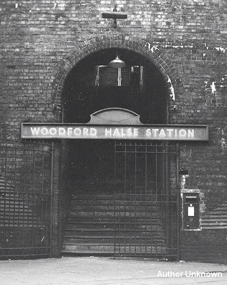
The entrance when in use. (R. M. Crasserley)
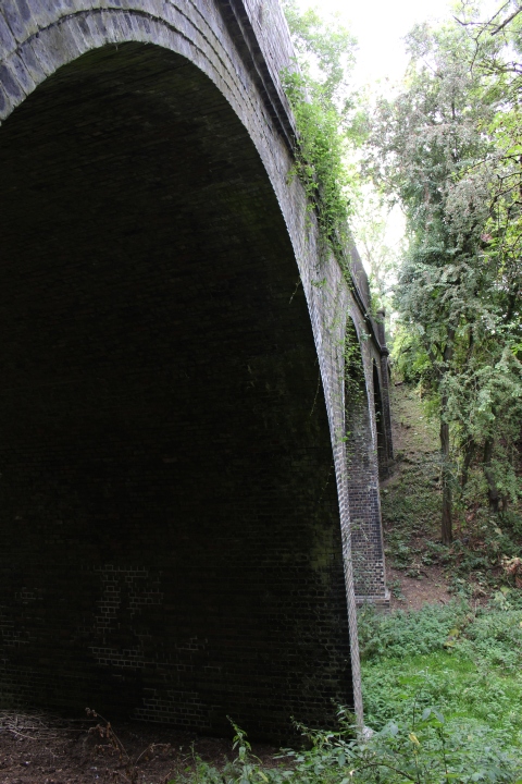
The east side of the bridges. Looking up Station Road towards the village. No. 4 signal box would have been seen up on the left within the trees.
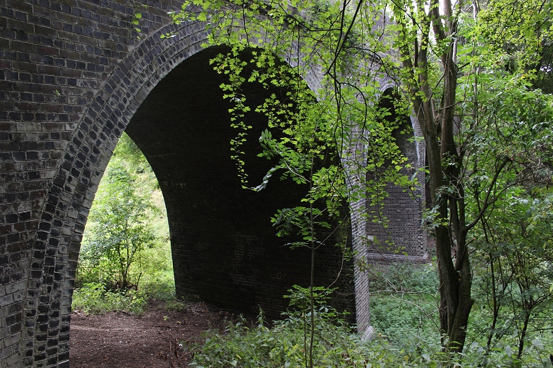
Virtually the same spot as above. Hard to believe these are the same bridges. Station Road has changed since they were built.
You should have been able to see the station buildings on the right but they have not been built as yet. c. 1897/8
The south side bridge parapet. Station end. The north end ramp of the
S&MJ platform was right behind the parapet.
Left: between both station bridge arches. Right: The path leading too the Station House.
The Ex station Master's house is a fine private dwelling.
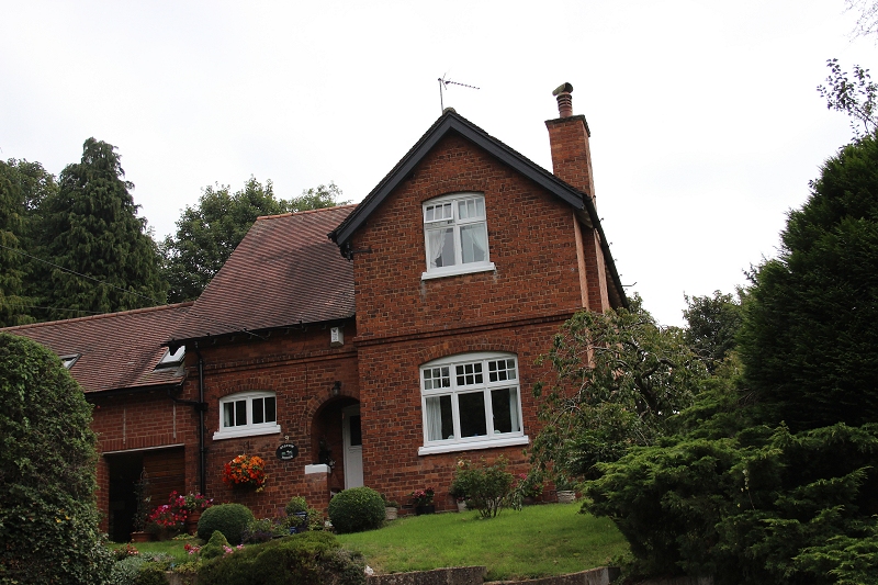
The Ex Station Master's House. A very respectful extension has been added to the left side of the house.
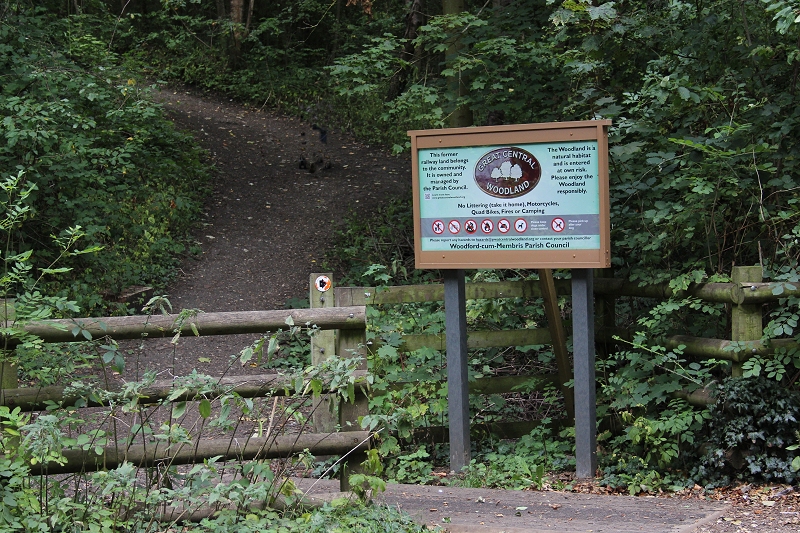
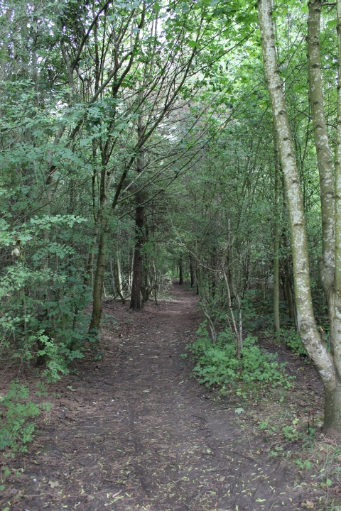
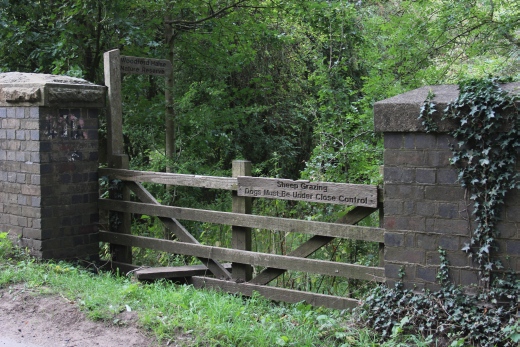
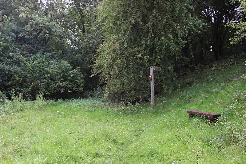
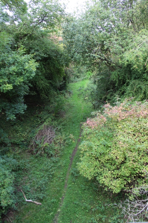
The entrance to the G.C. woodland walk over the old track bed from north of the station. It was well used by locals during my walk around.
There is also an entrance from the Hinton side by the Co-op oat the bottom of Phipps Road.
--------------------------------------------------------------------------------------
My next walk was to the Birdcage bridge over the main line and the two bridges that crossed over the Ex S&MJ railway and the South Junction to West Junction spur.
'Marble Arch' bridge was a favourite of train spotters and enthusiasts throughout the lifetime of the GCR London Extension. The bridges are down South Street.
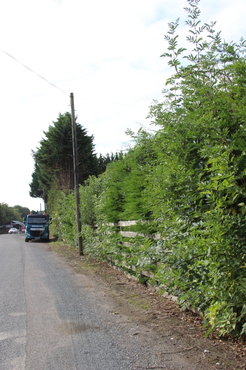
From the top of Station Road go onto Parsons Road and follow around past the Fleur De Leys Pub and onto South Road. Its not a busy road for much of the time but
with a couple of 'S' bends and on a hill you do need to take care. There are no pavements and little recess. A typical 'C' road.
Marble Arch Bridge. North side.
Marble Arch Bridge. From the north side. I wasn't expecting to get thi view as the gate is usually closed. However it was open at he time and
a chap repairing a door on one of the lock-ups, so I was able to get this close. This is private land and the arches are fenced off to keep
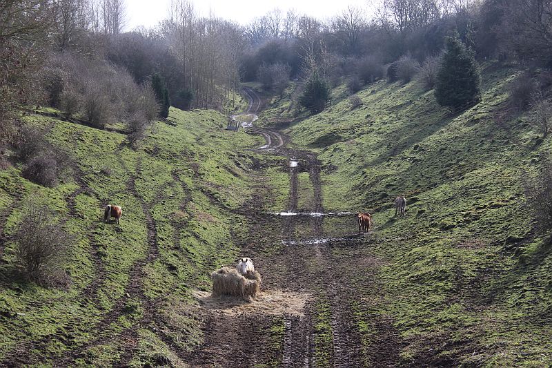
animals browsing the cutting southwards in. This was once a Pigery but all I saw on this visit was a Pony and a Donkey. A Horse is just
seen in the middle arch.
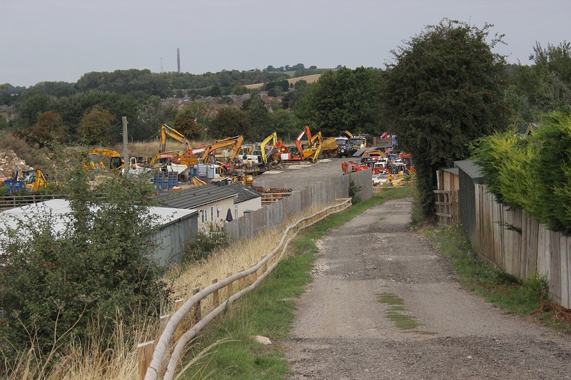
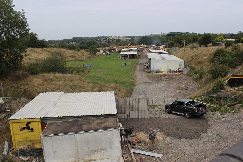
The 'usually' closed-off path down to the old railway site with a large collection JCB's on the track bed.
This is probably the most usual angle photos of trains coming and going have been taken from during the life span of the railway. A bit
cluttered today. However the line curved up to the right into the station and the coaling tower at the loco depot was usually seen on the
far right. There was a long head shunt running south from the station with stop blocks just by the white building to the right. The
Stratford Upon Avon branch curved off to the left up where the JCB's are seen in the back ground.. The BT Tower at Ellidon is
also seen in the back ground.
From approx. the same spot, around 1978. Before the Piggery took over the site. You can see the trace of the long head shunt that was
on the right. You can just make out the platforms up ahead.
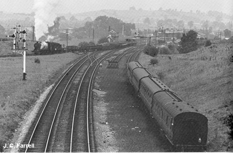
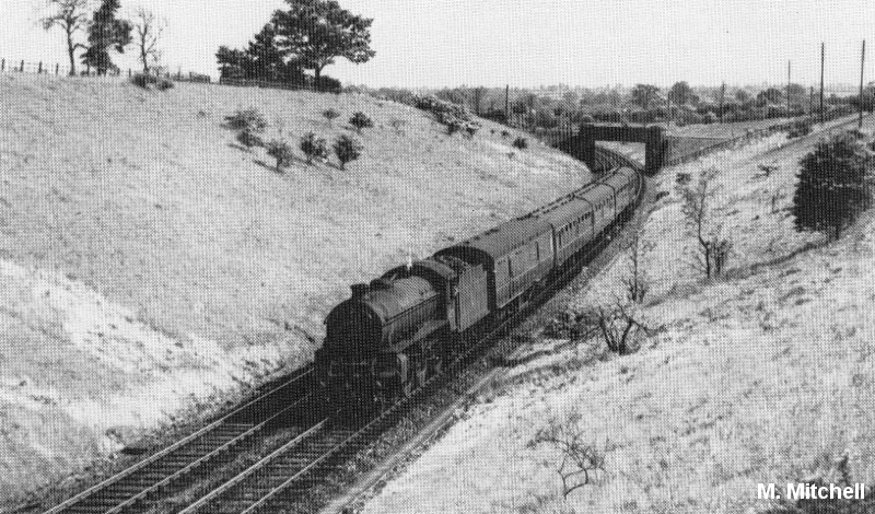
As it was. With a train heading west on the Stratford & Midland Junction branch. Photo by J. C. Farrell.
The other well photographed view southwards over the bridge. Closed off to the public. You can see as far as where the S&MJ line crossed the main line but it looks as if the
track has been back-filled up to where the bridge was. It is impossible to get to this spot and to where the south curve ends at South Junction.
As it was with the S&MJ line crossing the GCR. Near the end, vegetation is already taking over the embankments.
Close to the same spot as photo above right. (M. Mitchell).
Same spot as above but not the same angle. You can see where the Ex SMJR over bridge has been back-filled to track bed level.
(22nd February 2019).
My next interest were the two bridges going over the Ex S&MJ line and the spur from South Juncton to Woodford West Junction.
This spur was seldom ever used and was cut off at South Junction quite early on.
The nearest bridge is that over the Ex S&MJ railway. The second bridge ahead is over the South To West junctions spur.
The two bridges looking southwards down South Street.
Overlooking the West Junction side of the over bridge. The track bed is quit clear.
Left: The view northwards over the bridge. Right The view southward over the bridge. The track bed is very overgrown here with nettles and the bridge is
fenced off and blocked from walking eastwards towards the site of the S&MJ crossing the GCR.
The south side bridge looking west on South Street. The bridges on the GCR were on a large scale, both width and height in comparison to
most of the railways before them. It was a railway designed for fast running.
A footpath starts at the east betwen the two bridges (North side) that takes you down to track bed level where you can walk up to the site of West Junction and aso walk
westwards through the two bridges to wards South Junction with the mainline while the Ex S&MJ track bed leads to the site of the Ex bridge that crossed over the
GCR towards Towcester. The Footpath sign is misleading as you both pths, either on the S&MJ track bed nor the Embankment path to west Junction are usable and you
must scamper down the West Curve side of the bridge. The embankment path requires clearing.
Photos of the Ex S&MJ track bed below the bridge. It is fenced off towards Towcester and walking towards West Junction is heavily overgrown.
At track bed level.
Scampering down the east side of the arch where the Ex S&MJ came through. The south to West curve came through the other arch. Before
the GCR was built this had been a single arch bridge. The track bed was higher than the South junction line due to it climbing to cross over the
GCR mainline. As the S&MJ track bed was so over grown I walked as far as I could towards Woodford South Junction. You get very close to
the junction but stopped by a barbed wire fence. If you could get around it you should be able to reach the junction site, where you can possibly
walk north wards to Birdcage bridge or southwards to the Culworth junction site.
The Ex S&MJ over bridge, west side, showing a much clearer track bed towards the West Junction site. The S&MJ track bed is in the
over growth to the right.
West side of the bridge. A water trough put in by the farmer. A simple piece of metal
acts as a rain water guide.
.JPG)
Both: Looking through the arch towards South Junction. I walked this from South Junction to West Junction back in the early 70's. I recall how eerie
it felt as the cutting was covered in tall plants with large yellow flowers that made it look as if you were being attacked by Triffids. There was no track
but shallow ballast with ridge marks where the sleepers had been. The base of West Box was till evident. I then walked around the northward curve to
the station site. All that remained was the two 'bare' platforms and little else. But the track bed was very clear and you could have walked just about
anywhere you wanted.
As far as you can get, just short of the junction site. However, there is a path up the right hand side where it is possible to get around
the barbed fence and along the footpath to the over bridge at South Junction..
This appears a pile of concrete slabs of either a ganger's hut that had been dismantled or perhaps, never built.
Looking over the fence towards South Junction, which can only be a matter of yards up ahead.
Right hand side of the fence. A sleeper stands proud. It has been used as a wire
tension post at sometime.
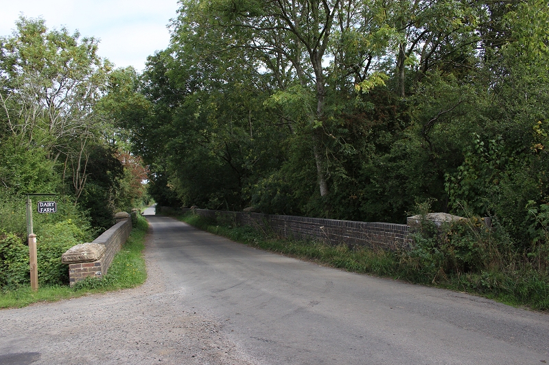
By the side road to Dairy Farm. The buildings stand on the track bed close to the site of West Junction. There is a cafe available.
Left: The two bridges, looking back towards Woodford Halse. Right: View towards South Junction.
Left: The South to West Junction track bed loop is quite clear while Right, you can see the Ex S&MJ track bed is heavily over grown.
A Donkey browsing the 'Up' east side embankment of Marble Arch ridge.
A final look over Marble Arch bridge, southwards towards Culworth Jct.
A pictorial view from a gap in the hedgerow on South Road looking northwards. The station and cutting to the south is behind the treeline in
the back ground.
Woodford Halse had a supurb railway staff social club. Possibly the finest in the U.K. The building still stands today and is well maintained. It is situated on Hinton
Road, at the bottom of Station Road. Sadly, it was not open at the time of my visit, which was disappointing. The building also contains a fine model railway of the
station. Ocassional meetings and talks are arranged keeping the memory and spirit of their station, extensive goods yards and loco depot alive. The Club is active
in many events that take place in and around Woodford & Hinton.
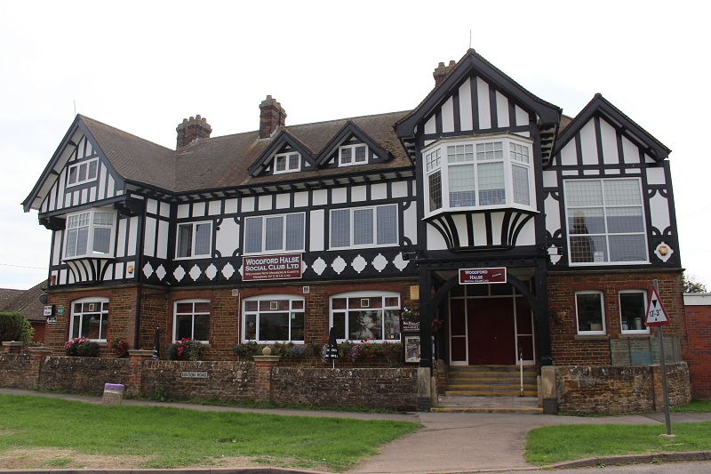
Woodford Halse Social Club Ltd. On Hinton Road.
Having enjoyed my visit to Woodford Halse I also learned more of how I can get to other parts of the old railway and hope to return for
another visit before too long. There is an hourly bus service from Banbury to Daventry, which also takes in Byfield and Charwelton.
The busservice is No. 200 from Banbury Bus Depot (Bay 7).
======================================================================================
Drone video of Woodford Station Site
Skyline photography by Neil
An over view of Woodford Halse Station Site.
=======================================================================================
To: Charwelton And Catesby Tunnel Visit
=====================================================================
Other railway walks:
The Dundee & Newtyle Rlwy Walks Opened in 1831 the route had three incline planes. The first was from the terminal station on Ward Street, up the
Dundee Law, where there was also a tunnel. The second was the Balbeuchley incline at Rosemill and the third at Hatton that ran down to Newtyle station.
It was also the very first passenger train service in Scotland. Worked by Horse over the levels until the first steam engine was purchased in 1833. Came
under the Caladonian Railway with it's terminal moved to Dundee West station. Passengers service ended in 1952 and the line totally closed in the mid
60's. The inclines were by-passed in the 1860's.The Cromford & High Peak Incline railway in Derbyshire has been luckier in having much of it's buildings, including an Engine House preserved. This
is what could have happened with the D&N, indeed, should have happened with at least one of the D&N inclines. However, the C&H gives an excellent comparison
of what the D&N would have looked like, albeit the inclines were only single track.Boddam To Ellon Branch (Walks) By Bill Reid. Ex GNSR branch line
Dyce To Fraserburgh and Peterhead Walks. Ex GNSR
Bath To Wellow Rlwy Walks Ex Somerset & Dorser Rlwy.
Contact: reidcrcwdr@talktalk.net
Hosted by www.theatreorgans.com