
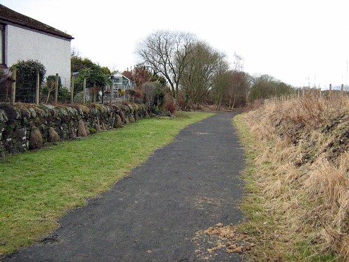
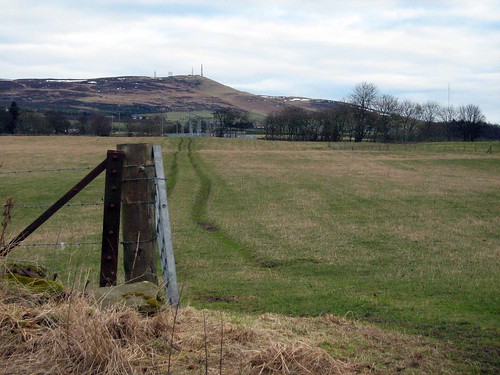
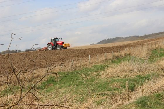
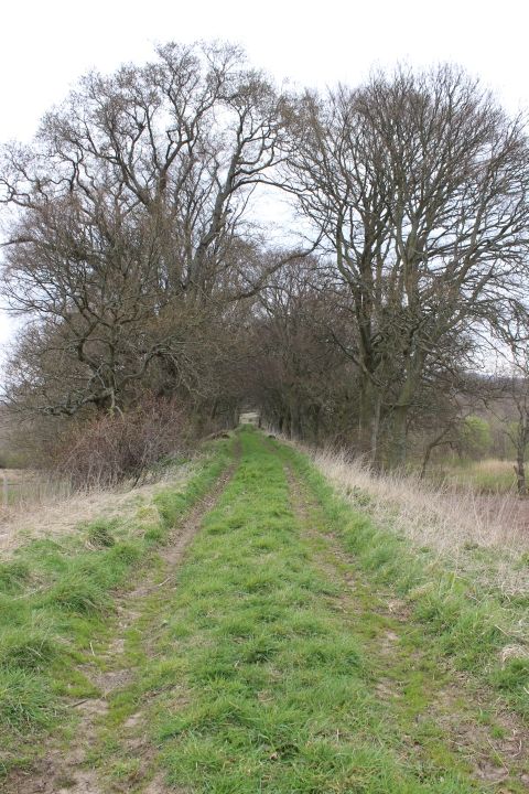
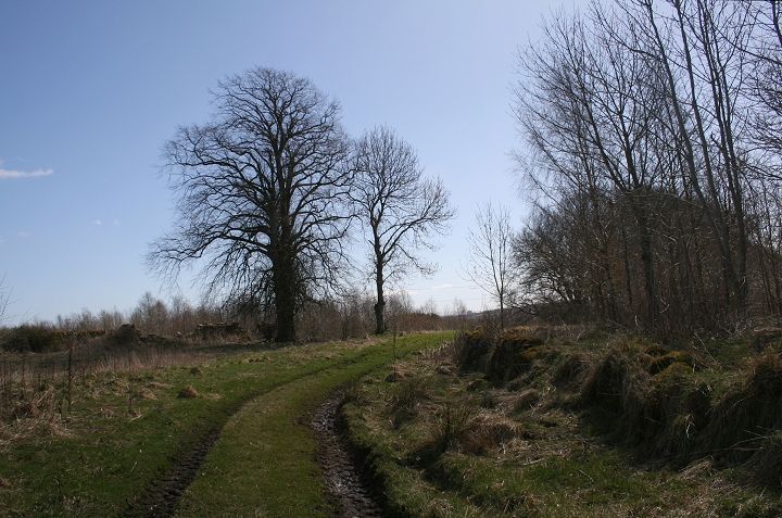
Both lines from Rosemill are shown here. I have traced in the old line via Balbeuchly to Auchterhouse.
ROSEMILL JUNCTION TO AUCHTERHOUSE
Via the original Incline route
(Update May 2015) (New with text in blue)
Both lines from Rosemill are shown here. I have traced in the old line via Balbeuchly to Auchterhouse.

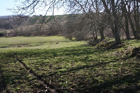
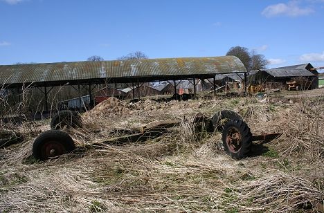
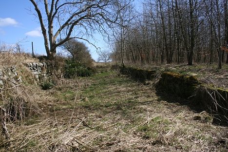
An overall view of the railway lines around Rosemill. Leoch and Fallaws quarries are completely filled in. The formation of the goods sidings can
be seen as a light patch between the two branch lines, on the south side of the line. (From Flash Earth)

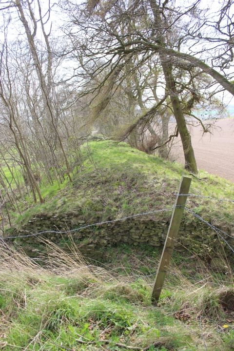
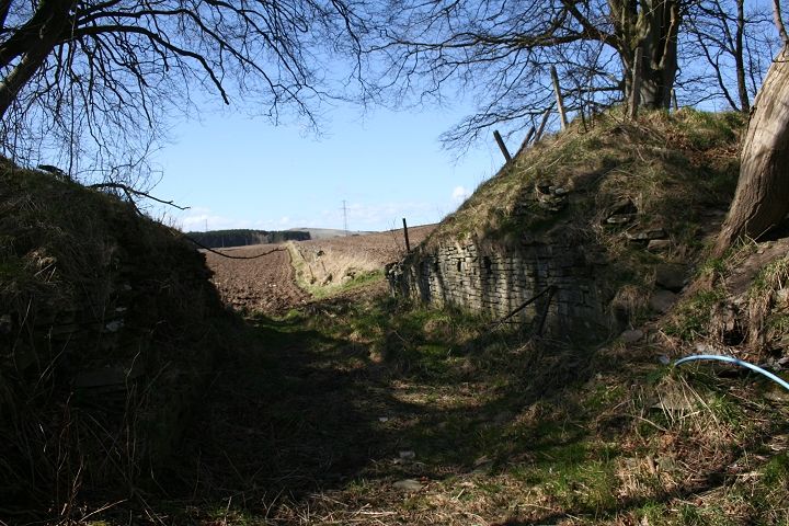
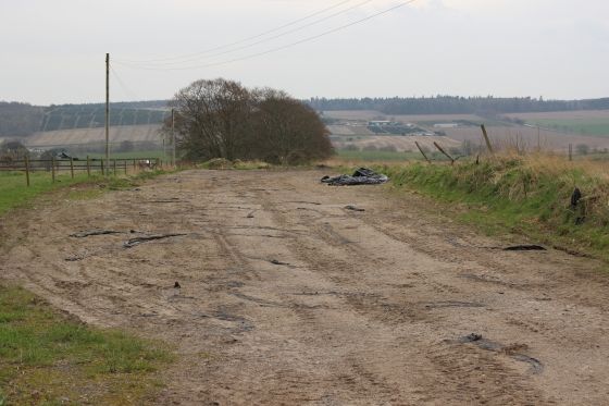
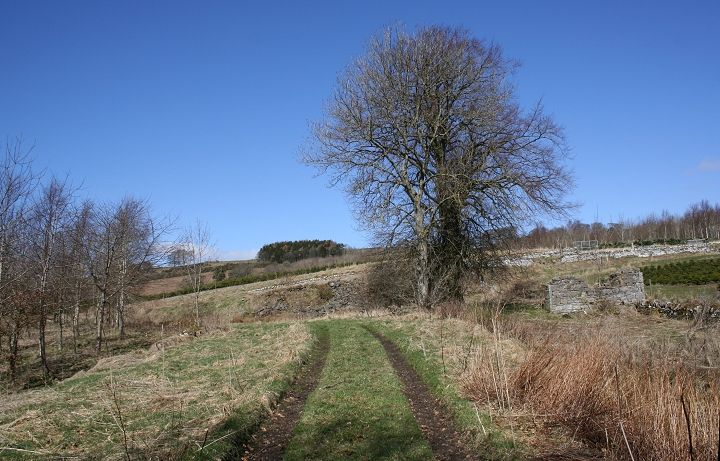
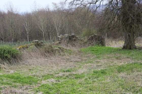
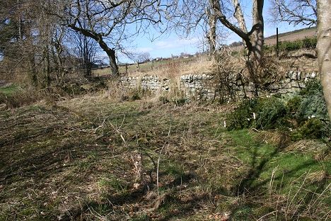
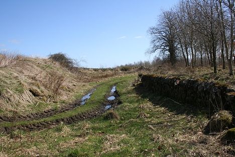
Rosemill Signal box and loop, from the west side of the level crossing. The right hand loop went into Fallaw quarry.
(Thompson Press)

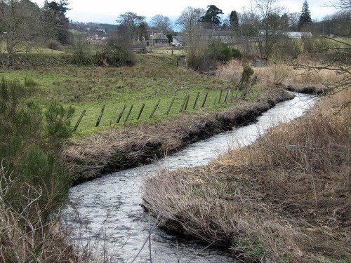
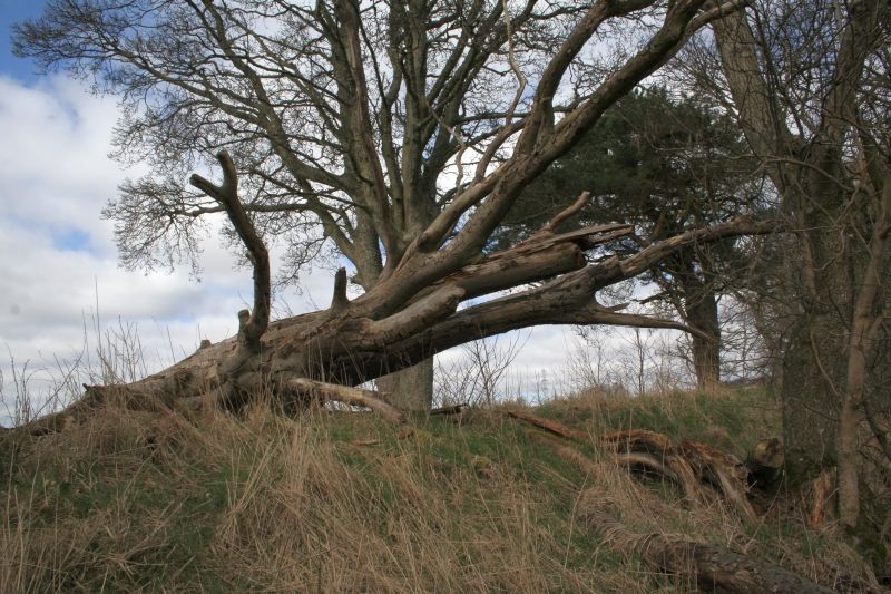
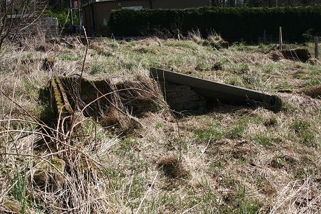
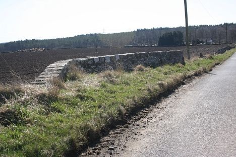
Left: The railway widened here to allow a siding to head off to the left into the old quarry (David Martin). Close to the 1960's scene, above.
Right: Remains of the embankment brickwork. (Bill Reid)


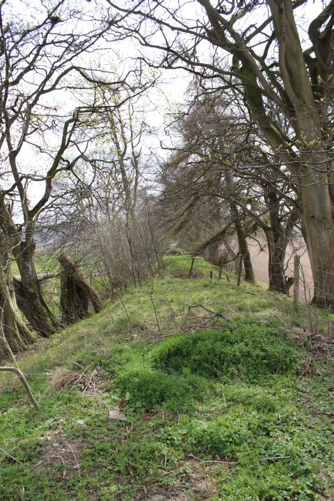
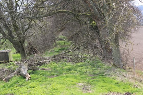
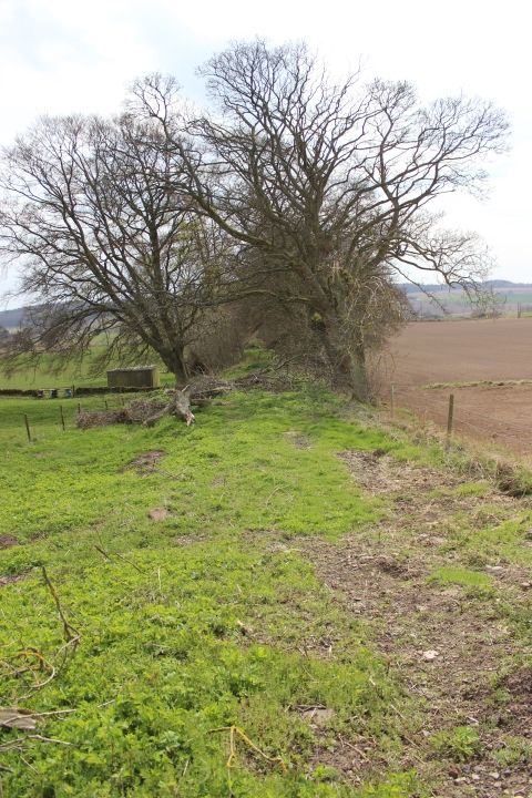
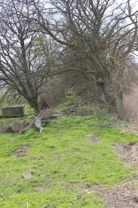
Left: Looking back towards Rosemill crossing. Right: Where the Fallows spur branched off (left) at Rosemill Jctn.


Site of Rosemill Junction Signal box. You can still see numerous red bricks within the heap. From the B&W photograph below they had used red brick for the main
structure with a lighter, perhaps more yellow brick for the decorative outlining.


Left: A well preserved wire tensioning post where the signal box and out building stood . Right: Spotted close by the same spot are three cuts
of railway sleeper. This may have been part of the single line token ramp on the signal box side of the track..

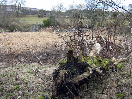
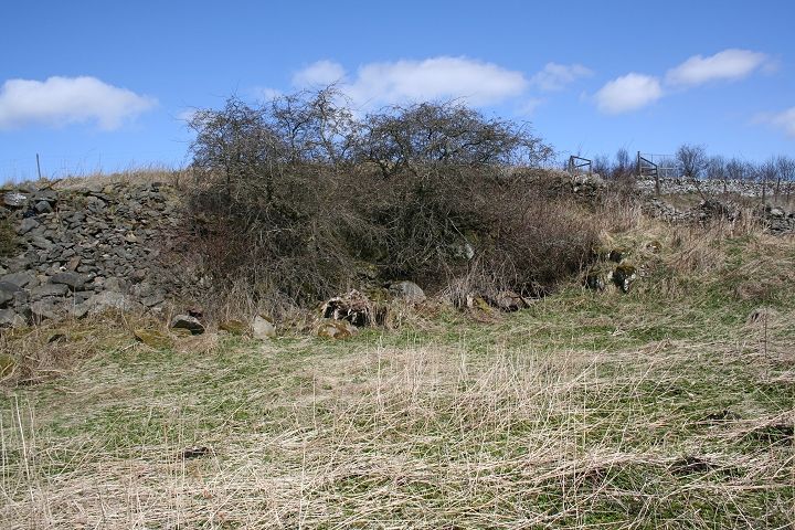
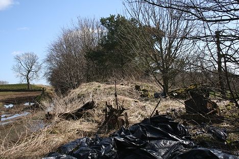
This is an interesting corner but may be nothing at all! I was interested in the fact that it shows a gap between the embankment
and the actual track bed and wondered if this had been the junction for Rosemill Goods! I have since learned that this was
indeed the Rosemill Quarry siding. It was merely a single line spur into the site, as most of the goods sidings at Rosemill were.

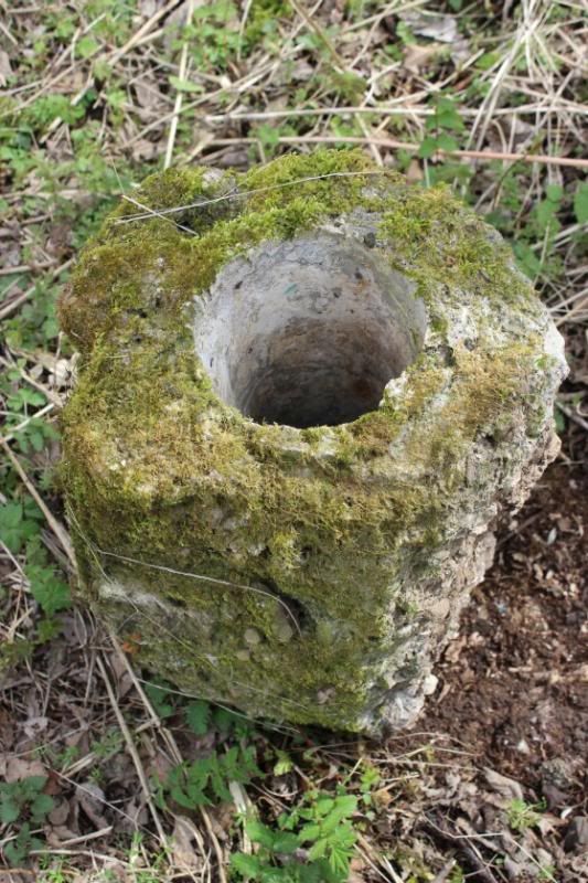
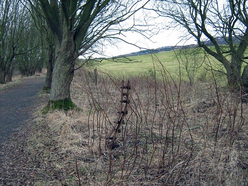
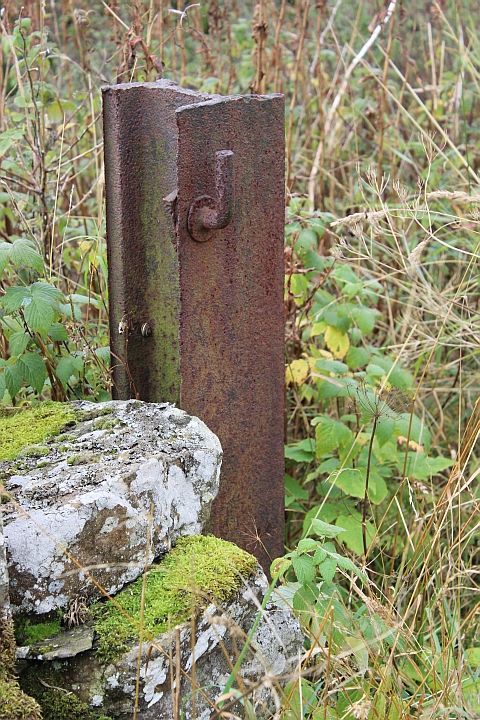
Left: Another interesting find! Can't quite work out what this post was for. It is well braced with bolts and a capping.
Right: Concrete base of a signalpost (16th April 2014)

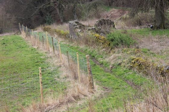
Rosemill Signal box, with the Token exchange platforms on each side of the tracks. The nearest track is the loop
and spur into Fallaws quarry. Dundee to the left. (Norris Forrest) N.B. Comments below on Token platforms.


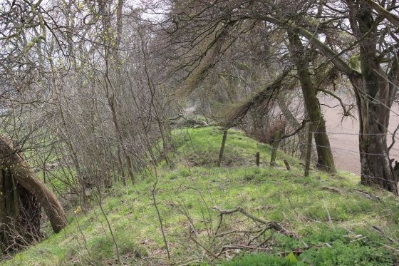
Left: The two wire tensioning posts indicate that the Fallaws spur was gated when not in use. Right: Same spot looking back to the junction and Rosemill signal box


Left: This was possibly the remains of the signal box ramp where the single line tokens, on the opposite side of the signal box was exchanged from.
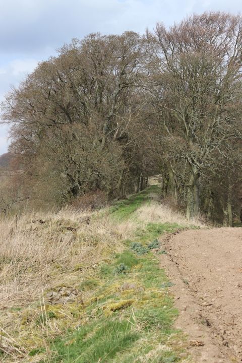
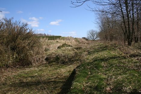
Right: The west end of Rosemill Junction. This is where the all the sidings came together and ran towards Balbeuchly Junction and westwards to Auchterhouse.


Right: Heading away from the junction towards the quarry just as it left the junction.
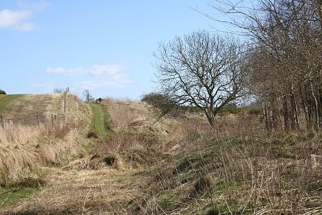
Right as it curves northwards to cross the Dighty up ahead.


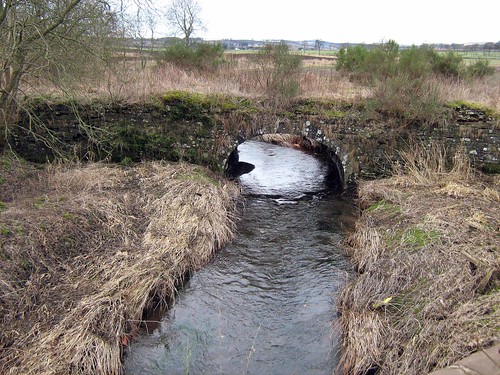
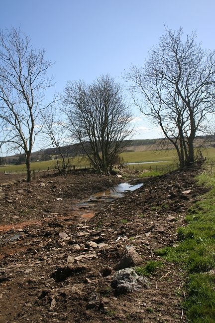
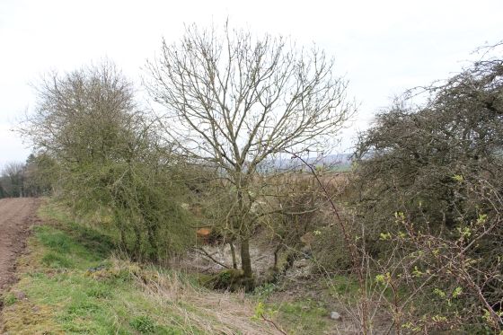
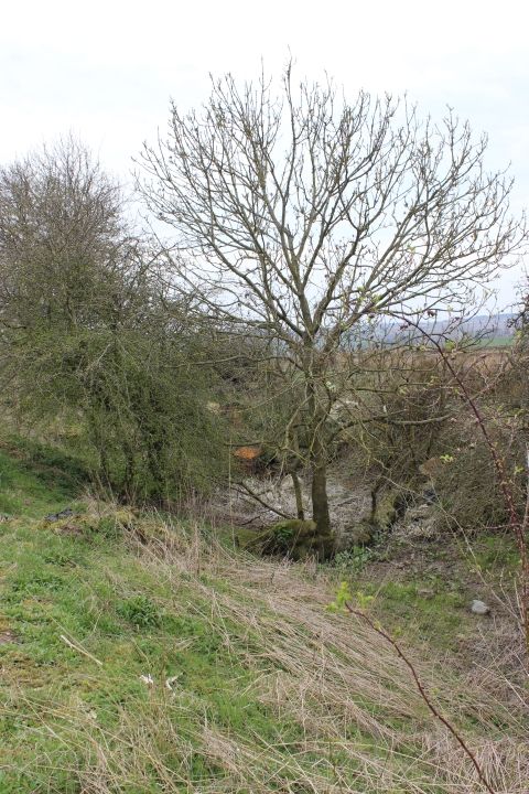
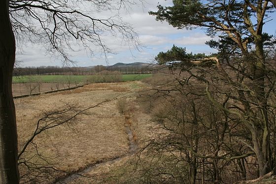
On leaving Rosemill the old quarry track bed crossed, first the Lade that went to the Chemical Works then the river Dighty, on stone bridges.


Left: Turning north at Rosemill Junction the Fallaws spur heads towards the bridges over the the Dighty stream. The steam bank is erroded by grazing cattle.
Right: Remains of the Lade & Sluice Gates, by the Dighty bridge (East side)

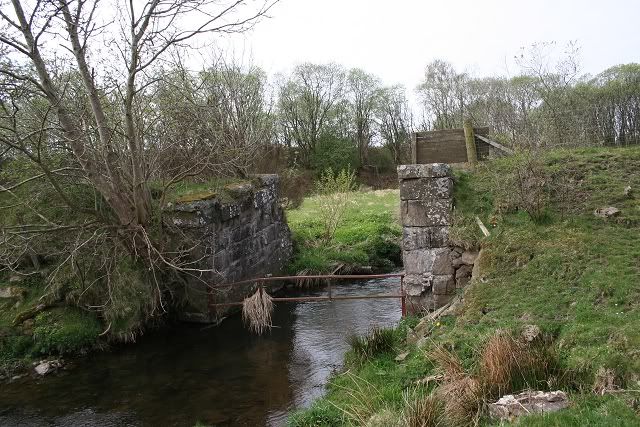
Left: Looking west. Remains of the main Dighty bridge. Right: Looking west with the newer divergence line in the background

Remains of the bridge by the side of the stream.

The Dighty bridge from the east side of the Fallaws branch

From the Fallaws spur track bed where it crossed the Dighty. Looking towards Rosemill Jctn. Right: Same spot, looking north to where the
track bed has been back-filled for some yards. A fence runs down the center of the track bed.


Left: The Dighty bridge with the Fallaws embankment running northwards to the quarry site. Right: From the western side of the fenced track bed. Rosemill Jctn to the right.

From the eastern side. The remains of the Fallaw quarry spur with Rosemill Signal box in the background. This is the spot
as above where today the track bed disappears below back-fill northwards towards the quarry. The track bed seen is now
separated by a fence running down the center. (Elliot Simpson).
Almost the same spot as above on the 19th of April 2013.

The Fallaws embankment (left) only runs for a few yards northwards beyond the bridge. It has been back-filled and ploughed over at the
end of the tree line.

1960's. Remains of the bridges over the river Dighty and the Lade that ran side by side from Fallaws quarry.

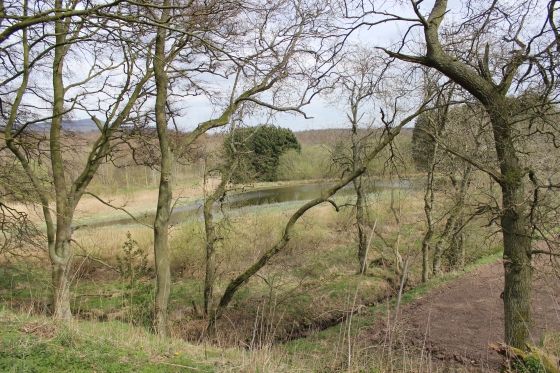
The remains of the channeling for the Lade to run up to the sluice gate then onto the ferteiiser works on Craigmill Road.
The Dighty stream proper runs eastwards behind it, to Dundee and beyond.
(Photos by Elliot Simpson)

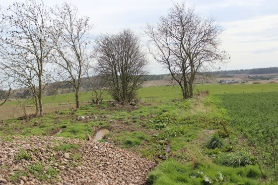
The Dighty stream from Craigmill Road, with the Fallows Quarry track bed in the middle distance and the remains of the two
bridge arches, as seen above. The Lade was to the left but has been back filled.

Cropped image of above. The lade ran to the left of the Dighty but you
can see where it would had led up to the sluice, just made out up ahead.
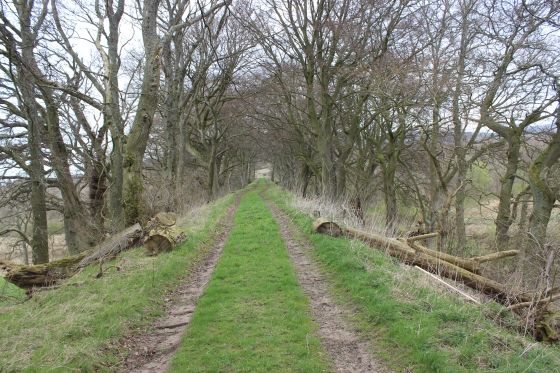
Video: The Fallaws Track bed Remains Today (April 2011)

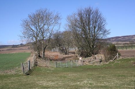
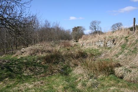
There is no remains of the Incline junction, indicated on the right. There were various tramways between the two quarries.
Rosemill Goods sidings is the light patch following the south curvature (top) of the railway. Rosemill Quarry was to the
right and is filled in. You can see where the two stone bridges of the Fallaws line and the the Lade crossed the river.
The Incline branch also crossed the Dighty over a small, arched stone bridge. See below.

This bridge was mistakenly thought to be part of the the Balbeuchley incline at Rosemill Junction. However, it was a footpath from
the Rosemill Quarry area that led down to the where the Incline Junction with the new line joined. The Newer diversion to
Aucherhouse via Dronley is in the foreground. This is looking west.
Crossing the Dichty. The bridge carried a footpath from Rosemill Quarry
(Feb. 2010 by David Martin)
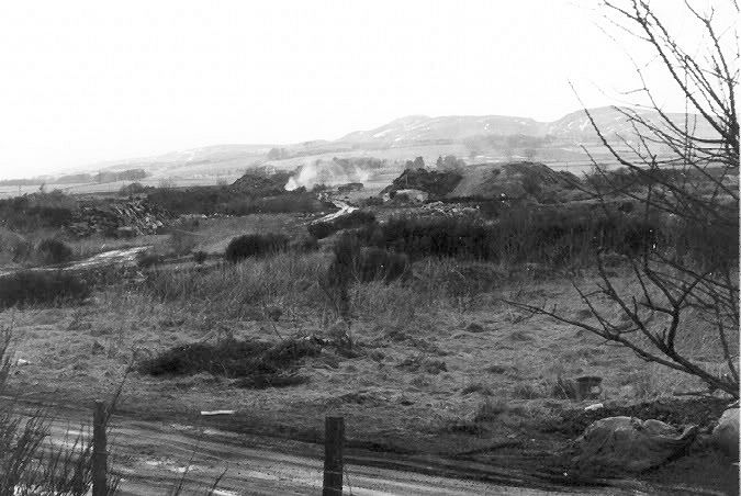
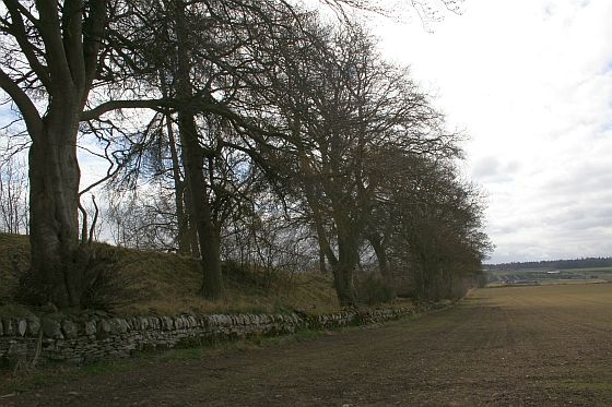
The Balbeuchley incline passed through Leoch and Fallaws quarries. (Elliot Simpson). 1960's.
(The photo has been brightened to open up the shadows)
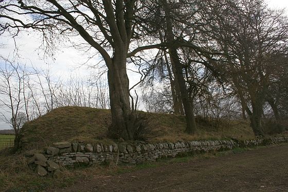
I am puzzled by the photo above in that the quarries don't appear to be all that deep. yet the backfill, especially of Leoch quarry is really quite high. Taking the level from
the junction I would make a guess and say that at the highest point you must be standing over 20 feet, and more from what had been the quarry ground level.
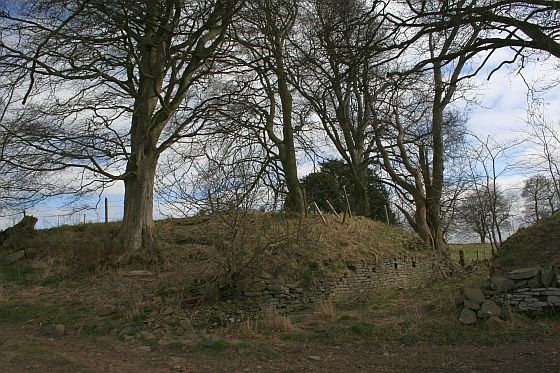
From the Dighty bridge on the new line the April 2011 view looking northwards is the area seen above in Elliot's photo. Hard
to believe you are looking at the same area of land and relates to my comment above as to just how much back-fill has been
carried out. The Balbeuchley incline was off to the far left. You can just make out the remains of the Fallows spur on the
far right, by the trees.
Left: Crossing the Dichty. The bridge carried the branch into Fallaws Quarry sidings. Right: Fallaws quarry spur
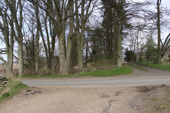
ROSEMILL Jctn. TO TEMPLETON ROAD

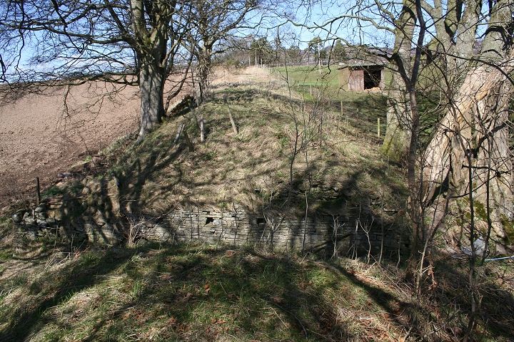
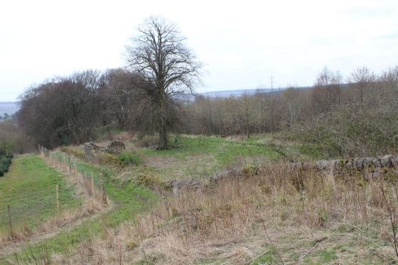
Rosemill Signal box from the trackless remains of the new line, looking eastwards Dundee. On the right of the signal box
and behind the wall is Rosemill Goods sidings and Rosemill Quarry. Today, this has been backfilled creating a
high embankment. (Both Photos by Elliot Simpson)
http://www.geograph.org.uk/search.php?i=7762615 Photos of trackbed, including Rosemill Signalbox.
This fence wire-tensioning post is the only indication where the original line of the D&N ran
originally towards the incline, more recently into the quarry. (David Martin. Feb. 2010)


This railway fence tensioning post marks the junction onto the Balbeuchley Incline. Right: Actual junction for the incline. No sign of the track bed exists
beyond this spot until approaching the Sub Station by Templeton Road. Looking ahead you can see how deep the cutting has been filled in.
Site of Balbeuchley Junction (trailing junction came in from the left). Looking towards the bridge over the Dighty
and to Rosemill Junction. April 2011.
========================================================
I found this an interesting surprise. It was'nt there the day before (16th April 2014) when I passed here during my Incline walk but around 09.30 the following morning when on my way towards Newtyle there it
was, just a blank triangle of concrete with no explanation of what it was about.
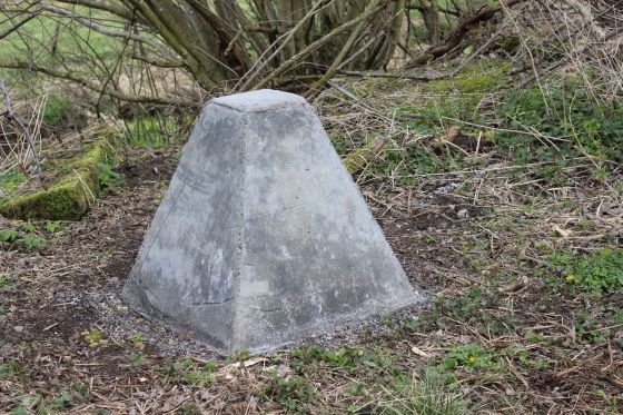

It is set between the sites of Rosemill and Balbeuchley junction sites. (16th April 2014 (Morning)). Right: towards Dundee.
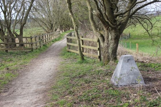
Towards Newtyle. Balbeuchley Junction site is just ahead of the underbridge.

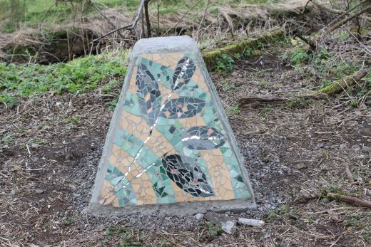
When returing from my Newtyle walk, around 16.00 on the 16th April 2014 (Eveing) I was surpised to find that someone (group) had been busy earlier in the day and the plaque had the plaque had
four picturesque images and saying, on a mosiac backing, all around it. Still no notice to say what this was all about or by whom. However, I found it an interesting addition to the trail.
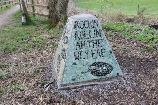
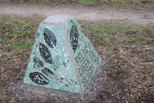
The south side reads "Rockin' Rollin' Aw the wey fae" and the north side reads "Fields O' green Tae Silvery Tay". Meant to be read all as one verse.
===============================================================================

From the east side of the incline junction. The Balbeuchley Junction stump, coming off the new track bed
in the immediate foreground. The divergence track bed continues behind, towards Dronley


Left: The only signal post base I came across over the entire route. However there may be others that I have missed. This was the Up control signal on the new line a few yards
north of the Balbeuchley Junction. This protected the branch from up trains. Right: close by I came across this railway sleeper with four nails still attached. This was probably
the widest brace where the junction of two tracks split, at the points.

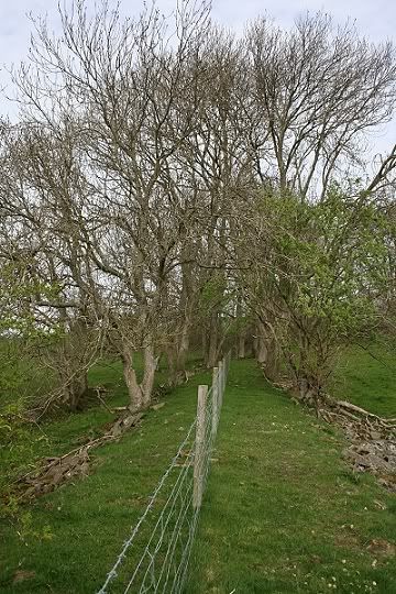
Viewed from the Incline track bed site to the remains of the Fallaw branch, just beyond
the Junction at Rosemill. The infill is quite deep with the river Dighty on the opposite
side of the mound.


The Fallaw track bed quickly disappears completely and is marked by the fencing on the right. Notice how the land increases considerably in height, to the
left, which buries the Balbeuchley Incline track bed from here to just short of Templeton Road. Right: It is a little ironic that it ends at a farm gate across
the track bed.

Standing high above the Balbeuchley Incline track bed the 'new' track bed is seen running across the scene,
towards Dronley.
Seen from the Dronley deviation, the Balbeuchley incline follows the line of trees to
Templeton Road. N.B. The Sub Station. (David Martin)

The Balbeuchly Incline midway between Templeton Road and the Leoch Road. (David Martin)


Left: It looks as if Leoch Quarry is trying to reform it's self once again! Right: The incline follows the tree line, passing the substation to the left.


Left: A couple of lads and their dog relax by the old track bed. This section is isolated between here and Templeton Road but sadly, it too is being slowly filled in and will soon be
just a memory. Right: Inside the enclosure the back-fill is gaining ground fast.


Left: No doubt these trees will quickly disappear once the back-fill is completed and settled. Right: Demonstrating the true depth of the incline.


This is the old section that gives a true picture of the depth to which the railway ran. However, on the right you can see that new soil
is quickly destroying this little bit of railway history. April 2010.
Left: The cutting is now very shallow and could be leveled any time soon. April 2013 Right: Same spot on the 16th April 2014.

Balbeuchley Incline 1960's. Looking south. The same spot as seen in the 2010 photos above and which is being back-filled.
(Elliot Simpson)

Looking towards where the railway went below Templeton Road. The cutting is already leveled. Right: 19th April 2013. The cutting is almost leveled.
TEMPLETON ROAD TO LEOCH ROAD


Left: South side of Templeton Road. Substation on the left. Right: The North side of Templeton Road, where the railway ran below.

Left: Looking back towards Templeton Road and the substation.


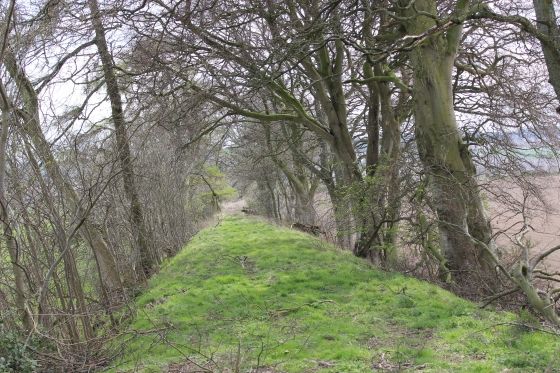
Left: The track bed northwards from Templeton Road. Right: On the right part of the railway dry stone wall is still showing
The embankment is blocked by a fallen tree.

The incline is well defined at this point. David Martin). The fallen trees once again.
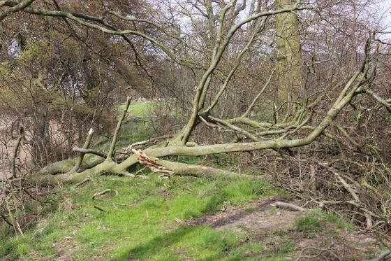


Left: The fallen tree looking northwards. (16th April 2014). Right: Looking back on the fallen trees.
The gap, looking southwards (16th April 2014)

Left: Another fallen tree bars the way, making it difficult to get by. Right: From the same spot, looking down the incline. (Both 16th April 2014).
16th April 2014

16th April 2014
16th April 2014

Just south of Leoch Road by Leoch farm. The steepness of the incline down to Balbeuchley Bottom is really noticeable. (16th April 2014).
===================================================================
B&W PHOTOS AROUND THE SAME AREA IN 1966 By Elliot Simpson

Approaching Balbeuchley Top, where the engine house was located.
This is the same spot as the fallen trees above (right)


The spot with the gap between the embankments

Looking down the gradient to the 'gap'
======================================================================


Both photos looking north. Right: The track bed has been cut off by a local farmer to make a direct entrance to his grounds.
I have since considerd that this gap was in fact a bridge allowing Leoch Farm access to each side of the embankment.
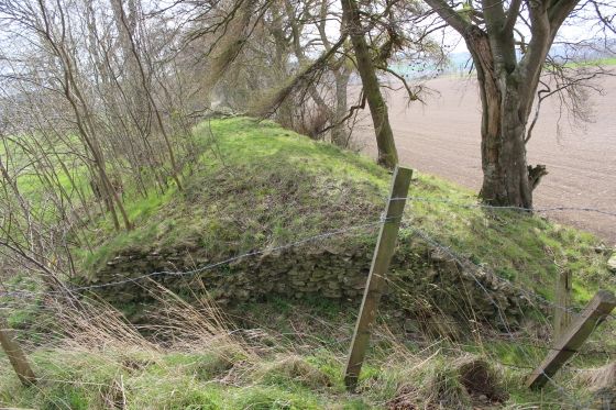
This photo taken on the 19th of April 2013 shows the stone re-enforcement for the bridge parapets.
Ditto
The sun suddenly went behind a cloud and this wooded are became very shaded. Both photos are looking south. On the left you can see the gap in the embankment.

Left: The divide between the embankment. Right: Back onto the embankment and going northwards. Note the shelter on the right.

The Incline by Leoch Farm. Looking north. (Both photos by Elliot Simpson) 1960's. N.B. A more modern Shelter
stands approximately at the same spot as above right.


Left: Looking back down the incline. You can just make out the gap in the embankment. Right: Northwards and the track bed is blocked by bails of cattle food.


Left: From the Leoch Road. The bails standing in the way. Right: The once road crossing. Looking towards Balbeuchley Top
LEOCH ROAD TO BALBEUCHLEY TOP
April 14th 2010 (Updated April 2014)

Left: The plastic Hay bags have been removed. (25th April 2014) Right: Where the track bed went below Leoch Road. Looking westwards.

Left: Looking towards Balbeuchley Top from the site of the Ex road over bridge on Leoch Road.To get back onto the track bed take the path on the right, which takes you through private property. (25th April 2014).
Right: The farm path through the plantation taking you back onto the track bed. You shoud request permission to go through their Christmas Tree plantation.


The view from the Leoch Road towards Balbeuchley Top


Left: From the Leoch Road looking towards Balbeuchley Top (David Martin). Right Just inside the Leoch Road crossing. Looking south.

Left: Partly back-filled and ovegrown track bed on the north side of Leoch Road. Right: The rising gradiant is notriceable on the marshy track bed northwards. (Both16th April 2014).
Left: The path where you get back onto the incline track bed through Leoch Farm. Right: The incline, looking northwards. (Both16th April 2014).

Ditto. (16th April 2014). Right: Back on the incline towards Balbeuchley Top.
Just to the north of Leoch Road. The cutting just before it becomes an embankment up to the summit. (16th April 2014).

Left: Towards Leoch Road. Right: The embankment rising towards summit. (16th April 2014).
Felled tree half way up the incline. (16th April 2014)


Left: Down the incline to Leoch Road. Right: Looking up the incline to Balbeuchley Top. (Both16th April 2014)
Left: View on the west side of the incline. (14th May 2010). Right: The reservoir on the east side of the incline. (16th April 2014).
Approaching the summit (16th April 2014).

Balbeuchley Top from Flash Earth. The area showing where the engine house stood is well defined. The track turned at right angle and headed westwards
towards Auchterhouse.
Head-on view of the Engine House site at Balbeuchley Top, with the track bed taking a right-angle turn towards Pitpointie Farm.
The engine house stood just behind the tall trees, while the water pool & tank stood to the left. The ruin to the right was the
engineman's house. A Coal Store stood behind that and in front of the engine house. This is the spot where wagons would have
been attached and detached from the wire rope. This would have been a busy spot at times with a loco getting watered and coaled
and wagons and a passenger coach awaiting to depart for Auchterhouse or lowered to Balbeuchly bottom. (19th. April 2013).
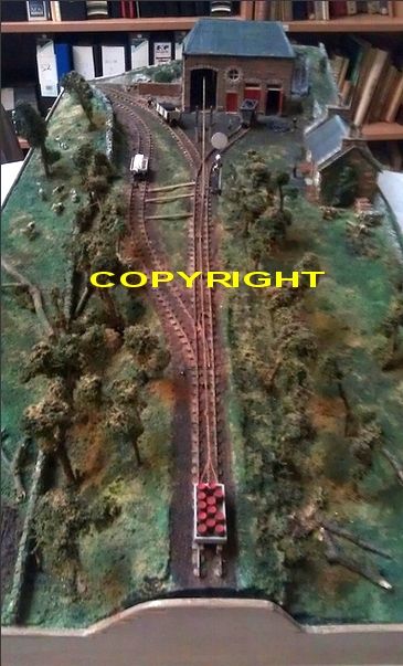
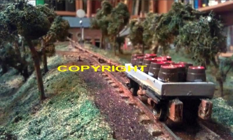
A VERY FINE MODEL OF BALBEUCHLEY TOP
I was nicely surprised to come across these colour potos of a very fine model railway of the top of the incline at Balbeuchley. My thanks to David Martin for allowing
the use of the photos on this web page. It is nice to see what the enginehouse and the Engineman's House actually looked like as well as seeing the layout and
wagons attached to the wire
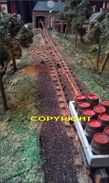
"Interesting"! The left photo shows the track running off to the right up to the engine house with what appears to be the coal delieverie. However, this line
and the coal wagon appears to have been deleted and the signal moved closer to the building, for some reason! The two photos appear to show the
model at different stages of building.
I had wondered about he sigaling used on the incline and it appears that ther was just the outside the engine house that gave the signal when trains wer ready to proceed down
the incline. However, was there a signalbox and signal(s) from Pitpointie to Auchterhouse! There were normal type signals at Auchterhouse old station therefore there must
have been a 'Starting' signal from Balbeuchley Top.
N.B. These photos are the copyright of David Martin (Dundee). Please don't copy or use these photos for any reason whatsoever without seeking permission.
You can find David's photos on Flickr.
====================================================================================

At the summit. The tractor grooves virtually follow the main line as it curves in off the incline. This is taken from the access path above
the Engine House site. The engineman's house is by the tree. According to sketches those two trees were there when the site was
operating. The siding was in the foreground with a shunt towards the trees and a back shunt up to the engine house where the wire
rope came out of and retuned back into the building. There was a loop line next to the main line where engines could take water.
The water tower stood to the right, this side of the two lines.
From the running line, towards the incline.
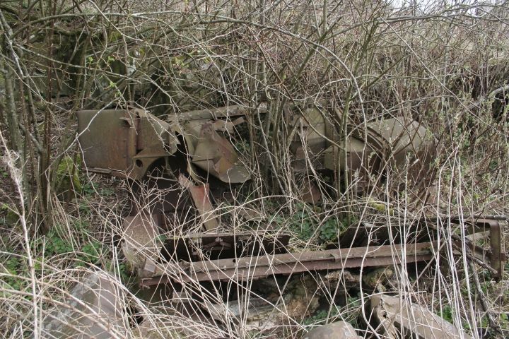
The site of the engine house. Sadly, nothing remains. There is a lot of rubble on the site, mainly stones and the remains of a tractor.

The rubble on the site of the Engine House (14th May 2010)
The rubble on the site of the Engine House (14th May 2010) .

Looking south from the Engine house, where the trains would have been attached and detached to the wire.

Coming in from Auchterhouse, with the remains of Balbeuchley Top buildings on the left, while the track curved
to head south down the incline. It's a pity that the railway activities that would have occurred here was never
recorded for prosperity. This would have made an excellent museum if they had kept the Engine and buildings
together. It is over 140 years since such activity took place here. As a point of interest the Museum in
Dundee has models of both the type of static engine used and also of the first steam loco to work the line.


Left: The Engine House Site. There is nothing remaining. Right: Ruins of the Coal Store and Engineman's House on the eastern paremeter of the site.


Remains of the Engineman's House.

The House ran north to south with the entrance on the west side.


Left: Interior ruins of the enginemen's house. Not even a fireplace or sink to show what had been here. The eastern corner of the ruined house. Right: From a diagram this would have been the lounge area.

South end of the house (Both 16th April 2014).

Left: The north-eastern corner of the house. Right: this shows the full length of the house.

The Enginman's House and incline seen from the footpath above the site. (Both16th April 2014).
Ditto.
Remains of the gate that protected the entrance on the path at the top of the site.
(28th Sept. 2013).


The stream that fed the pool and water tower. It still gurgles merrily
and is about the only sound heard at this deserted site.


Left: Parts of the stone wall still remains, where the trains took the curve before the long straight, passing through Pitpointie Farm to Auchterhouse.
Right: The tight curve heading towards Pitpointie Farm

You can just make out the eastern buildings of Pitpointie Farm, up ahead. I didn't walk this section as I was
told that it is quite bogie and is messy through the farm, where you would require permission to do so. I
walked back down to the Leoch Road crossing site and westwards to then go up to Pitpointie Farm
before getting on the track bed again towards Eastfield. Luckily a man was just about to drive away from
of the cottages and told me that it was OK to proceed. We also shared a bit of chat about the old line.
Pitpointie Farm To Balbeuchly Top, Walk (April 2013)
On the 19th of April 2013 I managed to get permission to walk the old track bed through Pitpointie Farm to Balbeuchly Top. It was a fine day but after a heavy day of rain two days
before, the ground was still saturated with water. Along with the years of overgrowth and the piling of old farm equipment and rubble it was noan easy or comfortablewalk.
It was slow going and having to be careful of every step. Other sections are either deep in rubble and/or very wet getting through the long grass and around some rather smelly
water. I had to creep along close to the wire fence taking care not to get tangled in the barbed wire and for the final length to Balbeuchly Summit I had to climb off the track bed
and walk along the southern edge of higher ground. This section would be alright to walk when really dry but certainly not on this ocassion.
Your way is blocked where the old track bed meets the farm house and you have to walk around the south side of the house, passing the main driveway to the house and carry on
around until you come to the eastern side of the farm where there is a number of farm buildings and old pieces of equipment etc. then the difficult through-way begins.......
Eastern side of the Farm, looking west on what was the actual track bed. This road led into Pitpointie Goods
which was to the right.

Eastern end of the farm with a large heap of rubbish piled upon the remains of the track bed. Both views towards Balbeuchly Top.
This was the site of Pitpointie goods siding.
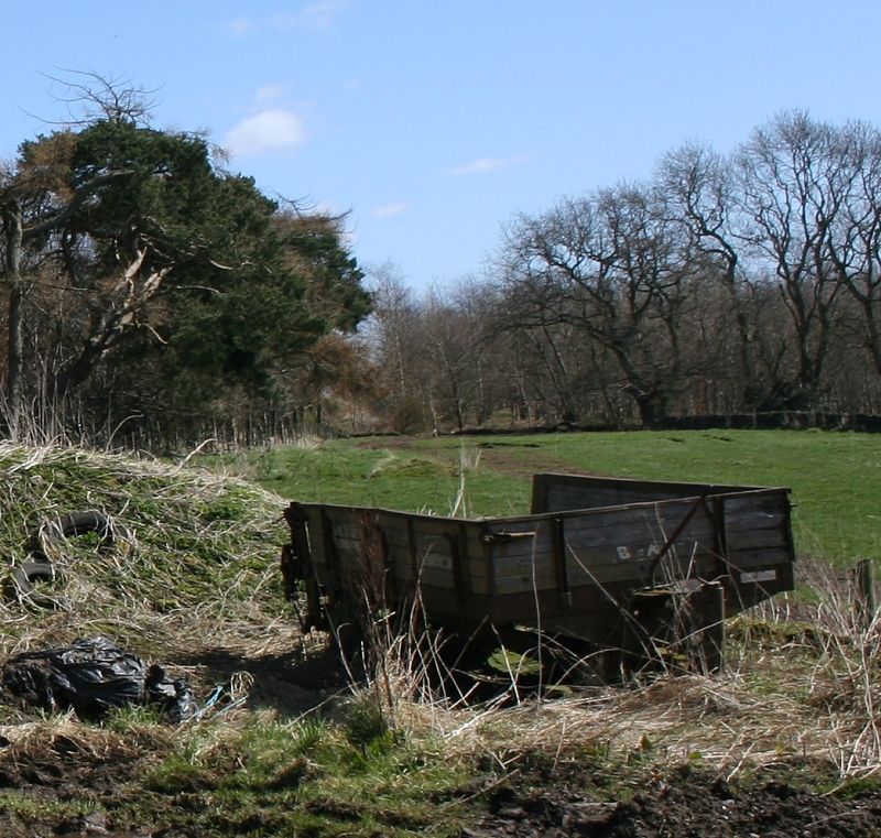
Initially I thought this may be an old railway wagon but turned out to be a two-wheeled farm trailer.
Left: Looking westward. Right: Looking eastwards. This is where it became quite difficult to scramble over towards Balbeuchly Top.
You need to take care as there is a lot of loose material where you could easily lose your footing or trip over something.
Westwards. The heap drops suddenly and is still rough under foot.
Left: This section was completely fenced off and I had considered the possibility of having to return to the farm and take the long detour around the main road to get back up to
Blabeuchly Top, which would have been annoying having got so close. Thankfully the wire fencing was damaged enough for me to keep going, although it was difficult climbing
over the loose wire. Right: The last lap to Balbeuchly Top. This would be easily walkable when dry but as we had a full day of heavy rain two days before it was more like a swamp
and deeper than it looks. A pair of Wellies would have been handy. This is where I had to climb up the south side wall and walk along the higher ground, which was dryer.

From the embankment. The flat section which was deceivingly waterlogged.
Left: From the embankment looking back towards Pitpointie Farm Right: Towards the summit.

Left: First sighting of the summit. The high path is where the staff would have arrived and departed from, unless catching a ride on the train up the incline.
Right: From the same spot, back towards Pitpointie.
Left: At he summit. It was still bogie underfoot and I had to walk between the tractor grooves to look around the summit site.
Right: Same spot back towards Pitpointie.
Continuing the walks from Pitpointie to Newtyle...................

From the Leoch Road. Over the years Pitpointie Farm has extended eastwards along the length of the old
track bed. The goods siding was to the right by the trees.

The western end of the track bed as you meet Pitpointie Farm land. The track bed
was straight ahead but now blocked by the house. The opening to the right is too
and from the Leoch Road and the entrance to Pitpointie farm.

The chap I talked to said that this site was possibly a water tank for the Steam locomotives! Being only about
half a mile from Balbeuchley Top, where water was available I am a little dubious if this information is
correct. Perhaps someone can prove this, one way or another!

It had been a fair sized building and it would be interesting to learn what it was for.

Looking west from the above spot, along the old track bed towards
the Ex level crossing on the Kirkton Of Auchterhouse road.

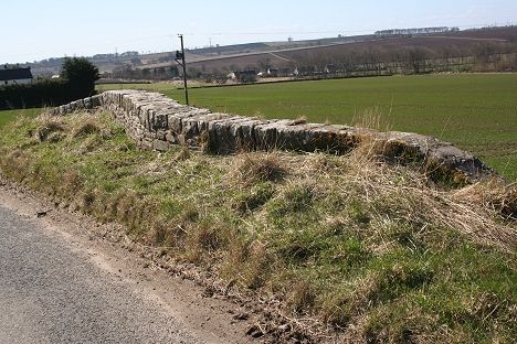
Looking back along the track bed towards Balbeuchley Top, with Pitpointie Farm hidden in the trees. The dry-stone wall is still evident, on the left.

Interesting wooden pillars by the Kirkton Of Auchterhouse Road. Looking east. This was the site of a level crossing.

Looking west, where the road crossing was. Part of the track bed has been ploughed flat but you can see the shallow
cutting up ahead, where it stops again just before the Eastfield under bridge. A point of interest is that the dyke on the
west side of the road doesn't match up with the width of the track bed and will have been built after the railway closure in
1861, making the fence quite old in itself. See latest news of the right-hand side post, below.

The wooden posts are very well made and quite a pleasant design.
They were obviously made to last.

19th April 2013. I was disappointed to find that the northern post had been up-rooted from it's base from a road incident. The post lies
back from the crossing spot and is temperarily tethered with some barbed wire to hold it up. How long will, it last like that! Rather sad
after standing at the same spot since the 1830's.

A telephoto shot of the shallow cutting heading towards Eastfield.
The site of the level crossing seen from the Leoch road junction with the eastern Kirkton of Auchterhouse road heading northwards
From the Leoch Road. The tracked running east to west up to Pitpointie Farm, to the right by the trees. You can see the two posts
guarding the level crossing site. (19th April m2013)

Also from the Leoch-Eastfield Road. The track bed restarts in the field for a short way, before disappearing once again under the plough, at Eastfield


Left: The track bed from Balbeuchley as it disappears again just before the under bridge. Right: The under bridge at Eastfield. Looking north towards Kirkton Of Auchterhouse.
Left: West side of Eastfield railway bridge parapet. Right: East side of Eastfield railway bridge parapet (19th April 2013)


Left: Along with some back-filling of the track bed the under bridge at Eastfield has also been strengthened to handle modern traffic. As well as giving me permission to enter the
garden to take this picture, the lady of the house kindly gave me some welcome refreshments, while we chatted about the railway and things in general . Right: The track bed
heads towards Auchterhouse from the under bridge.
The bricked-up under bridge at Eastfield , visible to the right of the house. Seen from the
Dronley road. (David Martin. Feb. 2010).

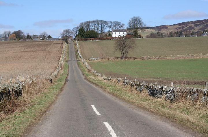
The old track bed half way between Eastfield and Auchterhouse

Now on the outskirts of Auchterhouse. The white houses stands on the 'newer' station site. There is a break in the 'old' embankment on the left,
while you see the end of the embankment as it approaches Auchterhouse old station site.

I find this cropped image of interest both for it's nice pastrol colouring and lighting but also, it shows the old track bed coming in from the left and
ending just above the Auchterhouse 'new' station site. The white houses stand in the old Goods siding. The station ran the full length, in a cutting,
up to the over bridge, just noticeable to the far right and you see where the incline track bed entered the old station site, on the extreme right by the
small arched-roof stone building.

The incline track bed coming in from Eastfield and to where it ends just before it ran into the old station. In the background are the twin communities
of Birkhill & Muirhead , which are just to the north west of Dundee.

The end of the incline embankment from the Ex road bridge by the old station site.
A cropped image from a wider view, showing the stump of the embankment that remains. Due to some tree cutting you can see the filled-in over bridge
up ahead at Eastfield, connecting it properly to the direct view as it woud have done when the line was open. (April 2014)
AUCHTERHOUSE 'OLD' STATION
The old station was to the north of the village. You cross over the track bed on the Kirkton to Auchterhouse road with the station and goods yard on the north side of the bridge.
The new station was closer to the Newtyle-Dundee road and was on a new loop that met the old line just north of the old station. Goods trains had to take the original track bed
into the old station goods yard.


Left: Site of the under bridge where the incline railway came into Auchterhouse 'old' station. Right: Reverse view. looking north.


Left: The north side of the road as the incline railway entered the old station platform, hidden in the undergrowth, behind the right hand fence.
Right: Auchterhouse Goods Yard from the newer line over bridge, looking north.


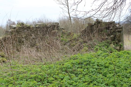
Remains of the 'old' station platform. It is fast deteriorating. It really should be preserved considering it goes back to 1833! A gem of a Scottish Railway historical site.


Left: The old Goods yard, looking north. The newer line ran in a cutting to the left, while the old line ran at a slightly higher level, on the right. Right: Reverse view. The old station
platform is on the left by the arched-roof stone building seen in the background. The top of the 'newer' under bridge of the 'new' line is seen on the right and indicates how much
back-fill has been carried out in the goods yard site. The Army Tank seen here belongs to a group who sell driving lessons to anyone with the wish to drive a tank.

At the north end of the Goods yard, where the layout narrows as the single line went on to Newtyle. The old and new
track beds met at this point. Goods trains had to take the spur into the goods siding. If they were heading south they
would run directly into the goods siding and back out over the north points and reverse to go south again.
Goods trains going north would run beyond the north points and back into the goods siding then head
northwards when shunting was completed.
http://www.geograph.org.uk/search.php?i=7762615 Photos of this area. The map below (click on the link) shows Balbeuchley Top to the west of Leoch.
http://hsewsf.sedsh.gov.uk/eschedule/show?id=6123&OK=Y
Entrance to the new station, which was behind the houses on the right. The track bed coming in from the south is seen on the extreme right. It was just beyond this
point where the incline track bed met the new line. The center road leads up to the over bridge by the old station., while the main road on the left runs north to
Newtyle. Note the bus stop. There is an hourly service between Dundee and Newtyle.
http://www.geograph.org.uk/search.php?i=7762615 Photo of railway bridge between old & New stations.
https://www.youtube.com/watch?v=5_DxCgUWtuk Video includes the Balbeuchley incline seen from he air.
===========================================================================
HATTON INCLINE (Millhole) To NEWTYLE OLD STATION (Original Route) Back to D&N Index
Links & Reading:
The Dundee & Newtyle Railway by Niall Ferguson. Still available from some books shops and on the Internet.
The Dundee & Newtyle (A history by Elliot Simpson)
http://www.auchterhouse.com/history/railway.htm (Includes and excellent map of the railway)
http://www.geograph.org.uk/search.php?i=7762615 Excellent 'remains' photos including the Law Tunnel, Balbeuchley Incline and Dronley
http://www.hows.org.uk/personal/rail/incline/dund.htm Explains the inclines but sketches are very poor quality and almost useless.
Video Screen grabs from the The Railways Of Scotland Volume 8 "Dundee". An excellent video available on DVD, from Cinerail at: http://www.cinerail.com/cinerail/railways-of-scotland.html
There are many great archive scenes of almost every
Scottish route you can think of. Well worth a look.
The Cromford & High Peak Incline railway in Derbyshire has been luckier in having much of it's buildings, including an Engine House preserved. This is what could have happened, indeed,
should have happened with at least one of the D&N inclines. However, the C&H gives an excellent comparison of what the D&N would have looked like.
http://www.hows.org.uk/personal/rail/incline/hop.htm
Boddam To Ellon Branch (Walks) By Bill Reid.
Hosted by www.theatreorgans.com
