THE ISLE OF BARRA
A weeks visit on Motorbike in 1977 & 1978
Macraynes' Ferries run twice a week across the Firth of Lorne, between the mainland at Morvern and the Isle of Mull and then the open ocean to Barra.
Having traveled over night from London and arriving in Oban around 11am and caught the 3.15pm ferry (Caledonia) to the Island of Barra for a two day visit then onto North & South Uist
and return via Skye and Kyle of Lochalsh. It is a five hours journey (or at least, should have been...read on). With one stop at Lochaline on the mainland at Morvern.
It is interesting watching the ferry load up. All sorts of things, cars trucks, a bus, and of course, my motorbike, lashed to a corner behind the cars and trucks. Once my bike was safely
stored I went to the top deck to watch the goings on and the departure. At the last minute a truck pulled up with a 50-60 foot Chalet on the back. There was a chin-wag with driver and ship
crew and raised voices. The truck eased itself onto the deck and had to do a few maneuvers to be able to drive straight into the loading deck with much shouting of orders. The truck eased
back to straighten up and then suddenly struck the top corner of the loading bay doorway and a huge chunk was ripped off the roof and side of the challet... Oh dear, more raised voices
and some disappointed customer on Barra or Uist. I left them too it and looked across the vista of Oban town and MacCaig's Tower, or folly, built by a wealthy businessman to help the
unemployed during a depression and looking like a Roman Coliseum in a mountain setting.
The ferry suddenly set off and we sailed through the sound of Mull, with a stop at Lochaline to pick up a handful of customers and off again. On past Tobermory. Many types of sea
vessels passed with the grand mountain views over Mull, Morvern and Ardnamurchan Point, the furthest point west in the U.K. Then out into the open Atlantic. Down to the Buffet and a
nice meal and a drink. Back upstairs to watch the view.The lovely blue skies were now grey and the wind was bracing, there was nothing to see once beyond the Islands of Coll and Tiree so back into the passenger lounge. It grew dark yet it
was only just around 4.30pm. I sat with my thoughts then suddenly was aware of a young child being sick, the lounge was strangely quiet after all the chatter. I went to the toilet. It stank of
sick, even the urinals were full of it. I got out and went for a look outside. It was bleak with nothing to see on the open see. I went back inside and sat down again. After a while I was
suddenly aware of a headache I got up and sat down as fast, my head spun and my stomach ached and I felt as if I was drunk, but without having had more than one pint over an hour back.
I was seasick... and so was just about everyone on the boat, even the crew. It went on for hours and I just couldn't shake it. I went outside again and found the air helped. I met an English
chap (Ted Barr) and we tried to hide our discomfort in chat and got to know a lot about each other over the next hour or so until the cold forced us back inside. He was from Old Coulsdon
in Surrey and travelling with his wife and two sons on a caravan trailer holiday to Barra and the Uists like I was planning.
I have never felt so ill in my life and it was miserable and once I recognised it as seasickness felt sorry for all the other people I have met over the years who talked about it, not really given
it much thought. It's really quite a nasty experience.
We were going through a force ten storm and the boat was bucked about like a wild stallion. On and on it went. We should have arrived in Castlebay around 8.30pm but finally didn't arrive
until just after midnight. I hadn't eaten or, had a drink for several hours, and couldn't care less. We (Ted and I) watched the tiny spots of light get wider and wider before we realised we were
finally entering the harbour and started to see the lights of buildings on the harbour front and the dark shadow of Kisimul castle slowly pass by.
We then went down to the bottom deck to get ready for disembarkment. It was a great effort to get my gear on and to unleash the biker from its ties. The boat shuddered as they turned to
side up to the pier. After a while the great doors opened into an inky darkness, with shadows of people on the harbour front. I wondered if my friend Donald Boyd would still be waiting to
greet me. I nodded to Ted and his family as they moved off. We were to meet a number of times over the coming week and was always greeted with a friendly chat and offered a drink of tea
and on the final meeting, on Uist I was invited to a nice meal. It was a chance meeting that resulted in occasional correspondence and a couple of meetings over the years.
I started my bike up, usually no effort at all, by the normally peaceful tick-over seemed like a roar and the vibration made my stomach shake like a jelly. I was sure I was going to be sick, but
it came to nothing, just a horrible dull ache. I saw my path and revved up and had to hold my breath as the pain grew so strong and I was pleased to ease off power as I leveled out on the
pier. I didn't even notice Donald approaching me but was pleased to see him. Donald was a retired Schoolmaster from North Uist and retired to Barra. I was put onto him when I started
studying Gaelic and we had exchanged many letters and it was nice to meet him and looked forward to giving some of my Gaidhlig a try.
Two days later I went on the same ferry to South Uist and was till feeling the effects of the Seasickness which was constantly with me as I traveled around the islands on my motorbike.
Well, that's how my second visit to Barra went, but for my description of the area I will use my experience of the marvelous week of weather I ever experienced in ten years of motorbiking
around Scotland....Note: I shared continuing corraspondance with Ted Barr and he came to visit me once. Ted and his family moved from Surrey to the Middlesborough area, where in retirement he was
involved with the North Yorkshire Railway. Ted died in 2005.
Barra: Gaidhlig Barraidh = St. Barr's Island. Is the second last inhabited island in the chain of islands that form the Outer Hebridies from the Butt of Lewis, and Harris, North Uist,
Benbecula, South Uist, to the southern tip at Barra, Vatersay and Barra Head. This is a magical land of wilderness and beauty or life threatening rain and gales. Whatever the weather
they have a beauty, atmosphere and light, all of their own.
Barra is only about 5 miles by 8 in size but has an excellent mixture of landscape that appears to combine all the various land and seascapes of Skye, in miniature. On the Island
only a single-track road circles the island with only two or three arms of any length, but every inch is worth the effort of driving, biking or hiking. The highest peak is Ben Heaval
(1255') which is an easy climb for most able folk can mange. The views are excellent.
The capital is Castlebay. Gaidhlig, Bagh a' Chaistle, a tiny town of little more than a thousand souls. The two main religions are Protestant and Catholic.
Castlebay and parts of the circular road were featured in Ealing Studio's "Whiskey Galore" in the 50's, and caught the atmosphere of the period and how the island and town looked
at that time. The spired church and big house were still immediately recognisable, when I was there last.
The only shops on the island are at the harbour. The Bank of Scotland, Post office, a Spar shop, general store and fuel pump. To the right of the Kirk is Craigard Hotel (High rock) a
modern two story building. Most of the houses are single story, cottage style. The older ones with grey roofs while more modern ones have red tiles making a nice contrast. On
the western outskirts is a row of semi-detached houses. The main livelyhood is fishing with some crofting. A small ferry plied too and from Vatersay but in recent years a causeway
was built between the two islands.
Kisimul Castle in the Bay with the shop and Bank by the shore.
Local Fishing Boats and repairs at Castlebay Harbour
Statue of St. Barr at Northbay. It stands on an island to the east of St. Barr's Church.
White sands & blue sea at Northbay by the airport. Mosiac by local Schoolchildren at Airport Waiting room
A Tri-lander from Glasgow lands on the Cockleshell beach/runway
Passengers boarding and the Tri-lander takes off for Benbecula and the Uists
The one, circular road around Barra means that whichever direction you start off at you will eventually re-enter Castlebay from the opposite direction. One comical scene in Whiskey Galore
used this as a joke when the army set up a road block only to be reminded that all the enemy had to do was turn back and go around the opposite way.
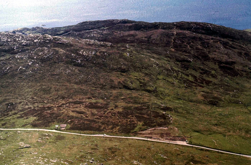
The main road is the A888 and we shall go in a clockwise tour around the island. With an immediate climb you leave Castlebay just past the modern children's school at Kentangaval. In
early June this corner is a carpet of colour with Buttercups and daisies. Next on to the hamlet of Tangusdale. Ben Tangusdale (1090'). A footpath takes you to the summit of Ben Heaval.
Then northwards to Borve. St. Brendan's Chapel overlooks Borve Point and Bay. On past Ben Mhartin and Sgeir Liath (grey rocks) and the road starts to curve eastwards If you look
sharply you may just catch sight of the ruin of a Dun on the left and just before Cuir hamlet. Here a side road goes off to the left to Cliad by Greian Head (Sunny point). And
overlooking the whole of the coastline to the northern-most tip of Barra at Scurrival Point with its white beaches.
About a mile on, you reach another road junction, on your left. This wandering single track road heads north, past Loch Obe to Northbay then on to Traigh Mhor (The great beach),
which is made up of cockelshell and is also the island's Airport. Tractors rake the beach level and chase the cattle off before the twice daily, Loganair `Tri-lander` plane comes into land.It is interesting watching the plane come in over the sea and circle around the hilltops and eventually land and taxi up to the small but modern passenger building at the edge of the
beach. For it's opening one wall was decorated with scenes of Sea Birds done in Moziac, by the School children. The plane also carries mail. The mail van also acts as a local bus.
At that time the Airport Manageress was the daughter of the "Coddy", a local
dignitary (more on this later).
John MacPherson's Daughter. Manageress of Barra Airport at that time.Walk over the hill behind the airport and you look out over the great bay that stretches down to Greian Head and Cliad. The sands are so white and smooth that in bright sunlight
it is quite dazzling and sunglasses wouldn't go amiss. In places the sands are being eroded and blown away making the banks fall in and Sparta Grass is being planted to try and
act as a shield and base. The white sands and Blue skies make the sea look an even deeper blue and you get the feeling of being in the Mediteranian.
The view north and east is over Oiter Mhor with numerous islands, The largest directly ahead is tiny Orosay with larger Fuday behind, to the tiny Hellisay, and Gighay in the
Sound of Hellisay. Flodday and Fuiay lays off to the far right. And far out in the sound of Barra is pretty little Eriskay, off the shore of South Uist.
The road goes on northwards ending just beyond Eoligarry at Scurrival Point with the small island of Fiary out in the sound of Fiary. Eoligarry House stood in a large walled
enclosure but is now sadly no more than a ruin.
At the pier a small launch plies too and from Pollachar in south Uist. Behind Eoligarry Church is the graveyard where two of Barra's best known characters are buried. John
MacPherson (The Coddy) was a local storyteller and businessman, and his long time friend Compton Mackenzie, the author of Whisky Galore. Both appeared in the film,
Compton as the Captain of the ill-fated 'Politician', in the opening scenes. The 'Coddie' appeared during the party scene. He is seen standing behind the serving hatch.
The two graves are easily found. They are both granite crosses. The Coddie (1876-27.2.55 and Compton's (1883-1972).
Left: John McPherson "The Codie" and his son Neil who was lost on air operations in June 1944.
Right: Compton McKenzie Author of Whisky Galore and other books.
A book, Tales of Barra - Told by the Coddy is Published by Morrison & Gibb Ltd. of Edinburgh. It is written in the manner of how Gaels handed down their history, by
word of mouth to each generation and gives stories and antidotes of events that affected the island and its People.
Renovation work at Eoligarry church. Summer only passenger ferry departs the peir at Eoligarry for South Uist.
I have not been back to Barra since 1978 but by the magic of Google Street View I was able to grab this image of how the church & grave
yard look today.
Returning to the main road, turn left and head on eastward around the island. Then turning southwards to Bruernis overlooking North Bay and the small islands. A small inlet is used as a run in by
a fishing boat that leads to a landing stage and shed. And on to Balnabodach (the old man's town/wall) which overlooks much the same scene.
Southern tip of the Island and the village of Borve. The summit of Heaval on a crystal clear afternoon.
Then into Ersary on a double bend. A large house stands by the roadside and the area looks attractive when the wild 'yellow' Iris are in full bloom. You now start to turn westwards with a steep climb
to Breivig. From this high point, that also featured in the film, there is a grand view northeast with the long shadow of the Isle of Skye as a backdrop. On a crystal clear day (as it was when I was there)
you could actually make out the shape and peaks of the Cuillins although they must be 60 miles away.
For an even finer view of this scene and more just to the north. Stop in the small car park by the roadside and a track on the right starts the climb up to Ben Heaval. For the most it is a bit steep, but
then continue following the track and zig-zag your steps and apart from the final scramble the climb is completed within 10-15 minutes.
Just below the summit is a massive concrete statue of Mary & Child. You'll either love it or hate it, but there is no mistaking the scale it gives to the scene. Not to forget the numerous photographic
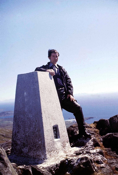
opportunities it gives, from different angles.At the summit (1255') there is an Ordinance Survey post. Sit a while or take a stroll and enjoy the grand view. Northwards you look down over the whole length of Castlebay,
with Kismull Castle off shore and the island of Vatersay, with South Uist in the far distance. On such a fine day the water is crystal clear and you can see the varying depths
around the coastlines. From the white sands that grow darker with each stage of depth then the deep blue of the water. The scene is then complete with the little white
waves as they break on the shores.
View from the summit of Ben Heaval with Castlebay, Kisimul Castle,
Vatersay and South Uist as a backdrop.
Myself at the summit of Ben Heaval. Taken by a Canadian visitor. The Isle Of Skye
in the far distance.If you are walking and have the time take a circular hike and climb to the summit of Ben Heaval and return via the mountain track, westwards which meets the main road near
Tangusdale. Or if you just wish, take the car. A road by the Kirk goes a quarter way up the mountain ending in a car parking area. You now only have the shortest climb to the
summit and back.
Back down to the road and you are soon back into Castlebay, having seen every road on the island. You enter the town on the west shore overlooking the harbour and there
is a seat where you can sit a while and just enjoy the harbour scene with Kisimul Castle as the centerpiece. The lifeboat lies out on the water with a number of small fishing
boats and possibly a yhat or two anchored around the bay.Kisimul Castle: The Castle was restored by MacNeil of Barra (45th Chief of Clan Neil) and it is still lived in but open to the public, by way of ferry from Castlebay. The story of the
rebuild is told in the Book "Castles in the Air" by MacNeil of Barra and published by Collins of London and Glasgow. It tells of how the 'Chief' who was born in Michigan USA
dreamed of buying back and restoring Kisimul Castle and which became a reality and began in 1937.OVER THE SEA TO VATERSAY
A visit to Barra would not be complete without crossing to Vatersay. A small ferry plied across the short crossing, leaving you to walk around the island. You would have to time
yourself for the next ferry back to Barra. However the islands are now connected by a causeway, so whether you need to walk all the way or there is a bus service I don't quite
know, but would expect there was.
It is quite a lonely, but pleasant walk, around the headland to the only village on Vatersay. On the way I passed the wreckage of an American plane that crashed there during the
war. On your own on a strange stretch of shore and on a bleak rainy afternoon it felt quite eerie.
As I came around the bay into the village, a boat was 'beached' on the sands. A truck was on the sands alongside being loaded with coal by a crane on board the boat. Once
unloaded the boat sailed out on the next high tide.
The village is a simple square of houses with a village hall. I noticed a face come to a couple of windows and look out on the passing stranger. It must be a very pleasant and
quiet place to live in spite of the occasional bleak, wet and windy days. If it had been a sparkling sunny day as I had when on the summit of Ben Heaval I am sure Vattersay
would have put on quite a different face.
Coal is unloaded while the boat is beached.
The 1942 Catalina flying boat wreckage on Vatersay (1978).
Dedication to the crew who died in the 1942 crash http://www.aircrashsites-scotland.co.uk/catalina_vatersay.htmWith my enjoyable two day visit to Barra over I next caught the Ferry (Iona) across to Lochboisdale in South Uist... the story continues.
The Isle Of Barra (Proshow Presentation) The above photos with musical background, composed and played by Johs Larsen (Denmark)
To "Ken Griffin Dedication" Home Page