Back To Radstock Railways Index
S&DR "QUARRY" BRANCH LINE
(1828 to 1920)
(From a visit on the 16th of June 2021)
Updated August 2021
This S&DR branch began from the Clandown branch junction that ran from the S&DR goods siding, around the south side of the station but dropping below the Bath Road then
below the S&DR just after the level crossing and met the junction on the north side. The main line continued past the gas works, Middle Pit and on to Clandown Colliery. From
the junction on the north side of the S&DR the branch turned sharp westwards, along the north side of S&DR before once again diving below the S&DR then in a short distance
dropped below the GWR Bristol to Frome line and ran westwards between the GWR and the Wellsway Colliery branch out to the site where it ended at a stop block just before
Old Welton Colliery. It never joined up with the colliery.
I have not been able to find out the name of this branch or what goods it was built for. If anyone can help it would be really appreciated. I will refer to this as the "Quarry" branch
until I learn the real name so that we know what I am talking about and will edit in the correct name once it is known. I already know that there was not a quarry at this spot and
there was just a sewage plant on the site. I wouldn't think the plant had been linked to the railway.
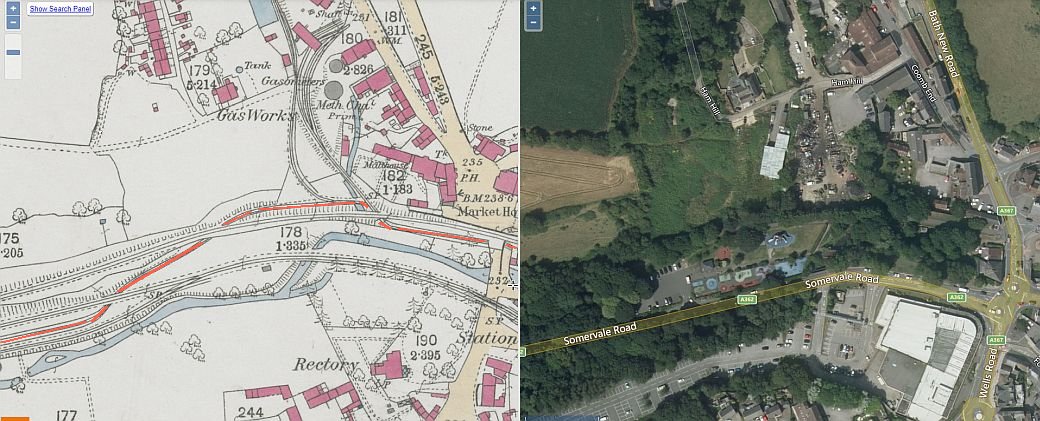
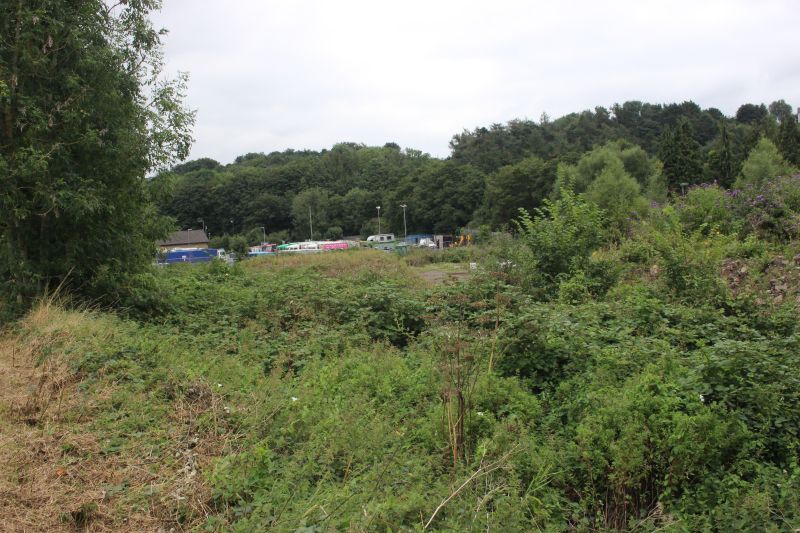
An over view of the area showing the S&DR branch came off the Clandown and Gas Works branch. Follow the red line. N.B. On the north side of the S&DR mainline
the Gas Works, Middle Pit and Clandown Colliery were served by their own branches. The "Quarry Branch" had a junction with the Clandown branch. This map is
many years from when the new trailing junction with the S&DR was built in the 1920's and shows only the original branches and junctions.
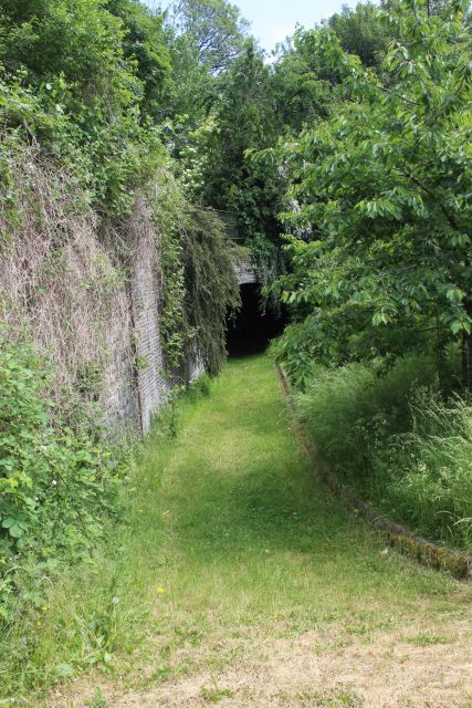
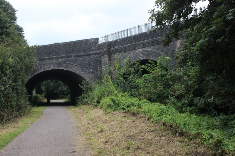
On the west side of the S&DR station and level crossing the Clandown and "Quarry" branch went below the road and exiting
here on the right. The tunnel opening has been back-filled and formed as part of the cycle way and footpath to Midsomer Norton.
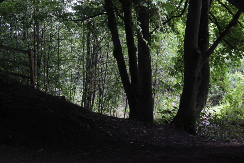
The branch then did a sharp turn northwards and went below the S&DR track bed. This is the south side of that short tunnel.
After dropping below the main road the branch turned sharply northwards below the S&DR. This was taken from the GWR
track bed over looking the Wellow Brook.
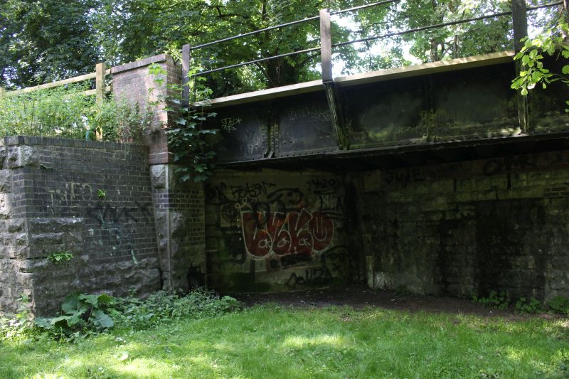
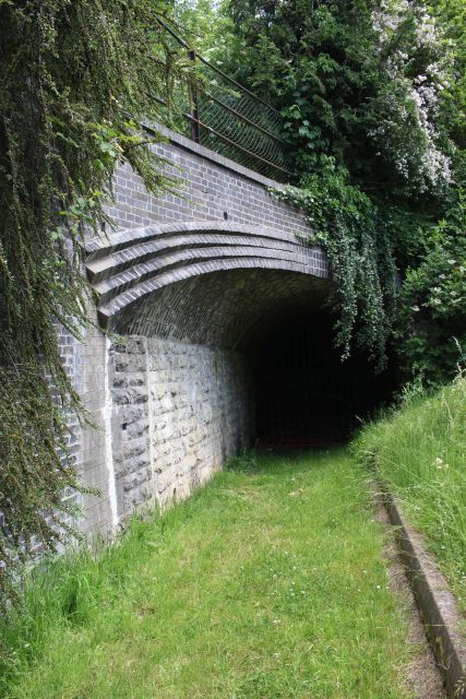
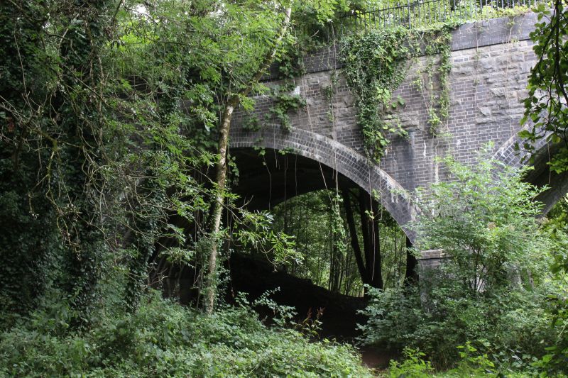
The bricked-up short tunnel. Immediately behind on the north side of the S&DR was the junction where the "Quarry branch
ran along the north side of the main line before turning sharply westwards below the S&DR once again then below the
North Somerset railway.
The north side of the short tunnel. Below, the branch continued on to the Gas Works, Middle Pit and terminating at Clandown.
Colliery. Also at this point, below the tunnel a junction turned westwards, following the S&DR for a short way before turning
southwards and below the S&DR once again before heading for the "quarry" branch.
This photo was taken after the 1920 closure of both the "Quarry" branch from S&DR main line and the closure
of Wellsway Colliery. A new trailing junction was built to serve the gas works, Middle Pit and Clandown
collieries as seen in this photo There is a train in the station that looks as if it may have just left the branch or
possibly waiting to shunt back down the branch. The original branch that ran from the S&DR station sidings
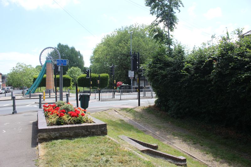
and dropped below the main road was also abandoned On the north side of the tunnel below the S&DR you
see the footpaths where the original junctions were. Just outside the tunnel was the junction for Middle Pit
and Clandown collieries. he footpaths follow the actual junctions.From the path junction the "Quarry" line
ran a short distance to where it again dived below the S&DR than at an angle to where it ranran below the
GWR main line then on to Wellsway Colliery.
ToShoscombe (4th Aug 2019).jpg)
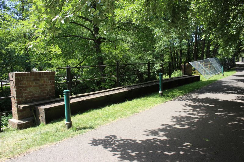
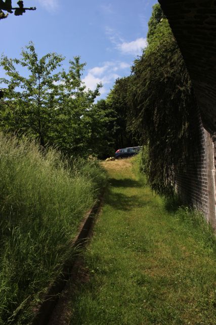
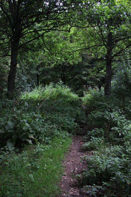
The under bridge where the "quarry" branch went below the S&DR track bed for the second time. Looking back towards Radstock
North station.
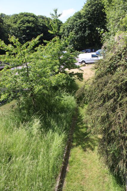
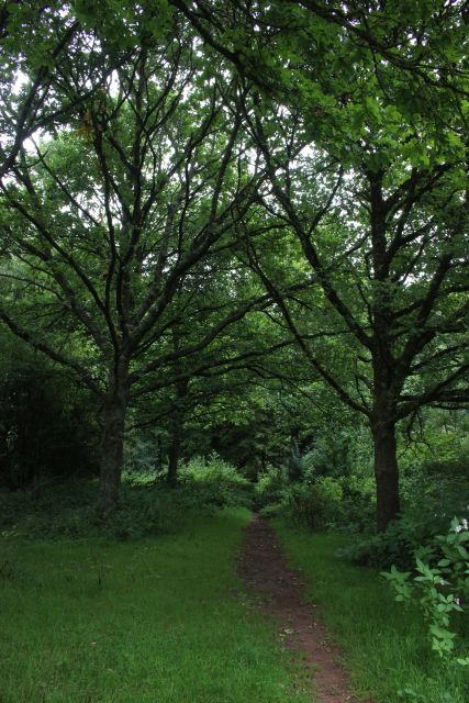
Looking down on the "quarry" branch track bed as it came out the
south side of the S&DR where it then ran at an angle across what
is now the car park where it then ran below the GWR Frome-Bristol
track bed and westwards.
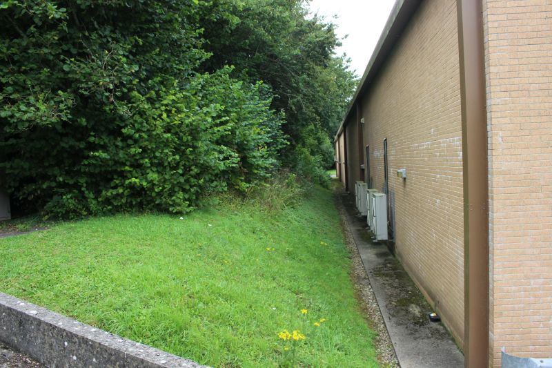
This was quite a heavily built structure and must have been a bit of a white Elephant albeit it did last until the 1920's.
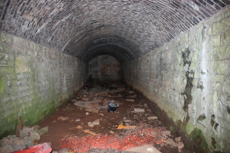
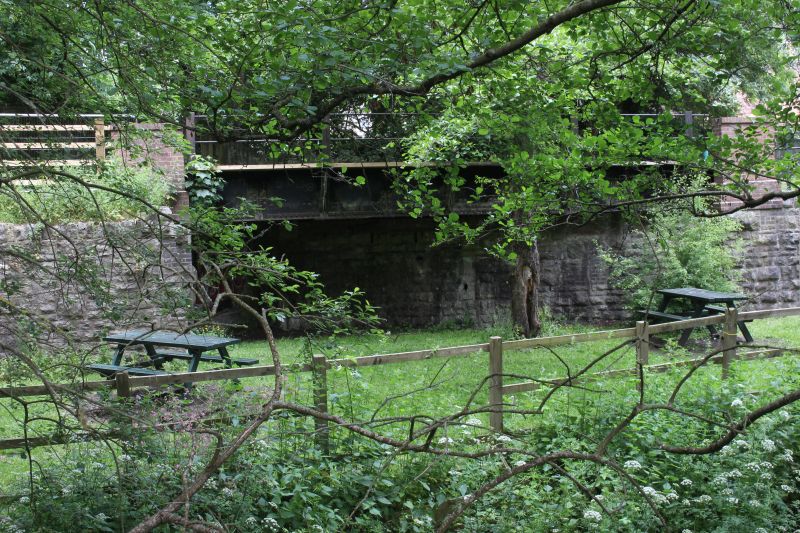
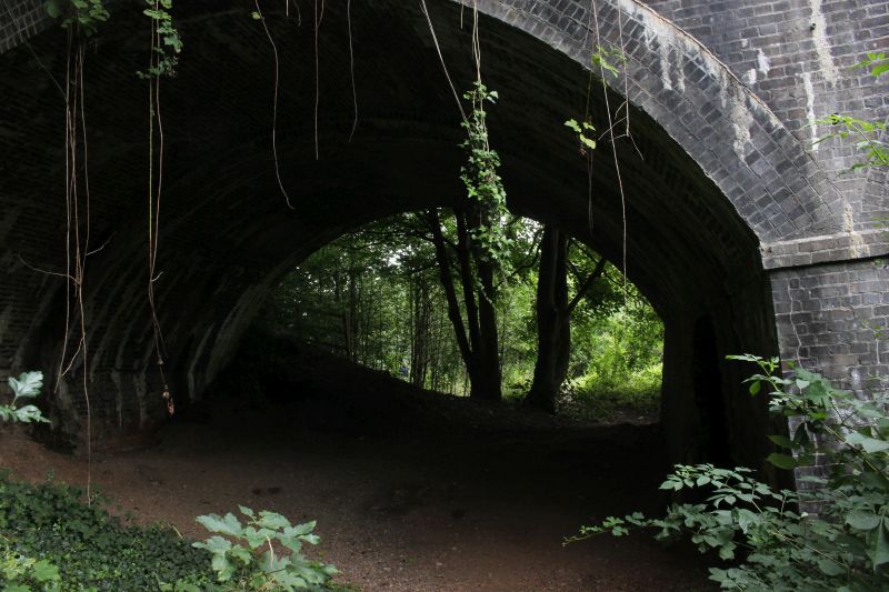
Taken through the bars across the tunnel mouth and using flash to see what remains of the tunnel. It is in quite excellent
condition when you consider how long it has been unused.
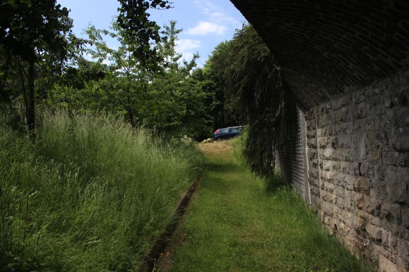
From the western tunnel mouth. It would appear that this has been back-filled as the line next went below the GWR branch
that was on a bit of an embankment at that spot. Today both track beds have been leveled to form the car park and the
children's playground that stands here now. This was also the spot where the S&DR, having been closed and the GWR were
joined during the closure of the S&DR and coal trains from Lower Writhlington Colliery was diverted over the GWR until
total closure in 1973. Therefore the whole railway structure here has been considerably changed and obliterated.
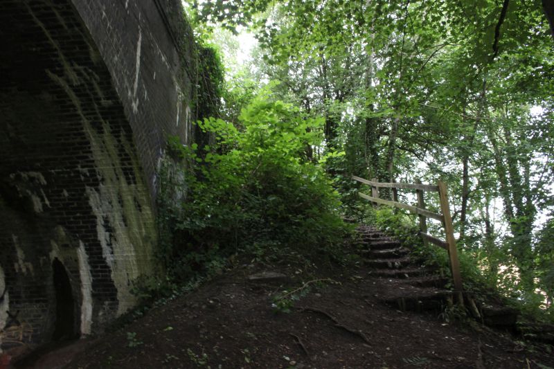
The climb from the west side of the tunnel and up through the
car park as it is today.
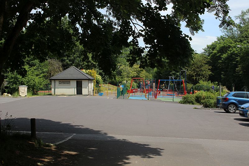
Standing on the GWR track bed. The junction for the Wellsway Colliery was at the children's round about which is just up ahead
on the blue painted area. The two lines came towards me with the colliery line running where the blue cars are on the left. Where
I am standing I would have been under the GWR main line where te quarry branch came up from having burrowed below the S&D
and then below the GWR where I am standing. The GWR was obviously on a rising embankment as it ran out of Radstock for
Bristol. N.B. t took a while to get this shot due to people and cars coming and going as well as waiting for a moment when there was
was no parents and children in view or using the play park. This still didn't stop one motorist from coming up and asking what was
was doing hanging about and taking photographs at this spot. He didn't seem very satisfied when I explained. Obviously not a railway
fan or of the railway history around him! Thankfully he gave up and drove off shaking his head and mumbling to himself.
As this section of tracks have been demolished and lies under the children's playground and car park.
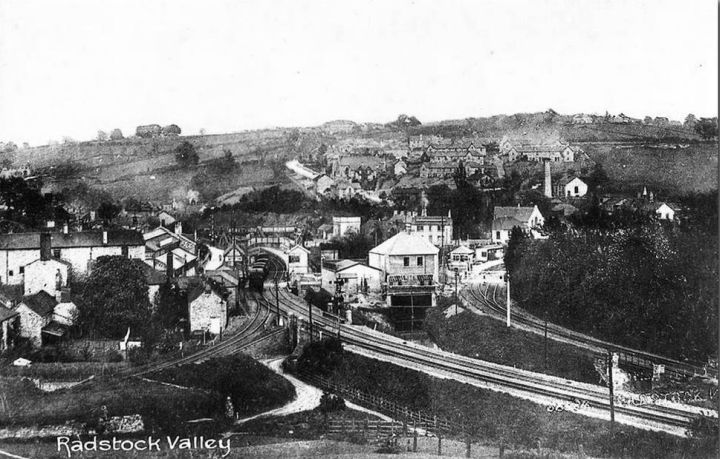
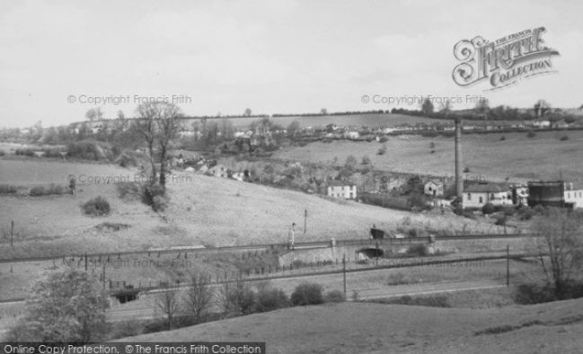
It is difficult to try and describe how it looked. However, Just came across this photo while searching
the internet and couldn't believe it! The exact spot when all the lines and bridges were still in place.
You can see the S&DR branch tunnel below the S&DR just off center right and the track bed running
towards where it then went below the GWR line. Interesting view of the Clandown valley too, with
Middle Pit chimney, the pump house and Gas Tanks are in clear view. This photo can be purchased
from The Francis Frith Collection without the water marks.
 (485).jpg)
Following the red line you can see the S&DR branch continuing westwards through the Five-Arch viaduc south arch and over the level
crossing at the Foss Road footpath and onto the dead end just short of Old Welton Colliery.
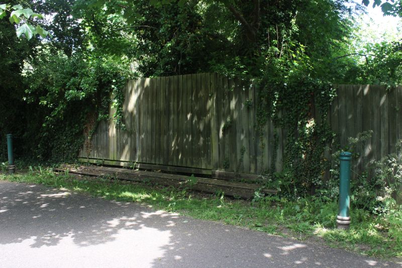
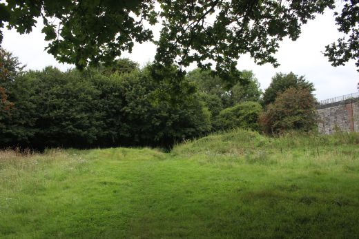
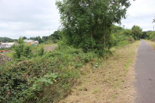
Just west of the car park area the branch track bed disappears below the undergrowth. However, you can join the track bed here, just by the east
end of Five Arch Viaduct via the south most arch and walk a short distance on the track bed until you reach where the level crossing was on the
Fossway footpath was then join the Ex North Somerset track bed up to the site of the Old Welton Colliery branch junction with the and
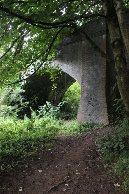
Looking westwards alongside Five Arch Viaduct and the southern arch that the branch ran below. Hidden within the trees.
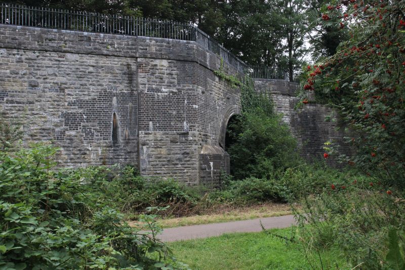
Passing Five Arch Viaduct where the branch ran alongside the GWR North Somerset track bed. The S&DR ran over the viaduct.
The most southerly arch where the S&DR branch ran through.
 6412
6412

The Ex track bed below the south side arch. Looking back towards Radstock.
Reverse view towards the stop blocks up ahead. There had been a short 'S' bend through and beyond the arch at this point.
Looking westwards through the viaduct arch on the branch track bed.
The present public connection to get too and from the S&DR on top of the Viaduct. The bottom of the steps is back-filled to suit
and creeps over the branch track bed.

The back-fill for the base of the steps is seen on the right.

Five Arch Viaduct seen from the track bed. The S&DR over head while the North Somerset ran through the arch on the far right.
The two southern arches.
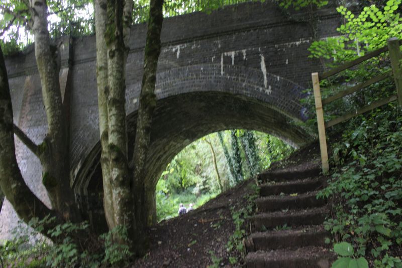
The steps down from the viaduct. The couple ahead came down the steps.
On the GWR North Somerset line looking towards Radstock.
Western end of the track bed where you have to get back onto the North Somerset track bed to continue. Just beyond Five arch
viaduct you then come to the site of the level crossing over the Fossway footpath.
Just beyond Five Arch Viaduct you then come to the site of the level crossing with the Fossway footpath heading towards Radstock
Road. The S&D ran up within the trees on the left where it went over Radstock Road and southwards to Midsomer Norton
South station.
Lookng northwards over the ex level crossing. The Fossway footpath continues to the village of Clandown.
The branch track ran east to west coming in from the green patch on the right that was on an embankment.
Looking eastwards along the Ex embankment of the branch as it came from Radstock. 6389
With the site of Old Welton Colliery branch junction on the North Somerset track bed. The junction was at the white Footpath
sign seen up on the right. The branch ran just below on the left. You can see how wildly it is overgrown that stopped me getting
to the site where the stop block stood as I explain below when getting into the site.
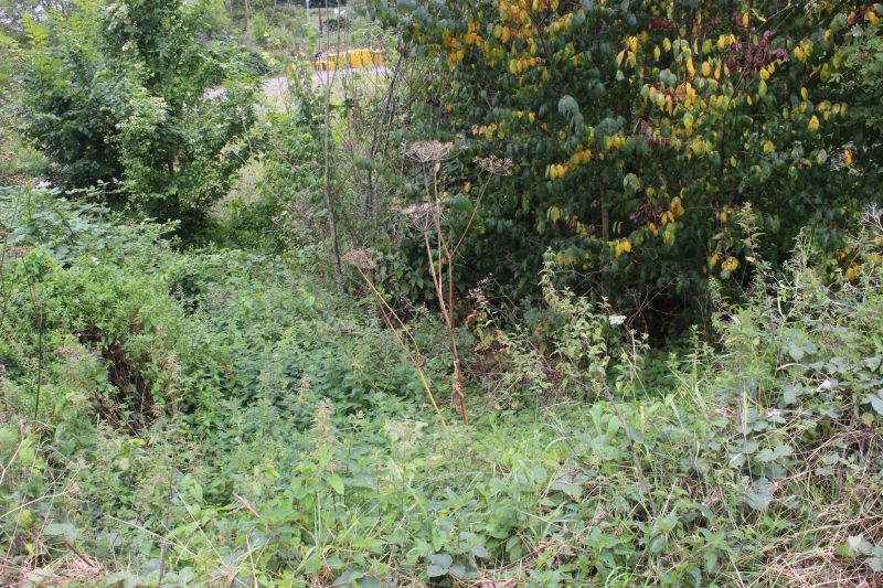
Looking directly down on the branch track bed and showing just how dense the over
growth is.
Another over view of the site from the North Somerset track bed. You can just make out a blue top of a John Martin bus where
I managed to get into the site.
================================================================
I couldn't see a way into the site where the stop block stood. However on my Aug the 23rd visit I looked to see if there was any way in off the Radstock
Road. From Google Earth I could see that there was an entrance but was heavily fenced off. The site is just behind the present John Martin Bus depot
which I had to walk through. However, as private land I searched out the office where I could find someone to allow me to look around. There were two
members of staff present and I approached them half expecting to be told to go away. However I found these two chaps very friendly and interested in
what I was doing. They also had a fair knowledge of the old branch but didn't know what it was called or what goods it was built for. They squashed my
thinking that there may have been a quarry and told me that all there was there was the old sewage works. Not many sewage plants were attached to
a railway and doubt that this one was also. So! I still don't know what this particular branch was called or what traffic it operated. If anyone knows
I would appreciate hearing from you.
An interesting stry from one the lads was that when he was a youngster a relative worked at Lower Writhlington Colliery on the tramway trains and he
got to ride on the train between Lower and Upper Whrithlington Collieries and remember what a beautiful run it was. What a great childhood memory.
He also told me that he was sure that the Stop block of the old Radstock. This got my interest as I had considered that possibility and I said that I would
love to have got into the site to check that out. With that he said that it should be possible to squeeze around the gate and go into the site. We gave it a
try and while it was a tight squeeze we just managed it. Sadly it was impossible to get to the site where the stop block was as it is wildly overgrown with
mostly Brambles so thick that they would tear you apart. The length f land from the stop block back towards the Fossway level crossing has never been
developed and just left to become thickly over grown. It is quite possible that stop block is still there and as it is so well guarded by Bramble plants long
may it continue.
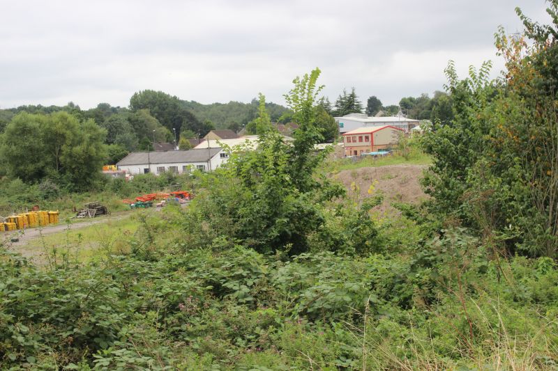
The first photo I took of the site was from the river bridge on the Old Welton Colliery branch. This was a grabbed shot with the camera pointing over the
bridge wall and the over growth using the viewfinder to try and balance a reasonable shot up. I had hoped that getting onto the site may find something
more interesting. However, having got into the site as explained above it turned out that there was no more to be seen than from my grabbed shot. It is
a large site but as you see from my photos there is very little on it apart from some rubbish and a large stone heap. Also, being so large we could venture
too far as my guide was still on duty and could only spend a few moments before returning to his work. However, I really appreciated their assistance and
learning what knowledge thay had of the site. Many thanks Lads, I really appreciated your help and permission to be on the sites.
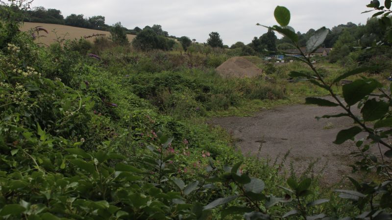
This is a grab shot taken by raising the camera above my head and pointing it over the side of the branch bridge and overgrowth
and using the monitor screen to balance the scene as well as possible. As it turned out this caught the scene well enough and you
see as much as the scenes taken within the sight taken a bit later whn getting into the site.
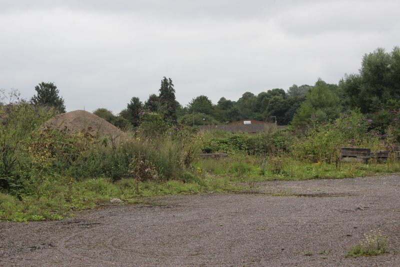
As mentioned getting into the site didn't show any more information than in the grabbed shot seen above. The site is relitively
clear as it has never been developed since closure but the heavy overgrowth covers the actual track bed and is too dense with
bramble bushes to get on to.
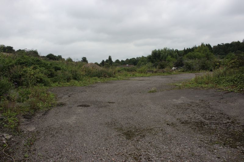
A large swathe of empty land. There is nothing left of the sewage plant and on the left you can see how high and dense the
overgrowth is that stops you getting to the actual track bed or where the stop block stood.
GoogleEarth.jpg)
Overview of thew complete site between Five Arch Viaduct and Old Weldon Colliery. You can see the branch site is relatively clear of redevelopment with
mainly rubbish piles dotted here and there. This is why I thought it may have been a quarry site. However the only works was the old sewage plant.
====================================================
To: Wellsway Colliery & Incline
Other railway walks:
The Dundee & Newtyle Rlwy Walks Opened in 1831 the route had three incline planes. The first was from the terminal station on Ward Street, up the Dundee Law, where
there was also a tunnel. The second was the Balbeuchley incline at Rosemill and the third at Hatton that ran down to Newtyle station. It was also the very first passenger train
service in Scotland. Worked by Horse over the levels until the first steam engine was purchased in 1833. Came under the Caladonian Railway with it's terminal moved to
Dundee West station. Passengers service ended in 1952 and the line totally closed in the mid 60's. The inclines were by-passed in the 1860's.
The Cromford & High Peak Incline railway in Derbyshire has been luckier in having much of it's buildings, including an Engine House preserved. This is what could have
happened with the D&N, indeed, should have happened with at least one of the D&N inclines. However, the C&H gives an excellent comparison of what the D&N would have
looked like, albeit the inclines were only single track.
Boddam To Ellon Branch (Walks) By Bill Reid. Ex GNSR branch line.
To Fraserburgh and Peterhead Walks. Ex GNSR.
Bath To Wellow Rlwy Walks Ex Somerset & Dorset Rlwy.
Chippenham To Caln Walk.
The Test Valley Railway Walk. (New Mills To Hayfield).
Hosted by www.theatreorgans.com
BACK TO HOME PAGE
This page brought to you by:
VintageHammond.Com - We Buy-Sell-Trade Vintage Hammond Organs and Roll or Kari Organ/Vending Machine Moving Dollies Order Roll or Kari Dollies Here