THE ABERDEEN TO INVERURIE CANAL (Remains)
As at APRIL 2022with older photos to add to interest.
Bill Reid
(PAGE ONE OF EIGHT)
"WATERLOO BASIN TO KITTYBREWSTER"
The Aberdeen to Inverurie Canal only lasted 30 years or more as the coming of the railways quickly made it redundant. The Grea North Of Scotland Railway
purchased most of the Canal to build their mainline between Aberdeen Waterloo station to Elgin via Dyce Carnie Junction. The Highland Railwaycontinued
northwards to their own station at Elgin. From Carnie Jt. the GNSR continued northwards to meet the coast at Portsoy. There was a branch from Tillynaught
Jct. to Banff. From Portsoy the GNSR followed the coast via Cullen, Buckie to their own station at Elgin. The GNSR had running power over the HR to
Inverness.
From Aberdeen the railway deviated at points wherethe Canal was too near the main road (Great Northern Road) or where gradiant and curves were too severe.
The canal began at Waterloo Quay where there was a lock leading into the River Dee at the harbour. From Waterloo up to Woodside via Kittybrewster
there were seven locks that took hours to traverse therefore the Passenger Wharf was built where the large roundabout at St Machars Drive is today.
St. Machar Drive didn't exist during the time of the canal. There was a rough road leading down to which is now Bedford Road called Fullerton Road.
From here the canal ran more level with then road for the rest of the way to Inverurie. The canal ran more level with Great Northern Road and Then
Auchmill Roadpast Bucksburn then through Bankhead, Stoneywood, Dyce, Kintore and Inverurie.
At Kittybrewster the canal where the train driver's Booking on building was sitiated at the rear of the depot where it then ran is another series of locks up
to St. Machar Drive, passing at the rear of the three-storie tenements to the Wharf at the summit. It curved westwards where today very nie bungalows are
built up past the junction with Barron Street and to the fountain at the top of Don Street then following the line of buildings past the old tenements known as
the hard-up mansions then past Persely to Scatterburn and onto Bucksburn.
The railway ran a little to the south of the canal with four local (suburban) stations, Don Street, Woodside, Persely and Bucksburn. Thse stations all closed in
the 30's. However, Don Street, Persely and Bucksburn have come up over the years for possible reopening when/if the proposed Cross City service from
Inverurie to Aberdeen ever gets off the ground. With the work on-going re-doubling the line between Aberdeen and Dyce this may well happen.
I have only ever seen one photograph of the actual canal (on the internet) that was taken in the Marquis Road area at Woodside Fountain but could never find
it again.I keep hoping! There are no photographs at the Docks, as far as I know.

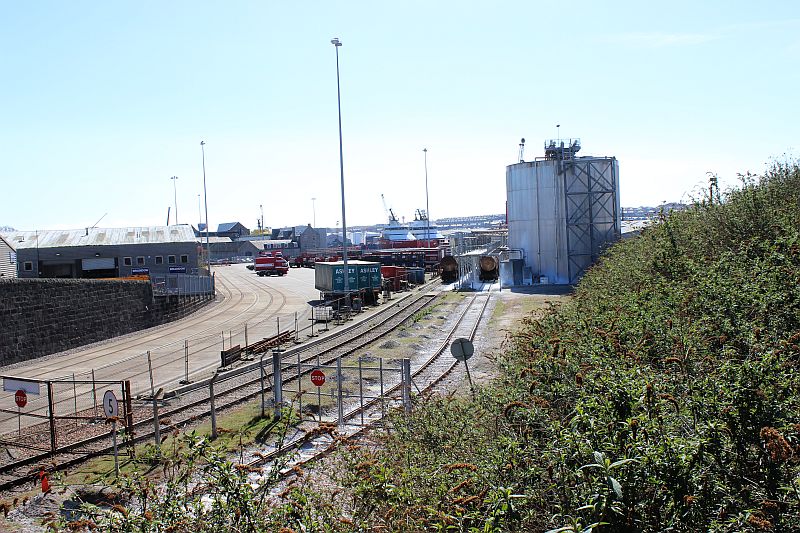
Waterloo Docks. Ex GNSR Waterloo canal wharf and railway station site. The five holding tanks stand on the station site. There was a Lock allowing barges to
enter the harbour to load and unload waiting boats. During the railway times a street branch led up through Church Street and Miller Street to the Gas Works
(Top right of the photo.) In the opposite direction street running ran along side the harbour on Waterloo Quay and joined Guild Street Goods yard on South
Market Street. While scene looks very industrial the area from Church Street up to Castlehill Terrace had a large community in three-storie tenements houses
with shops and two churches and schools plus three pubs. My late mother grew up here and attended both schools. One and infant and the other a Junior
Secondary school. This image captures the Goods Yard as it is today. The whole area was cemented over and two new sidings laid into the deck. Apparently
some new train workings were planned but so far have never come to anything. Another 'modern' white Elephant, it seems. However the yard is well used
by heavy goods vehicles and a number of train movements.
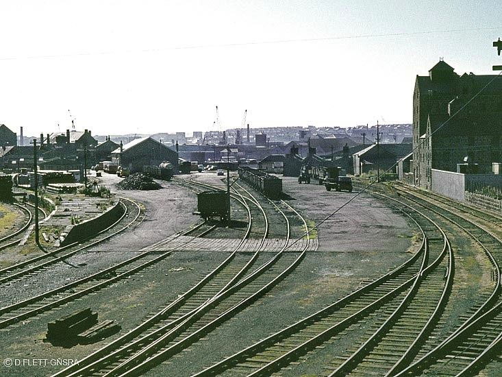
Nice all-over view of Waterloo Docks Goods yard. Possibly in the 60's. On the right is the island goods platform
and to it's right the large goods shed that belonged to Fry's Chocalate in the 60's. The centre yard is being ued by
domestic coal wagons. On the far right is the remains of the station platform and buildings. (D. Flett).
(GNSR Association).

Waterloo Goods siding in 2013 before the whole area was modernised and new sidings added. The passenger platform was where
the tanks on the right are today. More to the center of the yard was a large Goods Shed and an equally large Goods island platform.
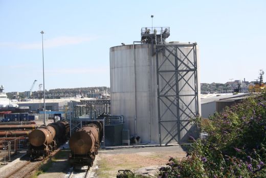
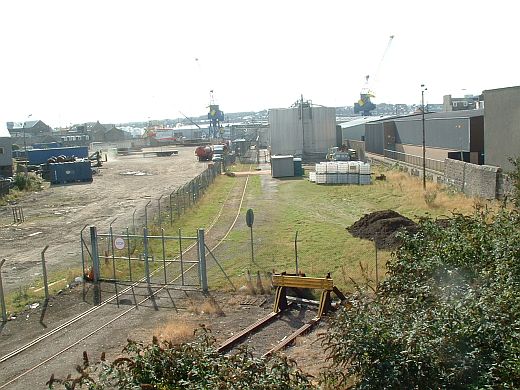
On the 20th April 2015 after the refurbishment of the Goods sidings. At present the new sidings have never been used. The project
was a failure. The Clay trains also have a second new siding.
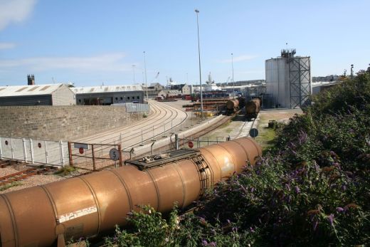

Three photos above 13th Sept. 2013.
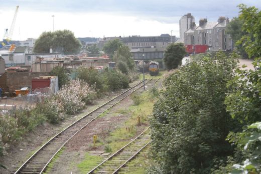
Three views above from The Promanade Road over bridge. Towards Waterloo Docks. A class 66xxx shunts a train of tanks ready for departure . (10th of August 2012)..
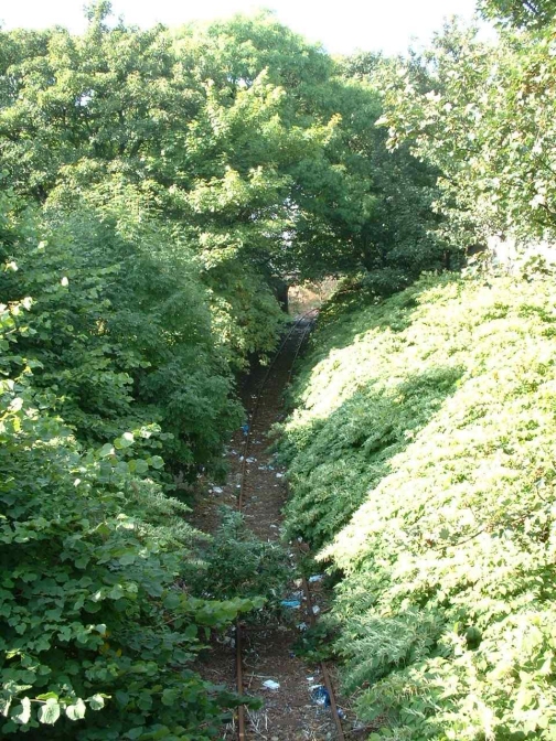
Bannermill Works by Constitution Street over bridge. Trams ran over this
bridge too and from the beach terminus. (Photo 1990's).
.jpg)
From the same spot as above but with wide angle lens on the 17th April 2017. Quite a change of scene.

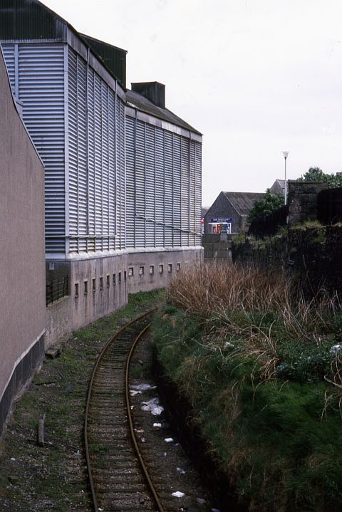
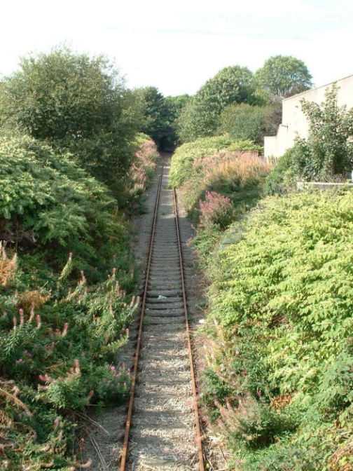
Start of the climb from Bannermill up to Kittybrewster was through a number of Locks. The building wall remains on the
right may have been part of the canal. (Photo 1990's).

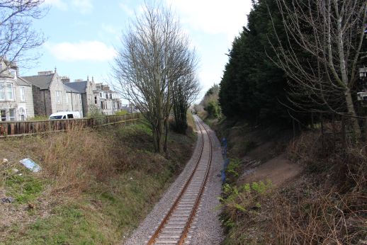
From the Park Street over bridge. Left: Towards the Bannermill over bridge and Waterloo Docks.
Right: Northwards towards King Street over bridge. Roslin Terrace is on the right.
(April 2004).
April 2019 same views as above but with newly re-laid track. Left: Note the old buildings on the far right is now a housing estste.mmm

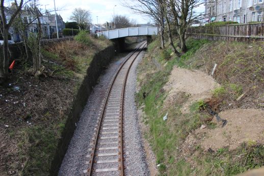
From King Street over bridge. Left: Towards Park Street over bridge and to Waterloo Docks. Right: Northwards towards Nelson Street over bridge and
Kittybrewster. (August 2016).

From Nelson Street over bridge. Left: Towards King Street over bridge and Waterloo Docks. Right: Northwards towards Canal Terrace over bridge and
Kittybrewster. This was taken just before trains started running at least twice a week. The area was eventually cleared. (Aug 2009).
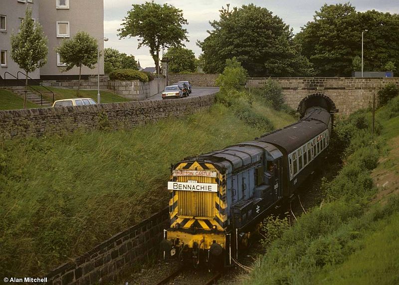
Unusual working at Mounthooly over bridge. There was a wharf here. (Alan Mitchell).

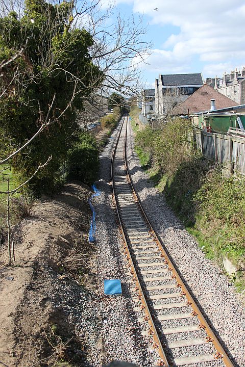
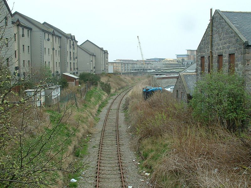
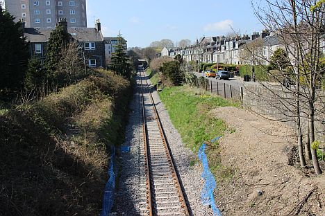
View from Canal Terrace over bridge. Left: Towards Waterloo Station Site. Right: The climb towards Kittybrewster. The branch has been
re-laid throughout. (April 2019)


Canal Road over bridge. Towards Kittybrewster. Right: Towards Waterloo Docks.
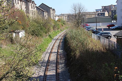
Left: Looking northwards from the over bridge at the junction of Erskine Street and Elmbank Terrace towards Kittybrewster.
Right: Towards Waterloo Docks.


From Bedford Road over bridge. The summit of the canal at Kittybrewster. The canal carried staright on then rose again with a
number of locks around the back of the loco depot and up to the wharf where St. Machars Drive roundabout is today.

Kittybrewster Loco depot and Station Site with the Waterloo Docks branch on the right. Run round loop where original station stood.
South signal box stood where the white circuit box is to the right. From Powis Terrace over bridge. (1999).

Kittybrewster Station, Loco Depot and Goods Yard site. Looking north from the Powis Terrace road over bridge.The canal ran
left to right approx where the new crossing is, mid scene. The original station stood where you see the Docks branch coming
in and run ahead forming two sidings for trains to run around today. The new station was just where the long office building
meets the track bed up on the left. The two platforms were staggard.

From the same bridge in the 50's. (Author Unknown).
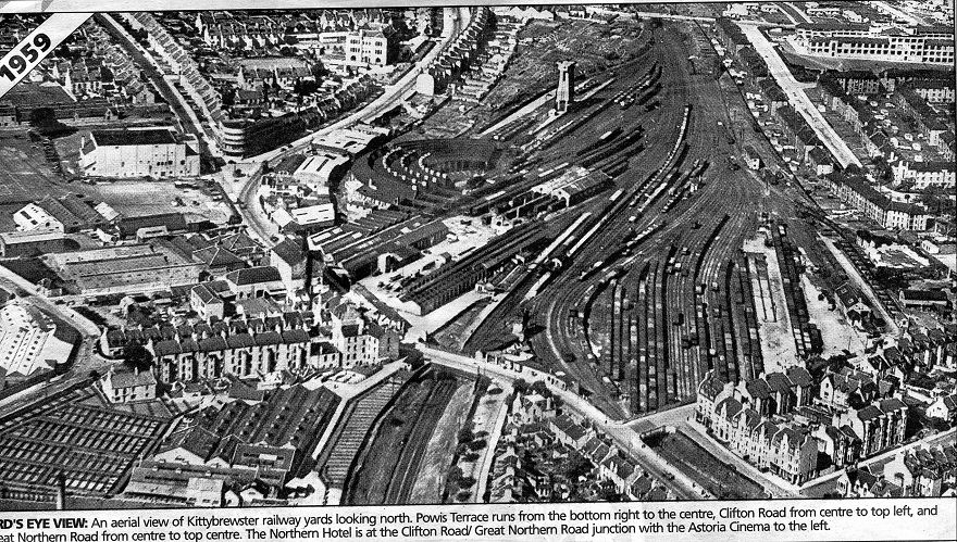
My old School (Powis J.S.) top right. You can follow the route of the canal, from bottom right and following the east side of Great
Northern Road, around the loco depot and up to the top of the road following the line of tenement to where the Wharf at St Machar Drive
was. The loco depot had twenty two roads served by a central turntable. Eleven roads were under cover and eleven in the open. This side of
the depot was bombed during the war and the roof over that section was never replaced. You can make this out in the photo above.
TO: PAGE 2 KITTYBREWSTER TO THE FOUNTAIN (Woodside)
Back To Index Page
=============================================================
Please respect the copyright of all photographs and videos in these web sites. Thank you.
All My Web Sites (Web pages and videos).
Contact me at reidcrcwdr@aol.com if you have anything to add to these pages.