.jpg)
Woodford Halse South Junction (NLS Maps)
WOODFORD HALSE RAILWAY WALK
(March 2023)
WOODFORD SOUTH JUNCTION
TO Ex S&MJR OVERBRIDGE
52 years to the month since the closure of the Great Central Railway London Extension from Annersley Junction to the north
of Nottingham to London Marylebone station. The line closed on the 26th Sept. 1966.
Following is a series of photos showing that it is like within the Woodford Station cutting up to the Ex Startford & Midland Junction
Railway's over bridge site.
#
Woodford Halse South Junction (NLS Maps)
The West curve had a very breif existance of little more than two years as a though line. It was cut off at the south end by stop blocks
and the section from Woodford West Junction used to store wagons and carriages that lasted until 1960 followed by the closure of
the GCR in 1966.
3rdMarch2023).JPG)
Just north of the Footbridge.On the right water from the West curve cutting at the meeting point of the two lines at the junction.
The Woodford Halse line coming from the station to the left. This is about as close as you can get to the over bridge due to
the flooding. Looking towards Culworth Junction.
3rdMarch2023).JPG)
Another view loooking southwards towards the foot bridge. This area is quite clear and you can see that some clearing has been
carried out. This is about half way between the foot bridge and where the Ganger's hut stood between the two cuttings.
3rdMarch2023).jpg)
Reverse view from above. This is just south of the 'V' where the two cuttings join at South Junction. The photo below shows what a
grand wide open view it was from here
3rdMarch2023).JPG)
Looking down the two gaps of the cuttings to West Junction (to the left) and to Woodford station (on the right). You can visualise the
site of the ganger's hut in the 'V' between the cuttings, Where the Trap point board stood and just in front of that, the wooden
ballast box. The brick walled cut-out for the signal box is hidden the overgrowth to the far right of the photo. (See below).
(JohnEvens).jpg)
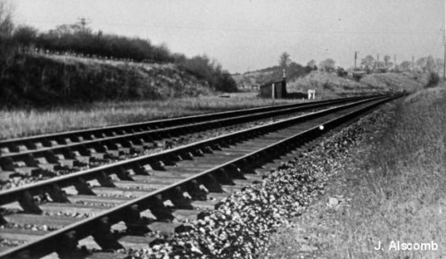
South Junction in the 60's. towards Woodford Halse. The link to West junction on the left that took trains on to
Statford Upon Avon. In the background, center right is the remains of the S&MJ bridge over the mainline as it
headed for Towcester. The link to West Junction only lasted a short time, closing in 1900 and being used as a siding
at West Jctn. I do plan another visit to the area in the hope of being able to get down the track bed to
Culworth Junction.
From close to the same spot above as it looked in the 60's near to closure of the GCR..
TNewman.jpg)
Left: A freight for the Western Region with Hall class loco passing the trap point site. This is precisely the type of train and locomotive I fired over this route albeit we also used
standard black fives and 9F 2-10-0's. Right: from around the same spot but with a wide view of the two routes with the ganger's hut and trap point sign post.Trap points slowely
disappeared once fully-braked trains became the torm. To the left you see the stop blocks in the West Curve cutting. However, the wooden ballast box has been removed.
3rdMarch2023).JPG)
Another view from near the same spot but looking down the maim line towards Woodford Halse.
3rdMarch2023).JPG)
The mound of weeds where the ganger's hut stood. The new fencing is at the bottom of the 'V' embankment separating the
two cuttings. Could there be some remains of the hut in there!
3rdMarch2023).JPG)
3rdMarch2023).JPG)
At the bottom of the 'V' between the two cuttings. The ganger's hut stood at the base where the heap of bushes to the left of centre is.
You can see the strength of the heavy barbed wire fencing that is being put up all around this area. I'm not sure why it requires such
heavy fencing unless some plans are in place for the extension of the Pocket Park. It would be nice if this was so and that the public
were able to visit this interesting part of railway history. This brought good memories back to me of firing goods trains over this section.
THE BRICK WALL CUT-OUT WHERE SOUTH JUNCTION
SIGNALBOX STOOD.
Ther is some doubt as to whether the South Jctn signalbox was actually built or possibly deserted when it was realised that the west curve to West Junction was not
really required. However, the south junction link was there for at leat two year until it was abandoned therefore some sort of signalling had to be in place and
working during that period.
3rdMarch2023).JPG)
The north face of the south wall of the cut-out.
3rdMarch2023).JPG)
3rdMarch2023).JPG)
The inside wall of the north end of the cut-ou.
3rdMarch2023).JPG)
3rdMarch2023).JPG)
Looking southwards along the cut-out wall. Again, showing the scale and quality of work and design that went into building the GCR London extension.
3rdMarch2023).JPG)
A number of these forms of signalbox cut-out can be seen still remaining
all over the Ex GCR London Extention. As indeed on many other closed
railways.
3rdMarch2023).JPG)
3rdMarch2023).JPG)
======================================
It would be interesting to know why some tree and bush clearing is being carried out.
===========================================
EX WATER TOWER REMAINS.
The remains of a water tank feed that was probably to the South Signalbox can be found in a field at the top of the cutting on the eastern side.
3rdMarch2023).JPG)
At the top of the cutting is a low brick wall that appears to be some form of bracing to stop slipping down the bank is seen on the
railway side of the fence with the water tank in the actual field at the top.
3rdMarch2023).JPG)
3rdMarch2023).JPG)
3rdMarch2023).JPG)
3rdMarch2023).JPG)
3rdMarch2023).JPG)
3rdMarch2023).JPG)
Clay piping taking water to the signalbox is broken and open to the surface.
3rdMarch2023).JPG)
The base of which may have been a tower with a water tank on the top. There is also another pow brick wall on the easter side of
the base that was part of the bracing for the tower.
3rdMarch2023).JPG)
How did a Sheep's head get there! Interesting too that a section of rail has been used in the building of this western edge of the base.
There is another length of rail pn the left side too.
==========================================
EX S&MJR OVER BRIDGE REMAINS
Passenger services from Stratford to Blisworth stopped in 1952. and the whole route closed in stopped in 1965. A year before the closure of the Ex GCR.
The over bridge at Woodford remained for some years before it was finally demolished. Things had been a bit different here prior to the GCR as the
S&MJR was built first and must have just passed here on a plain embankment.
.jpg)
A short freight train (a sign of the times) runs towards West Junction in the 50's. The bridge had been
designed for double track which was never carried out on this section of the S&MJR. This is the same
south face of the bridge that is covered in these pages. On the far right you can see the Down distant
signal for West Junction. (R.A.F.Puryer).
JEvens.jpg.jpg)
Excellent colour photo by John Evens. There are no telegraph wires between Woodford and Culworth Jct. therefore this
is just after closure of the GCR. This is from the north side of the S&MJR over bridge that is now under back-fill. You
can just make of the old ganger's hut sitting between the two cuttings and the still standing footpath bridge at South
Junction.
3rdMarch2023).JPG)
Full width view of the south side of the Ex S&MRJ bridge over the GCR mainline.
3rdMarch2023).JPG)
3rdMarch2023).JPG)
3rdMarch2023).JPG)
A good view of the west side abutment and embankment.
3rdMarch2023).JPG)
The back-fill is quite high and steep and there is a lot of stinging bramble branches to catch you. I gave it trhought but decided not to
attempt trying to tackle it, as much as I wanted to. It would have been nice to see the view down to Marble Arch bridge from this side.
----------------------------------------------------------------
3rdMarch2023).jpg)
3rdMarch2023).jpg)
Whie I couldn't get a photo from the top of the back-filled over bridge here are are two photos taken from Marble Arch bridge looking up the track bed towards the Ex S&MJR over
bridge. Left: The landowner has done a nice job of the fencing and landscaping. It looks very neat. In the background you can see the back-fill slowly rising to track bed level; at
the over bridge. Right: A 200mm zoom shot plus some cropping showing the back-fill leading up to the top of the Ex S&MJR over bridge.
----------------------------------------------------------------------------------------------------
3rdMarch2023).JPG)
The east side abutment towards Towcester. The back-fill is only on the north soide of the bridge which tappers steadily towards the
south side track bed level.
3rdMarch2023).JPG)
Face on with the east side abutment. Quite a strong build. Looks as if the bridge number is 37!
3rdMarch2023).JPG)
While face on, it looks quite straight the track bed ran across this bridge at quite an angle. Eastern abutment.
3rdMarch2023).JPG)
The eastside abuttment and retaining wall on the east side of the over bridge towards Morton Pinkney.
3rdMarch2023).JPG)
3rdMarch2023).JPG)
The Up side west facing wall and the extra bracing layer of Leicester blue bricks
3rdMarch2023).JPG)
Head-on view of the eastern abutment were S&MJR trains would have directly over head.
3rdMarch2023).JPG)
3rdMarch2023).JPG)
An overview describing well the size and scale of the work put into building this over bridge between 1889 & 1900.
3rdMarch2023).JPG)
Sadly, the stone work here is also slowely decaying.
3rdMarch2023).JPG)
Looking south from the over bridge site towards the footpath over bridge at South Junction. This section is quite clear and you can see
the remains of some present effort at over growth clearing. However, as can be seen the final 100 yards or so is heavily overgrown
and flooded and the footpath bridge is hidden.
3rdMarch2023).JPG)
A final look at this once fine bridge. I hope it lasts a long time yet.
.jpg)
From A video screen grab. A special running towards the Ex S&MJR over bridge, towards Woodford
Halse station. Close to the end.
==================================================
John Evens has a book (still available) of all his excellent quality photos from in and around Woodford Halse and elsewhere on the old GCR
which can be purchased at:
Woodford South Junction To Culworth Junction
NWP Exploring (Woodford Halse South)
The Great Central (Rise & Fall) by John Evens
==================================================
Other railway walks:
The Dundee & Newtyle Rlwy Walks Opened in 1831 the route had three incline plains. The first was from the terminal station on Ward Street,
up the Dundee Law, where there was also a tunnel. The second was the Balbeuchley incline at Rosemill and the third at Hatton that ran down to
Newtyle station. It was also the very first passenger train service in Scotland. Worked by Horse over the levels until the first steam engine was
purchased in 1833. Came under the Caladonian Railway with it's terminal moved to Dundee West station. Passengers service ended in 1952 and
the line totally closed in the mid 60's. The inclines were by-passed in the 1860's.The Cromford & High Peak Incline railway in Derbyshire has been luckier in having much of it's buildings, including an Engine House preserved. This
is what could have happened with the D&N, indeed, should have happened with at least one of the D&N inclines. However, the C&HPR gives an excellent
comparison of what the D&N would have looked like, albeit the inclines were only single track.Boddam To Ellon Branch (Walks) By Bill Reid. Ex GNSR branch line
Dyce To Fraserburgh and Peterhead Walks. Ex GNSR
Bath To Wellow Rlwy Walks Ex Somerset & Dorser Rlwy.
Contact: reidcrcwdr@talktalk.net
Hosted by www.theatreorgans.com