Back To Radstock Collieries Index
TYNING COLLIERY BRANCH (Radstock)
(1837 closed 1909 and batches used up to 1954)
(From two visits on the 9th and 17th of September 2020)
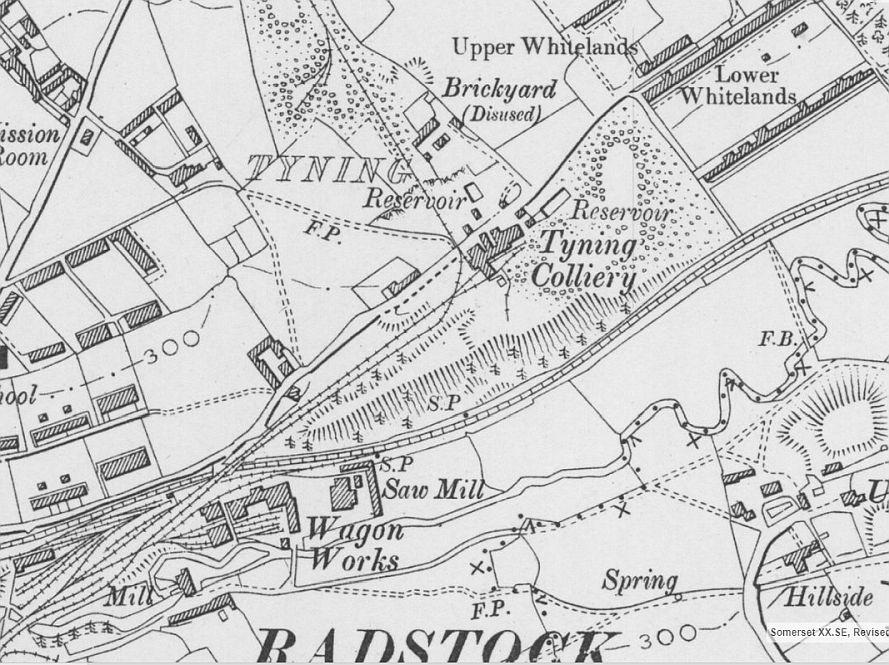
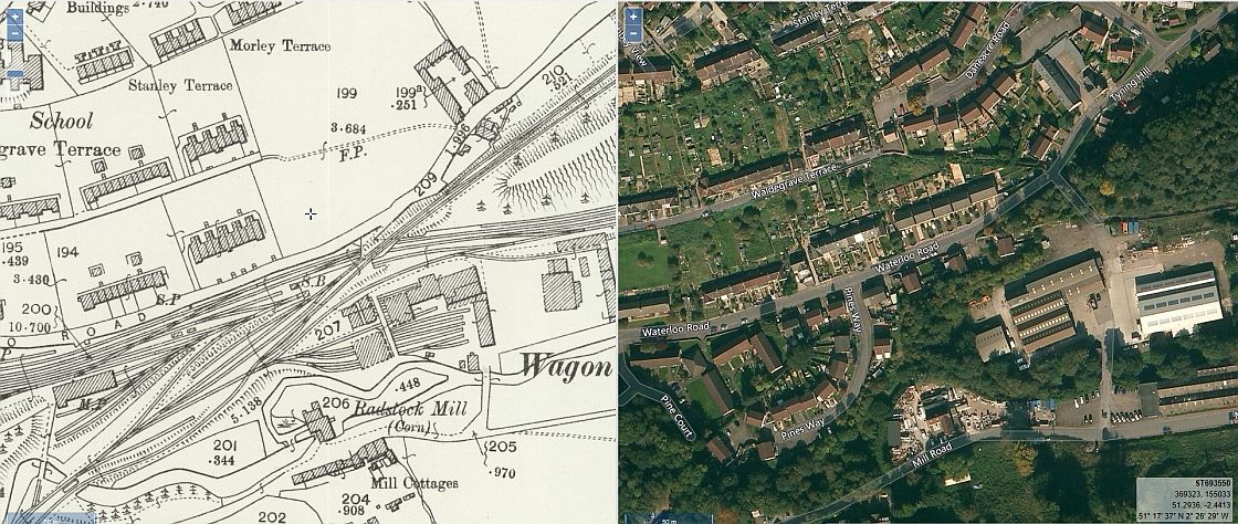
Tyning Colliery layout and branch. (NLSMaps).
Tyning colliery was linked to both the S&D and B&NSR railways by a branch that crossed over the S&D at the north end of Radstock North station.
It came off the B&NSR and ran through Ludlow Colliery where it crossed the Frome Road and through sidings where it then took a steep climb over
the S&D, following the Tyning Hill road to enter Tyning Colliery. A spur branched off northwards where two Batches (Slag heaps) were built up
over many years by slag from Tyning, Middle Pit and Ludlow collieries. Tipping ended in 1954 when Ludlow colliery closed. The branch must have
been demolished soon after that. It appears impossible to find photos of the branch while it was in use.
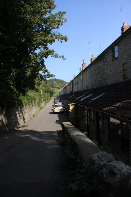
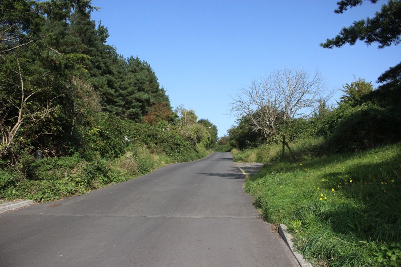
The rear of the Ex Miner's houses at the top of Tyning Hill at Lower Whitelands. Right: Looking down the steep lane that takes you
onto the S&D track bed to Shoscombe Vale or back into Radstock.
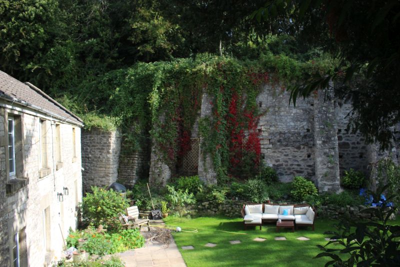
Ex Tyning miner's houses at Lower Whitelands. Very fine housing with well kept gardens.
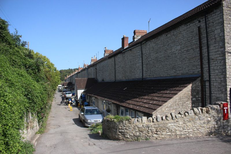
Rear of Ex Tyning miner's houses. at Lower Whitelands.
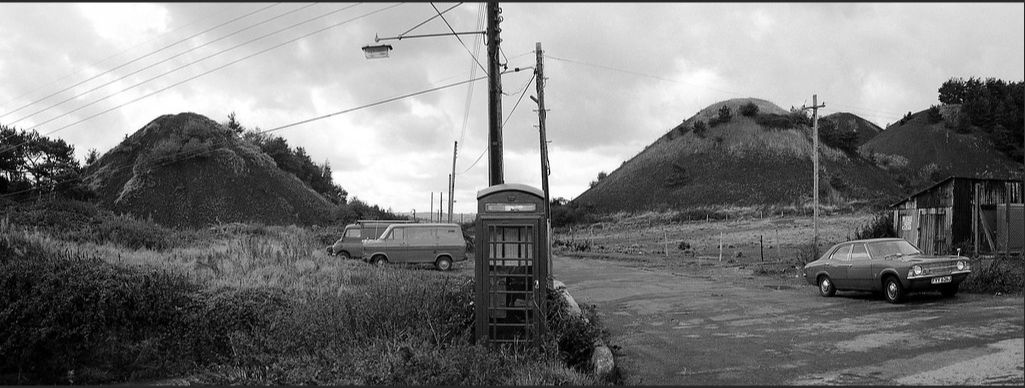
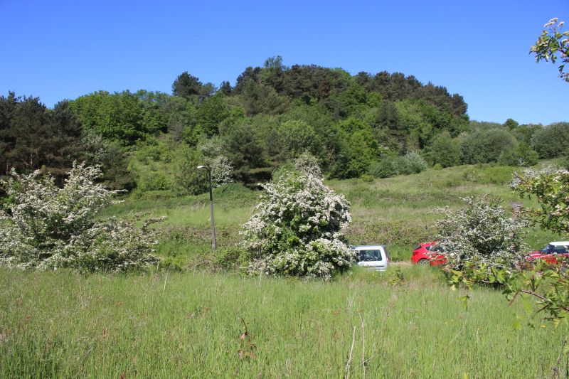
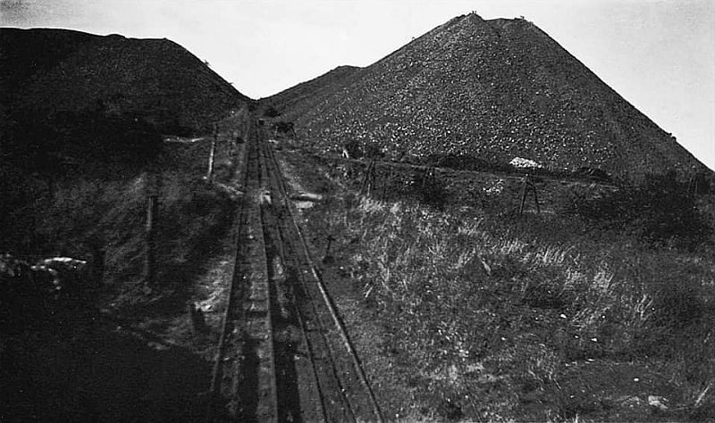
Tyning Batches from the top of Tyning Hill. . The heap on the left is on the Colliery site and on the right are the batches formed from Ludlow and Middle Pit
collieries. This scene is still recognizable today. Vehicles still park here and there are 'Unofficial' footpaths allowing you to walk the two sites, albeit rather
empty ground today. Also as a guide the telephone box and the pole with the lamp standard are still there but are behind the Google camera view in the
present ay photo below. (Steven Dowle).
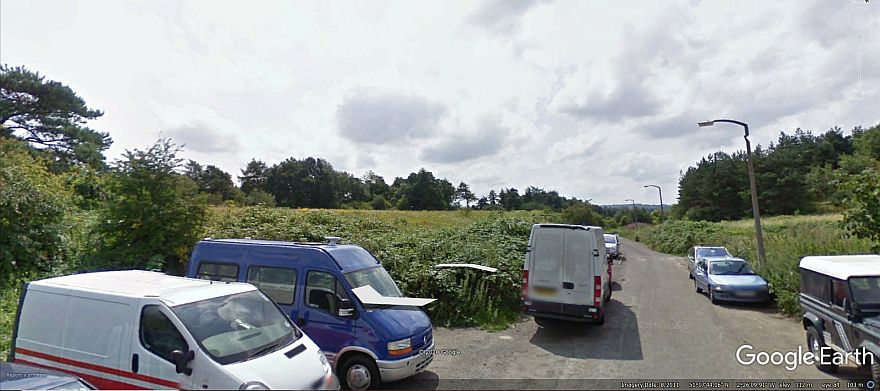
From near the same spot, today. The tress on the far left suggests that they are the same trees as seen in the old photo above.
(Google Earth).
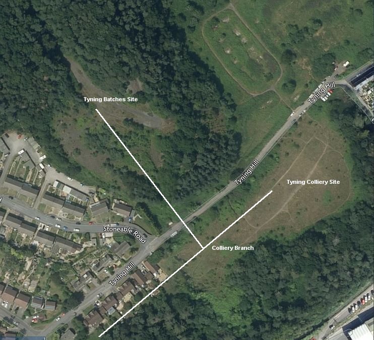
Tyning Colliery and branch site layout. Top right: You can see vehicles parked at the top of Tyning Hill and
the ground marking of the batches .(Google Earth).
The mine site looking westwards to where the tramway came up from Ludlow colliery.
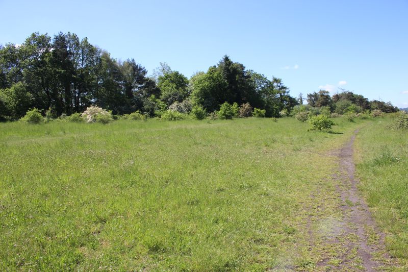
The whole of the coal mine would have blocked this scene out.
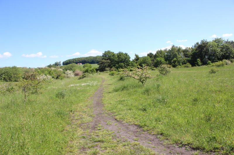
Face-on view as to where the coal mine stood. Nothing remains. The tramway, at this point went directly into the mine while
a second line turned to the left and then crossed the road and up to the site of the two batches on an incline.
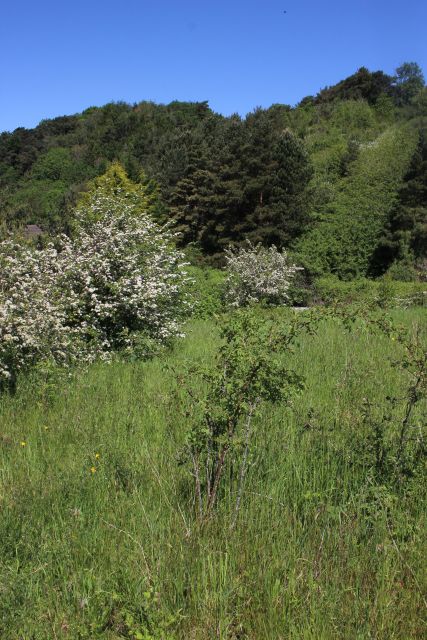
Taken from virtually the same spot as the photo below. The tree
line follows the contours of the peaks of the two batches.
After crossing the Tyning road the track became an incline railway feeding the two batches.
Looking up Tyning Hill. On the right there is an Ex entrance into the colliery site. This is where the branch crossed the
road and into the northern side Batches (Slag Heaps) that were on the left. By Stoneable Road junction.
Looking down Tyning Hill towards Radstock town center.
On he left hand side of Tyning Hill as you continue walking down the hill you can just make out the Tyning Branch track
bed within the trees just before it entered the colliery site and a spur branched off to the north side of the road into the
Tyning.
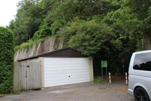
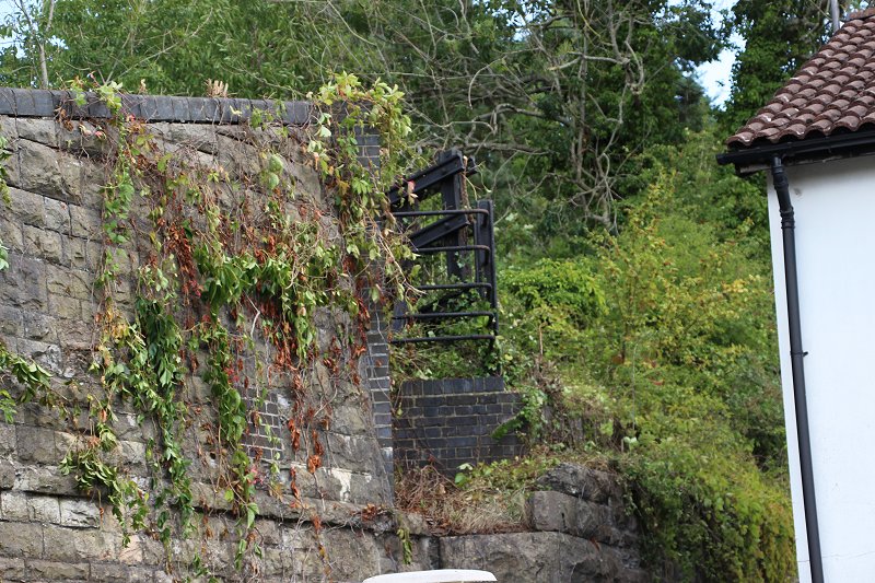
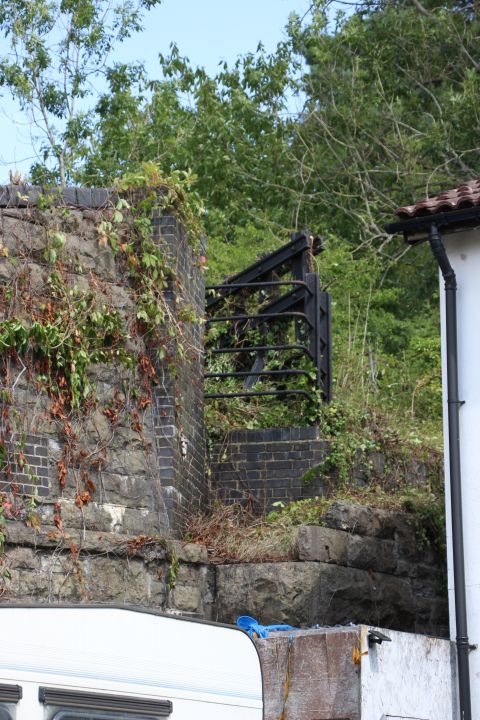
A shed has been built upon the track bed where there is also a gap where a bridge has been removed.
Just to the north side of the bridge where the branch crossed over a lane that today takes you onto the start of the S&D trail
up to Shoscombe Vale.There was actually two single lines to the Colliery running side by side. One went directly into the
colliery while the other crossed the road to the Batches (slag heaps).
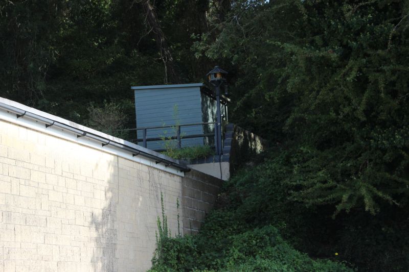
Left: The entrance off Waterloo Road to get back onto the track bed. On the right. The heavy retaining wall carried the colliery branch.
Right: The colliery branch ran over the top following the heavy retaining wall.
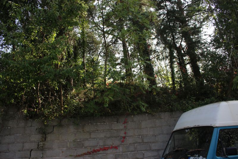
Just yards north of where the branch went over the S&D main line.
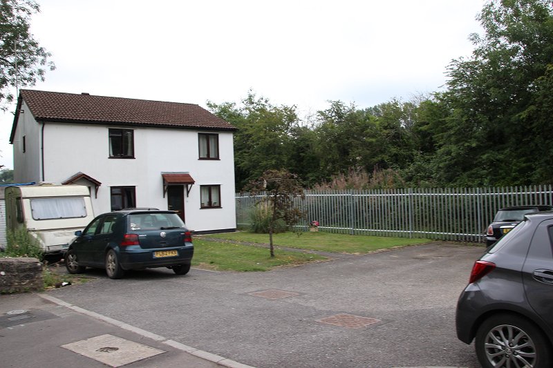
Along Waterloo Road. The house stands on the track bed heading north. The Tyning branch went over head on what was
known as the Marble Arch as it dropped down towards Ludlow colliery.
The modern house stands virtually on the spot of Radstock South signal box and where the branch crossed the S&D.
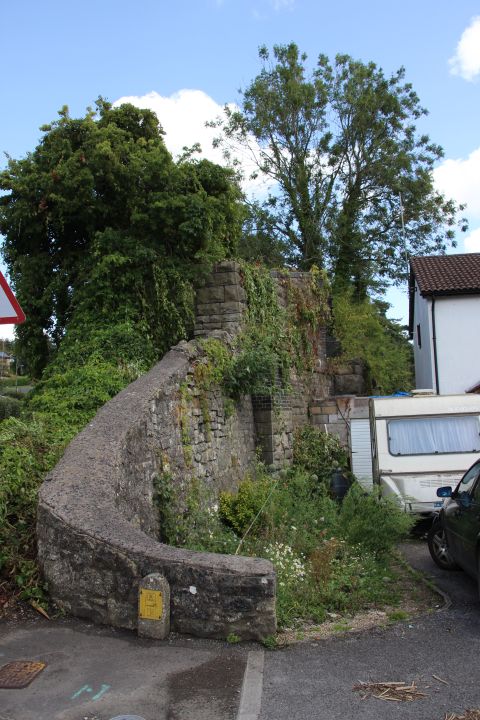
All that remains of the bridge and where the viaduct slopped down over the S&D towards Ludlow colliery.
There was two tracks up to the colliery. One going into the colliery and the other crossing the road to the batches.
The retaining wall and remains of the bridge that crossed over the S&D and
onto the Colliery. The metal work and the brick base is probably retaining
built after the bridge was demolished.
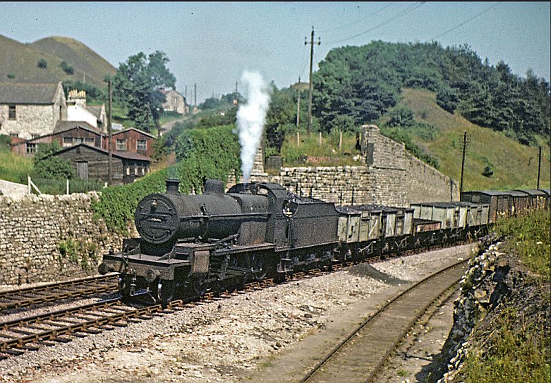
An excellent photo taken below the Ex Tyning tramway over bridge. The Tyning baches are seen on the far left. This shows
the very steep incline required to get from Ludlow colliery to Tyning Colliery. The track on the right leads into the loco depot
and is the line the shunting is taking place in the photo below. (Author Unknown)
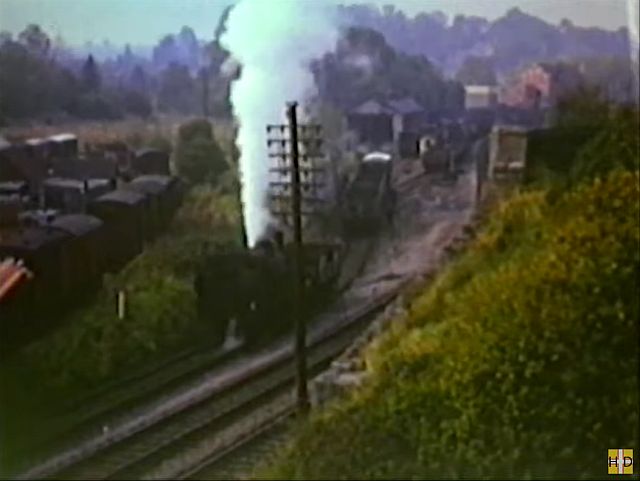
Shunting at Radstock from the ex track bed of the Tyning Colliery branch and remains of the over
bridge. Seen on the right. The loco depot is also seen up ahead. The sidings on the left with the
branch running through to Ludlow Colliery. (A video screen grab)
.jpg)
A very interesting find. It is very difficult to see into this area today and work out the layout of the sidings that served
the Tyning Colliery incline and sidings as they came out of Ludlow Colliery and this the best overall view that I could
have ever expected to see. It is virtually all here. On the far left is the sidings that served the Mount Pleasant incline.
In the center and to the right the sidings that served the Tyning Incline that rose over the S&D Mainline. The angles the
railway made here were all over the place. Note how a short tunnel on the left is almost facing straight on and the bridge
over the S&D. The tunnel appears to take a line behind the signalbox and into the Loco Depot and sidings while the
bridge for the incline appears to take the two main lines up to the station. A fantastic image of historical record. The
author couldn't have imagined what he was capturing at that time.(Author Unknown).
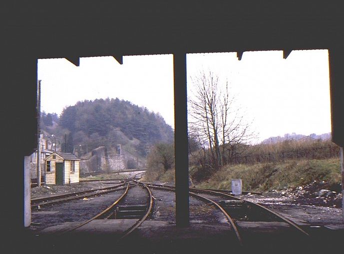
The remains of the Tyning Colliery bridge and incline from the old S&D loco depot at North
Station. (Author Unknown).
Where the colliery branch crossed the S&D. Some of the Wagon Works' building may still be in place. It is interesting just how much track and sidings there was in this area.
You couldn't imagine them today.(NLS Maps).
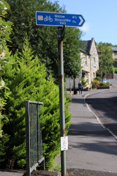
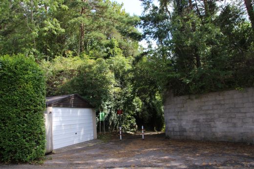
The sign for turning onto the old track bed on Waterloo Road and the
bottom of Tyning Hill road..You can walk the track bed from Shoscombe
to Wellow but have to take the main road from Single Hill.
==========================================
To: Ludlow Colliery (Radstock)
The Dundee & Newtyle Rlwy Walks Opened in 1831 the route had three incline planes. The first was from the terminal station on Ward Street, up the Dundee Law, where
there was also a tunnel. The second was the Balbeuchley incline at Rosemill and the third at Hatton that ran down to Newtyle station. It was also the very first passenger train
service in Scotland. Worked by Horse over the levels until the first steam engine was purchased in 1833. Came under the Caledonian Railway with it's terminal moved to
Dundee West station. Passengers service ended in 1952 and the line totally closed in the mid 60's. The inclines were by-passed in the 1860's.
The Cromford & High Peak Incline railway in Derbyshire has been luckier in having much of it's buildings, including an Engine House preserved. This is what could have
happened with the D&N, indeed, should have happened with at least one of the D&N inclines. However, the C&H gives an excellent comparison of what the D&N would have looked
like, albeit the inclines were only single track.
Boddam To Ellon Branch (Walks) By Bill Reid. Ex GNSR branch line.
Dyce To Fraserburgh and Peterhead Walks. Ex GNSR
Bath To Wellow Rlwy Walks Ex Somerset & Dorset Rlwy.
Chippenham To Caln Walk.
The Test Valley Railway Walk. (New Mills To Hayfield).
Hosted by www.theatreorgans.com
BACK TO HOME PAGE
This page brought to you by:
VintageHammond.Com - We Buy-Sell-Trade Vintage Hammond Organs and Roll or Kari Organ/Vending Machine Moving Dollies Order Roll or Kari Dollies Here